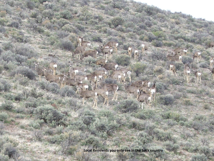
Upper Sinker Creek
Silver City Available
Overview
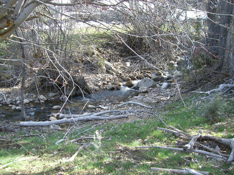
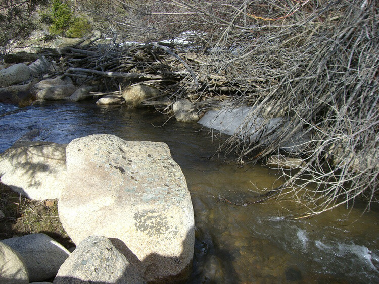
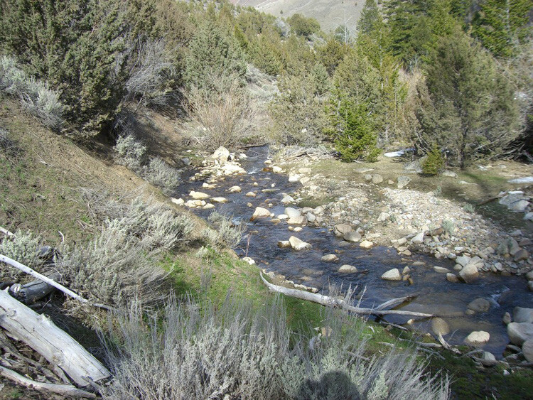
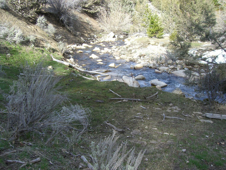
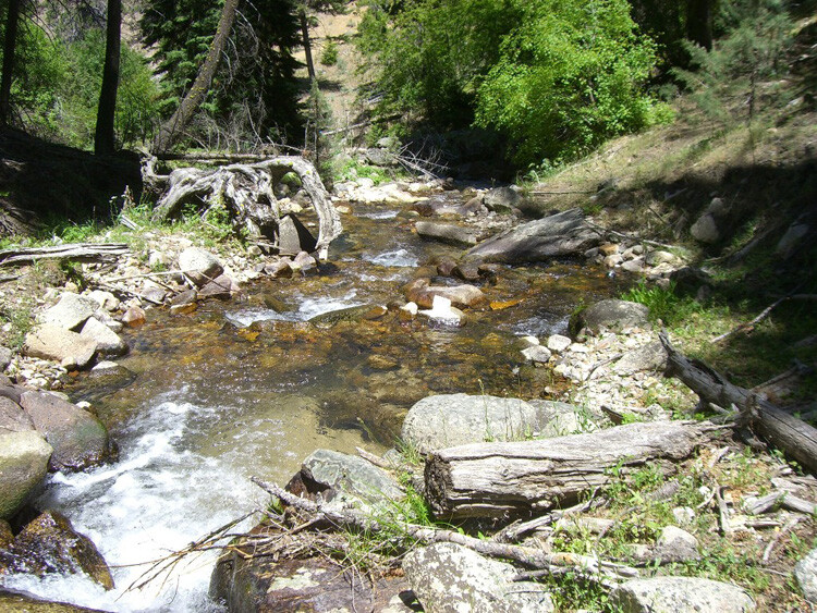
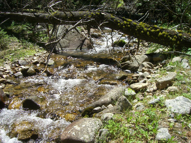
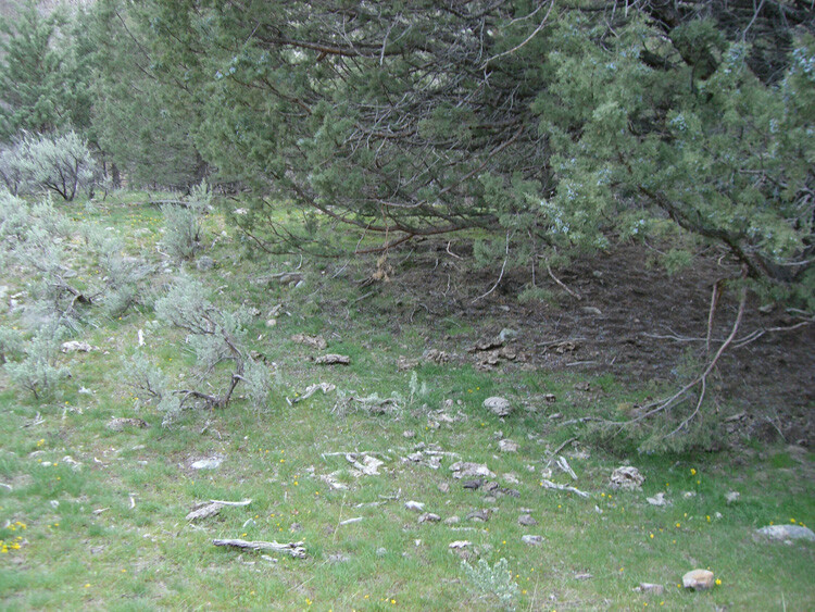
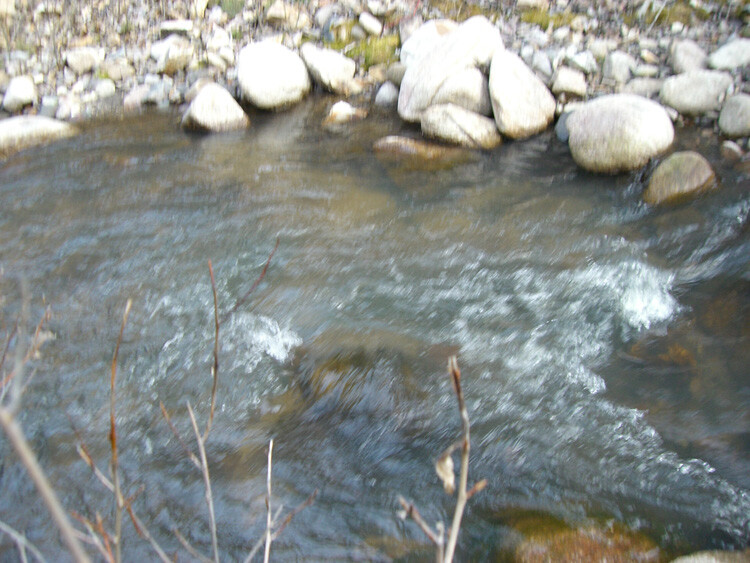
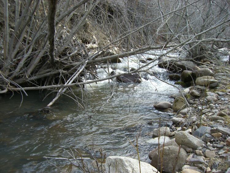
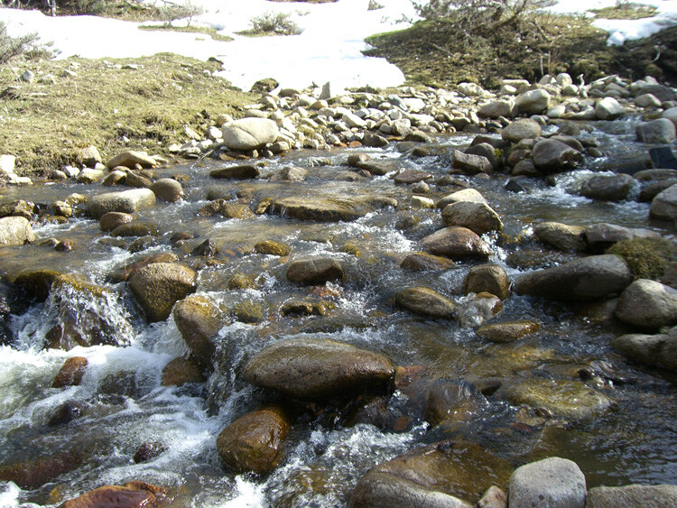
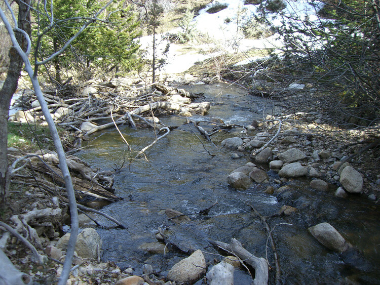
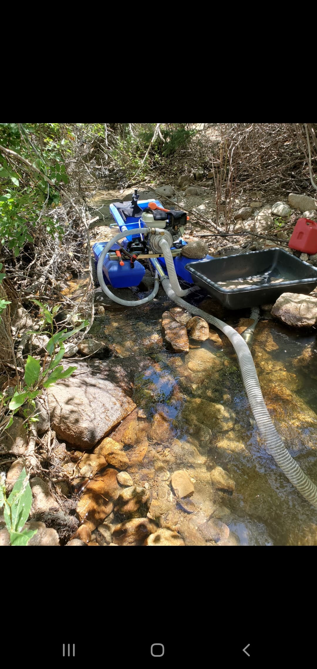
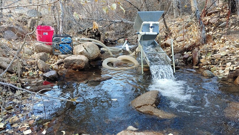
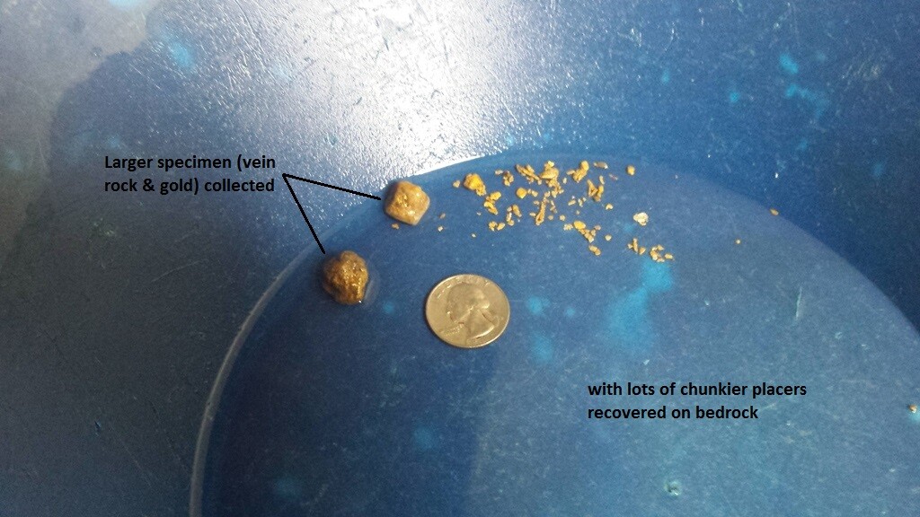
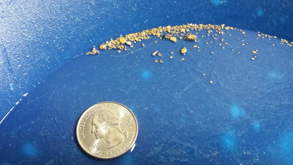
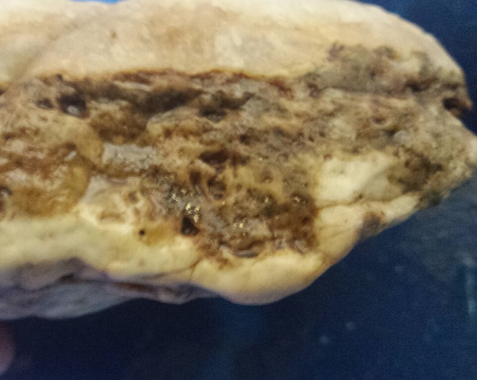
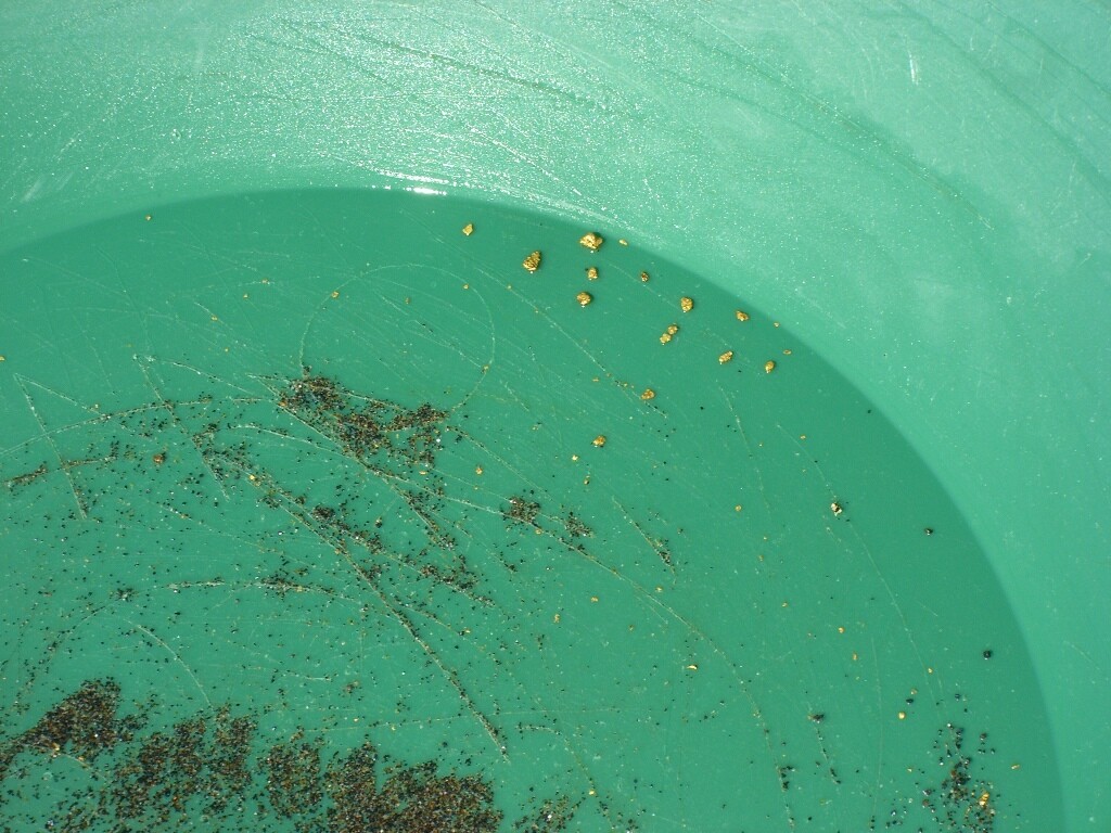
These placer claims are over deposits from all the vein activity from east side War Eagle Mountain (which geologically was the richest side on War Eagle Mtn), with extremely rich placer deposits right at the foot of some of the richest gold producers of the Silver City region. Oro Fino/Sinker Creek is a collection of all the hardrock mining from the eastern portion, with gold collecting and settling within these rich gravels. People constantly ask me about BLM claims, claims which could be developed into placer operations and for claims which are a bit more remote, that don’t show signs of being worked, and these claims would be ideal for such an explorer. As mentioned, these placer claims reside downstream & abutting some of the high yielding gold producing operation, and would encourage you to review the geological survey report illustrating the recorded values for those mines, as it shows the rich history of the placers and region. From metal detecting gram size gold and even nice specimens within vein rock have been pulled from just a couple hours playing. These pictures were taken in late summer, so as you can see there is ample year-round water to set up your own operation. I have personally helped set up the larger placer operation (with heavy equipment) further upstream (abutting Gold Delight), so it does hold the value to be pursuing this into that type of set up. Here is a link to that video where you can see Freddy Dodge assisting the current owners fix their equipment issues (at this Sinker site) https://www.youtube.com/watch?v=TLyhKZjsF7A
As you can see from the gold in that episode, some good color all along the Sinker drainage.
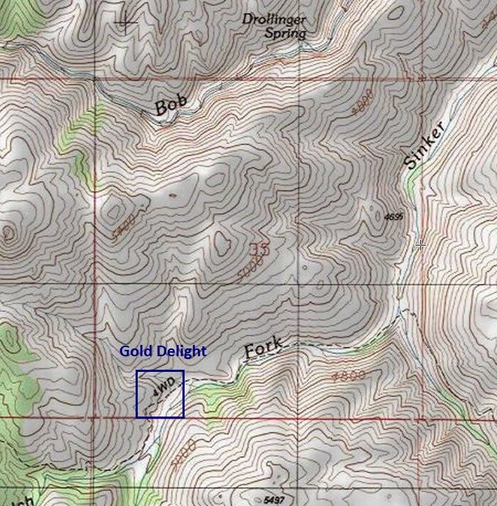
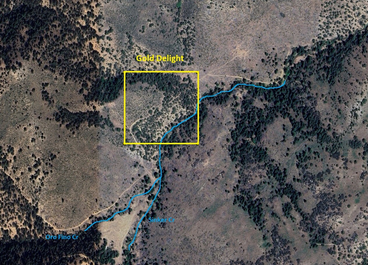
Gold Delight
Price: $2,250
- Acreage: 10 acre unpatented placer claim
- River footage: 550’ of Oro Fino/Sinker Creek - camping areas on claim
- Location: Owyhee County, Township 4S, Range 3W, Sec. 35 SW ¼
- Mining claim serial #: ID106736051
Map to Claim
Coordinates
Marker Degrees, Minutes, Seconds
NW 43°1’33.2112”N, -116°40’00.4800”W
NE 43°1’33.2112”N, -116°39’50.8860”W
SE 43°1’26.3784”N, -116°39’50.8860”W
SW 43°1’26.3784”N, -116°40’00.4800”W
Marker Latitude & Longitude
NW 43.025892’N, -116.666800’W
NE 43.025892’N, -116.664135’W
SE 43.023994’N, -116.664135’W
SW 43.023994’N, -116.666800’W
Aerial & Topo Images
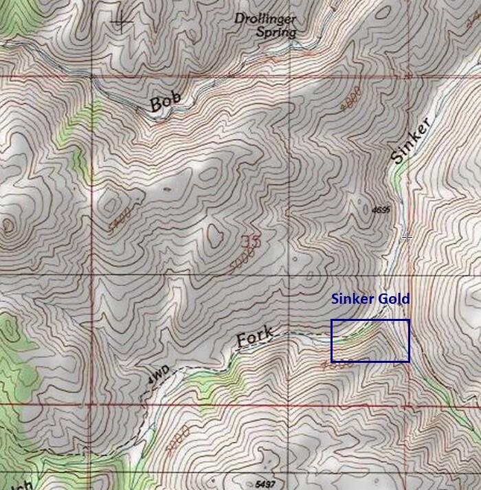
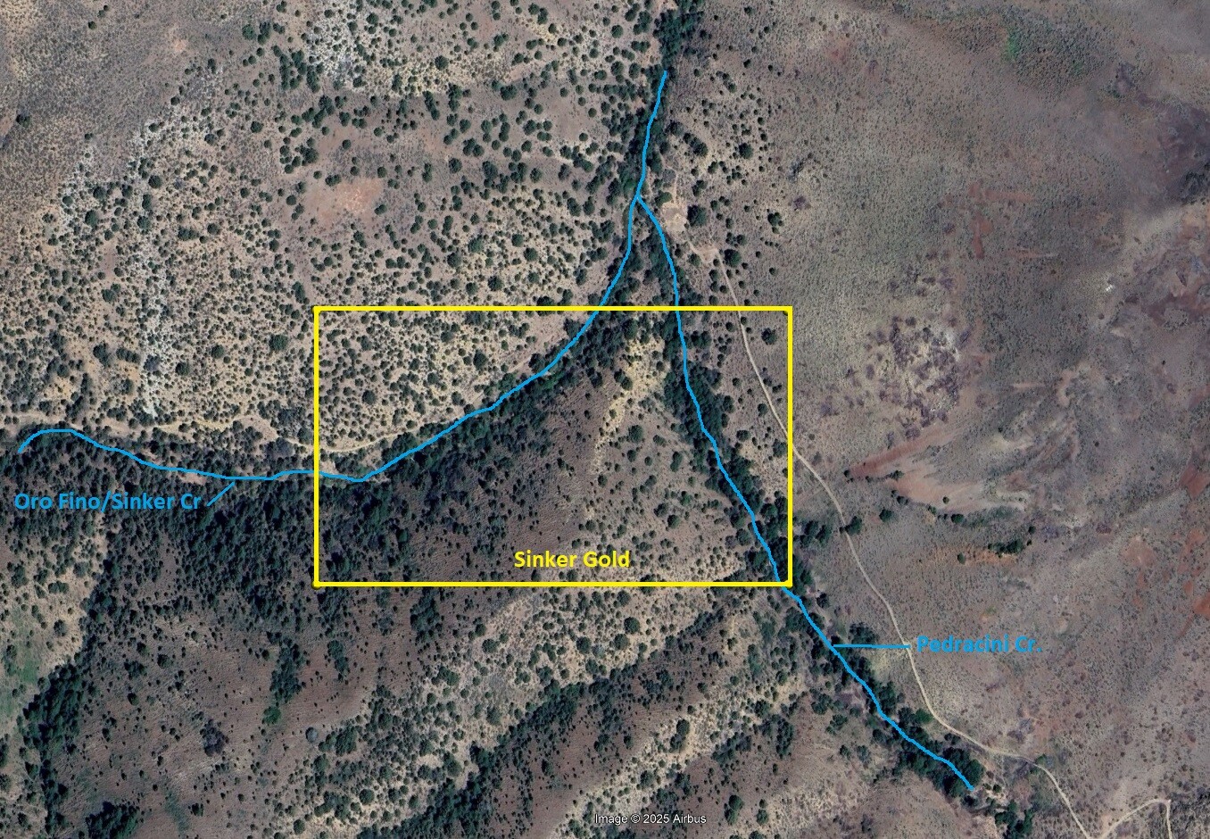
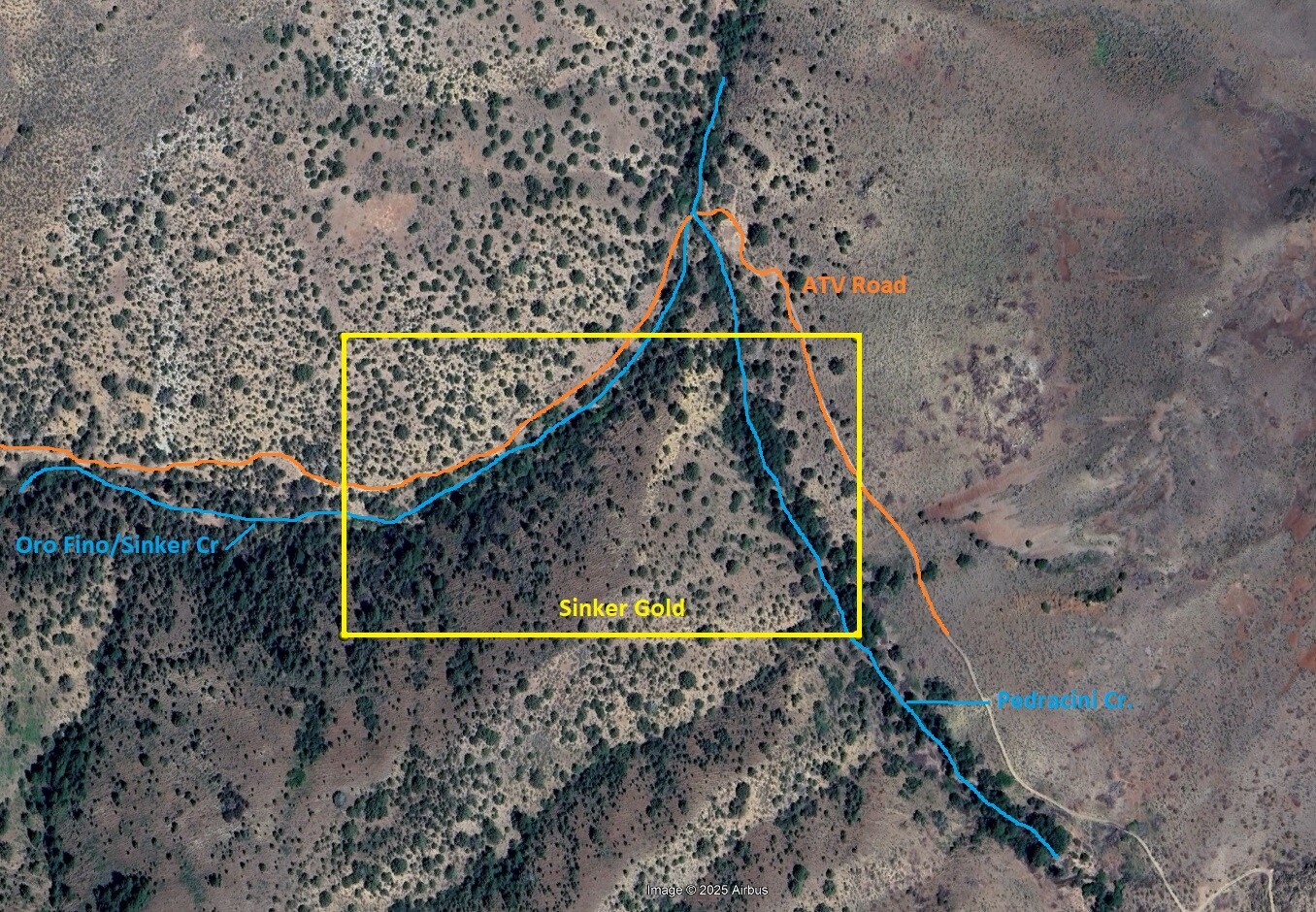
Sinker Gold
Price: $2,750
- Acreage: 20 acre unpatented placer claim
- River footage: 1000’ of Oro Fino/Sinker Creek & 850’ of gold bearing Pedracini Cr. camping areas on claim
- Location: Owyhee County, Township 4S, Range 3W, Sec. 35 SW ¼
- Mining claim serial #: ID106736052
Map to Claim
Coordinates
Marker Degrees, Minutes, Seconds
NW 43°1’41.5200”N, -116°39’15.9600”W
NE 43°1’41.5200”N, -116°38’58.3000”W
SE 43°1’34.0200”N, -116°38’58.3000”W
SW 43°1’34.0200”N, -116°39’15.9600”W
Marker Latitude & Longitude
NW 43.028200’N, -116.654433’W
NE 43.028200’N, -116.649528’W
SE 43.026117’N, -116.649528’W
SW 43.026117’N, -116.654433’W
Aerial & Topo Images
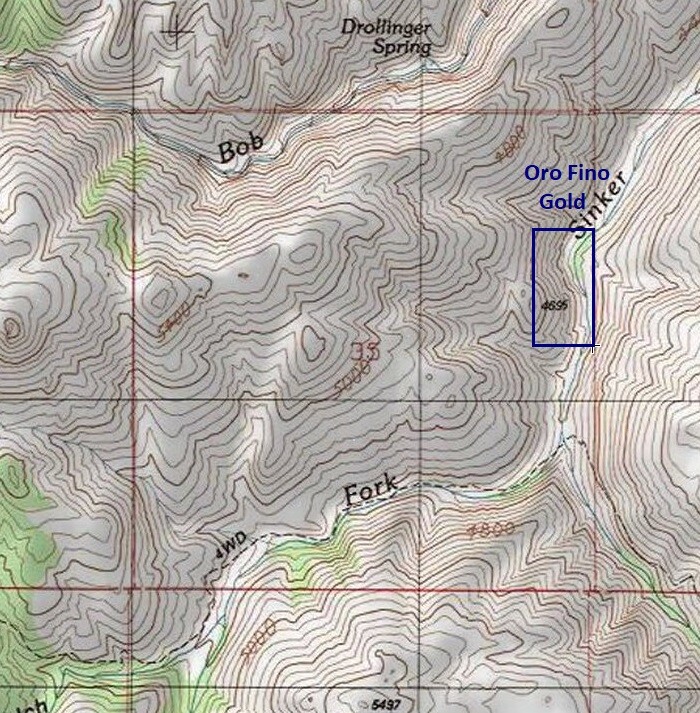
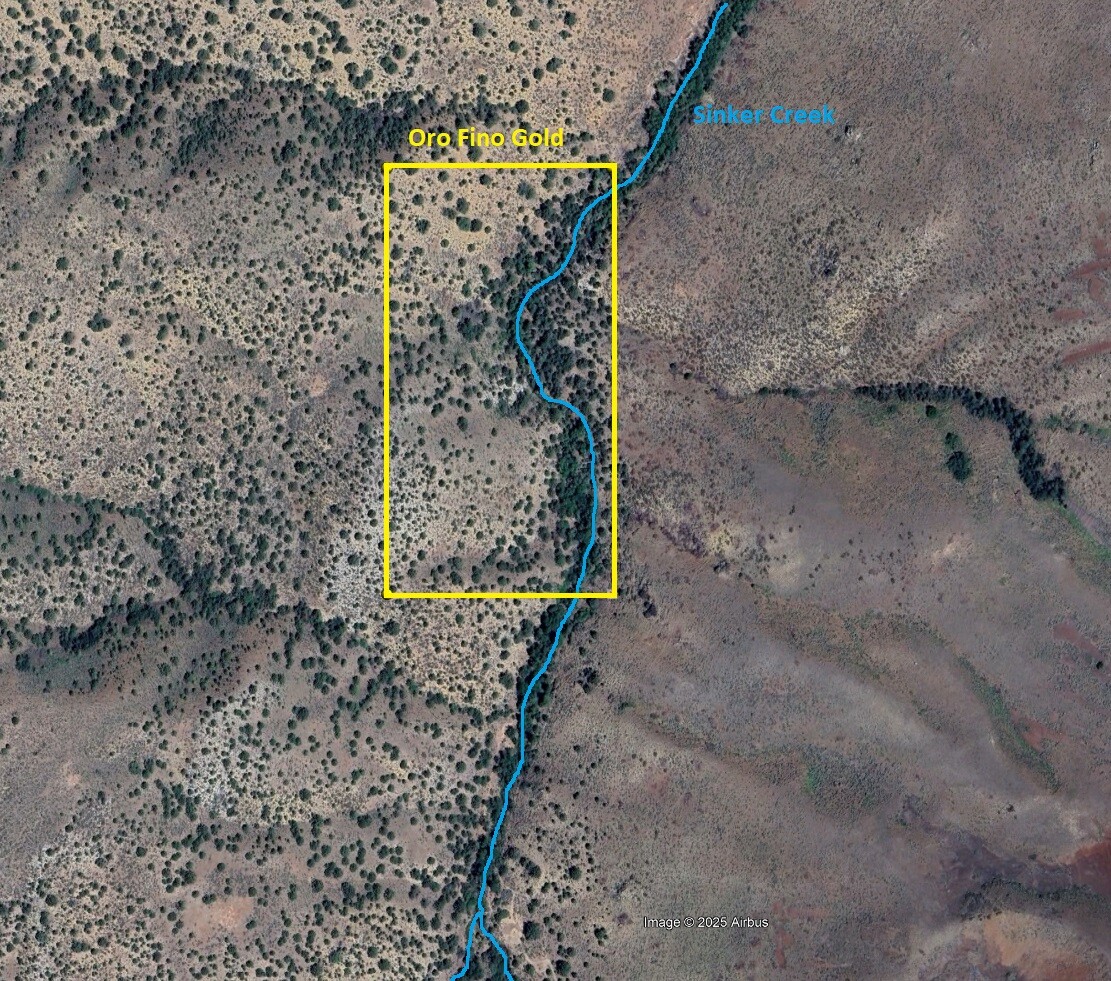
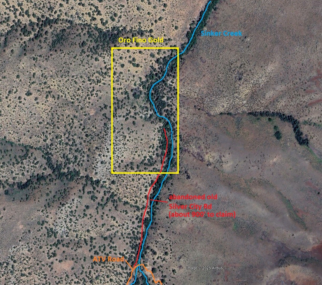
Oro Fino Gold
Price: $2,570
- Acreage: 20 acre unpatented placer claim
- River footage: 1500’ of Sinker Creek - The old abandoned Silver City Rd connects the 4WD Rd to claim - camping areas on claim
- Unpatented/patented: unpatented
- Location: Owyhee County, Township 4S, Range 3W, Sec. 35 SW ¼
- Mining claim serial #: ID106736053
Map to Claim
Coordinates
Marker Degrees, Minutes, Seconds
NW 43°2’07.6800”N, -116°39’07.8000”W
NE 43°2’07.6800”N, -116°38’58.3000”W
SE 43°1’54.5000”N, -116°38’58.3000”W
SW 43°1’54.5000”N, -116°39’07.8000”W
Marker Latitude & Longitude
NW 43.035467’N, -116.652167’W
NE 43.035467’N, -116.649528’W
SE 43.031806’N, -116.649528’W
SW 43.031806’N, -116.652167’W
Aerial & Topo Images
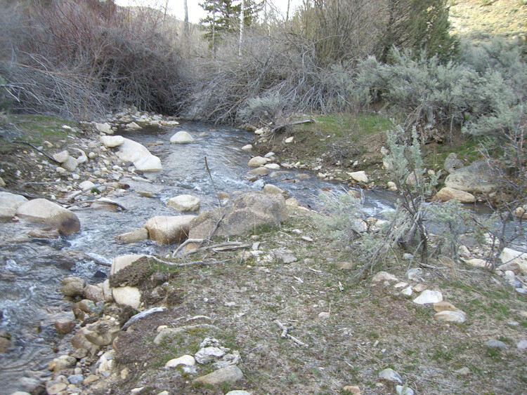
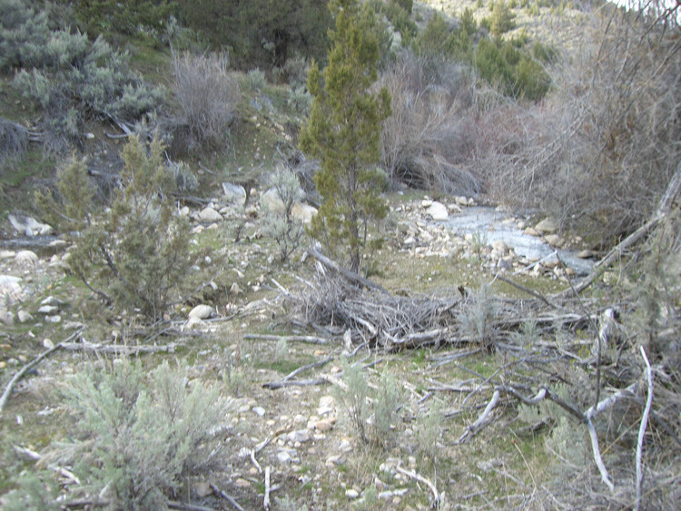
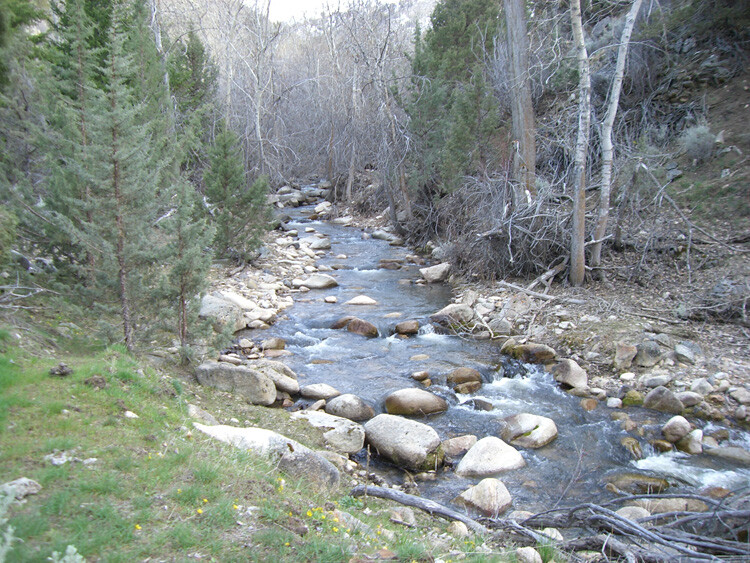
Images of Claims


Show me the Gold
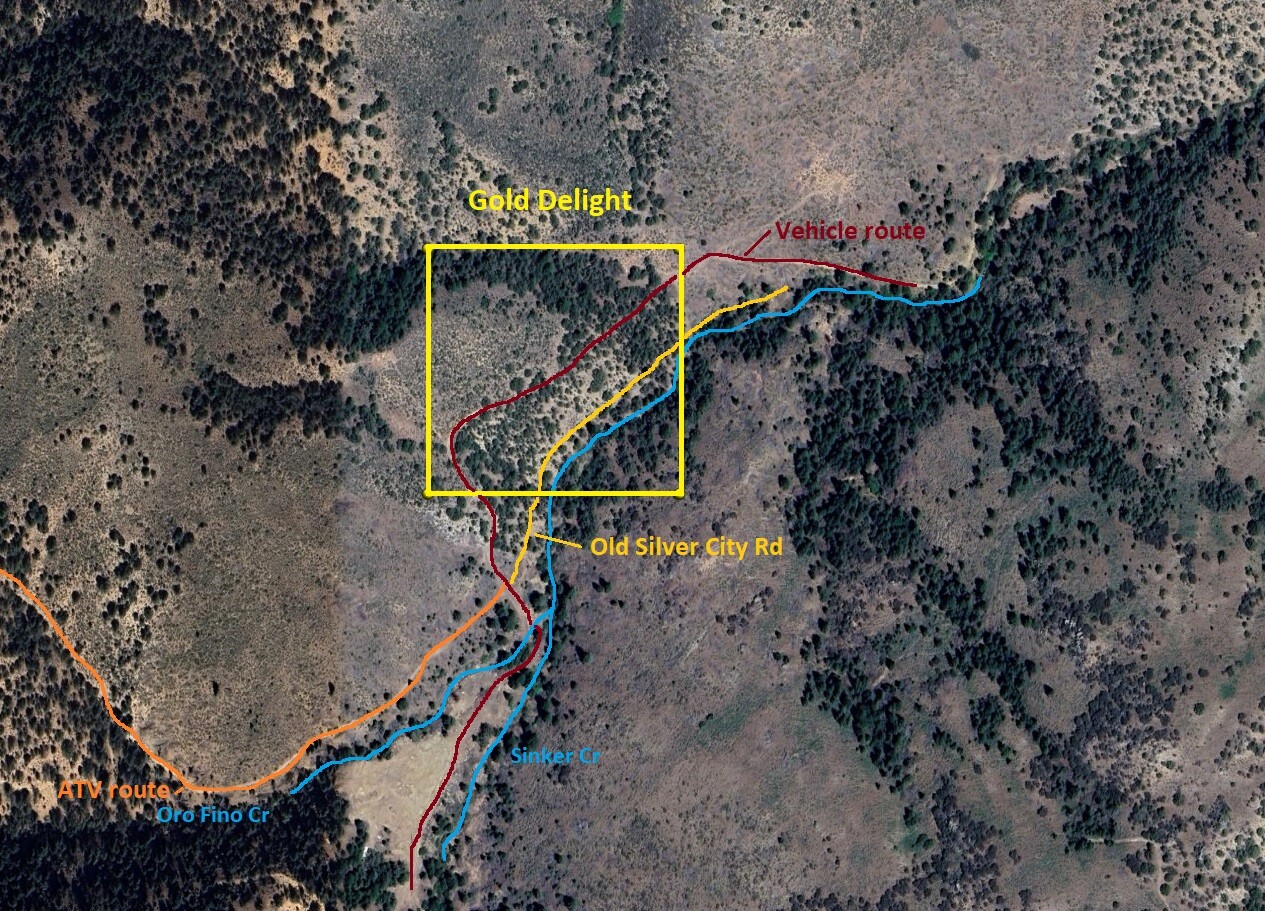
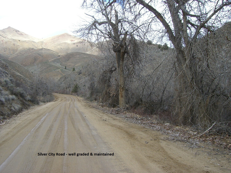
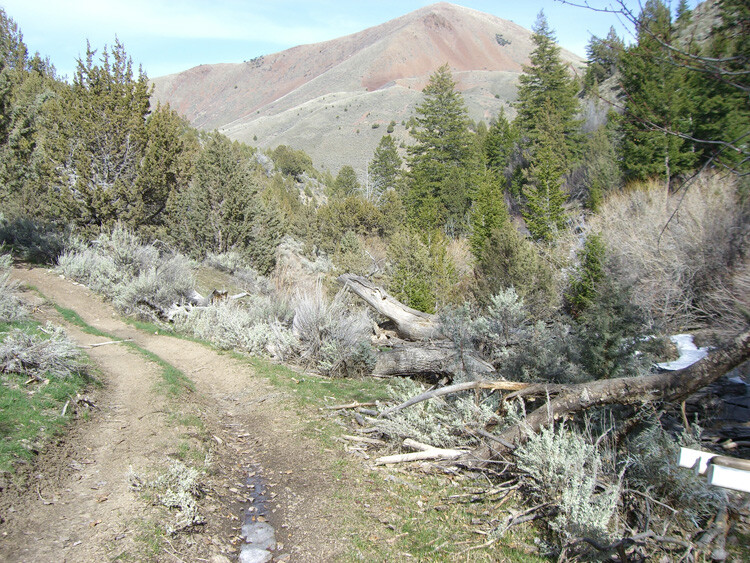
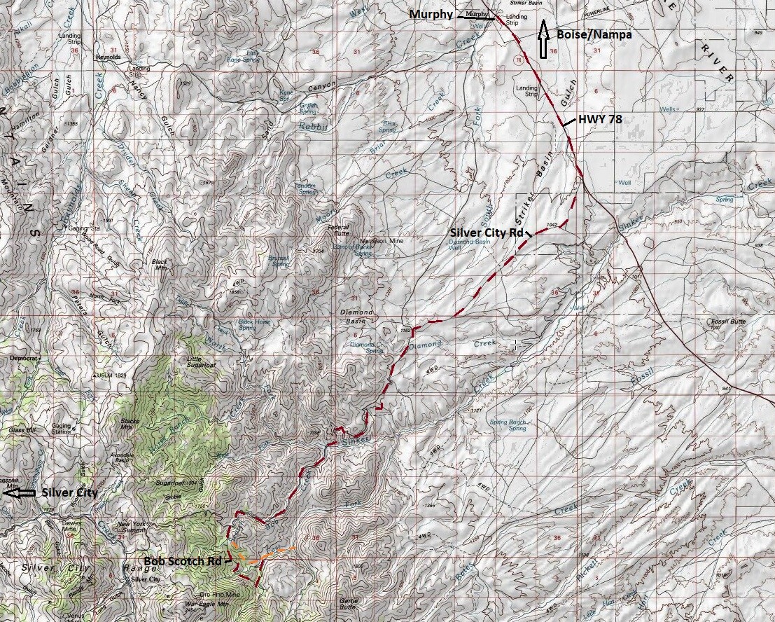
Driving Directions: From Nampa, travel south on HWY 45 approximately 14 miles to the HWY 78 junction (road will naturally head east on HWY 78), to approximately 14.5 miles past Murphy to the Silver City turnout, head southwest on the Silver City Road for approximately 13.5 miles. There is a Sinker Tunnel public access road to the left (south) which you will take for approximately 1/2 mile. You will reach a 4 way junction, south (straight, which is gated) would take you to Sinker Tunnel Mine, to the west (right) takes you up to War Eagle Mountain, and to the east (left) large parking/camping area with alternate ATV trail that you can access to the claims (Option II).
Option I: Head through unlocked gate, staying on this road for approximately 2 miles, which also passes the fenced off Sinker Tunnel site. As you head downhill and approach South Fork of Sinker Creek, there is a road to the left, which you will turn on, which will follow Sinker Creek for approximately ½ mile. You will see a large flat opening towards the junction (where the active mining operation is happening). From this point, from this point the road does get significantly rougher where 4WD or ATVs are advised along the trail that crosses Sinker Creek, and follows the creek, where this road actually crosses the creek, it is approximately 300’ to the Gold Delight claim, with the others being further down(stream) on this road. I have personally taken trucks back into the Sinker Gold mining claim, but it is a rough road that is not being maintained (some grading & tree trimming might be needed).
Option II: There is a large pullout/campground on the ridge top area to the left, where you will need to park your truck. From this location there is a 4-wheeler road that at the end of the pullout/campground, you will travel on this for approximately 1.2 miles to the first claim (Sinker Gold is another mile down). There are only two major Ys (two creeks come together), at the first is (Option I) where you can pull a truck to, and you will see the workings from a larger mining operation of someone else’s site, the second father down, the 4 wheeler road only crosses the creek at the Y (just past Sinker Gold)
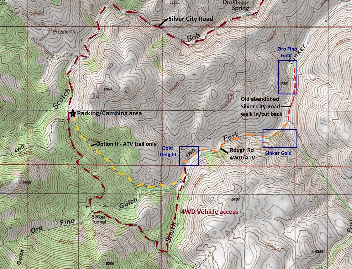
***The mining operation abutting Gold Delight is PRIVATE PROPERTY, so while Gold Delight does have camping, staging and parking areas, you would need to get prior approval to park/camp at the mining operation.