Spanish Gold
Idaho City Sold
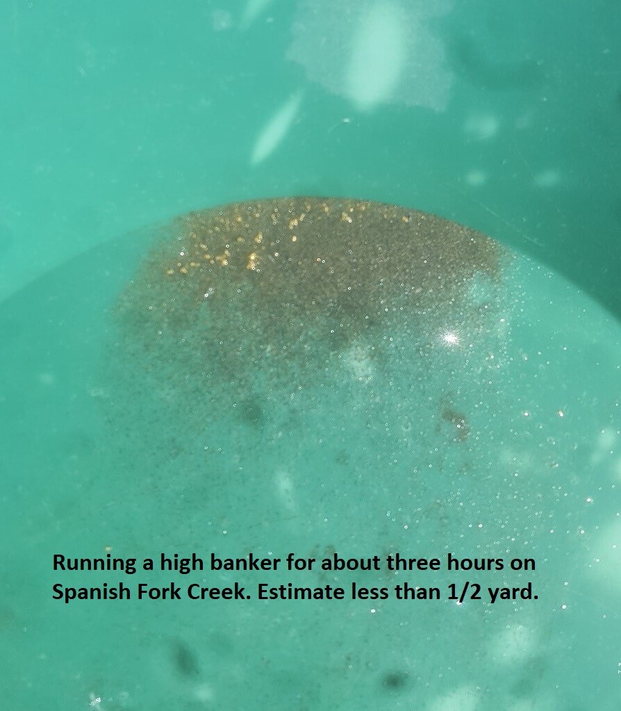
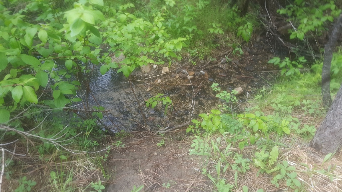
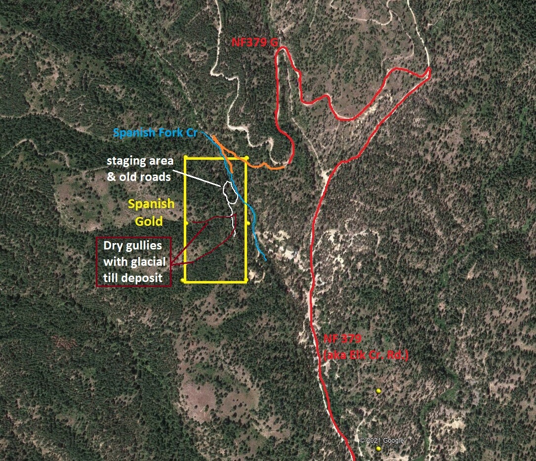
Where to start with Spanish Gold, for starters this mining claim resides on a very well-known gold bearing Spanish Fork drainage just outside historic Idaho City. I am asked often if I have any sites conducive to setting up larger mining operations, meaning an area where heavy equipment can be used, and this site is that perfect match (for several reasons). Besides the fact that this claim has a large flat open area of alluvial (bench) material deposit from Spanish Fork, it also has easy to traverse (with equipment) rollie hill terrain which holds glacial till which has been tested to find it hold production worthy gold deposit. So, aside from the creek itself (which typically has to stay protected during an operation), the entire portion of this claim has viable ground that can be worked, however (as experience will tell you) a “stream alteration permit” can also be submitted to divert the creek to the other side of the draw to work this creek portion as well later on. Another huge benefit to this claim is that the road to access this site dead-ends at the claim, with a larger flat area on the other side of the creek for staging an operation and processing material, which will alleviate any pass-through weekend traffic. The other thing that larger operations look for is areas of BLM managed lands (which Spanish Gold is), as the plan approval process is a lot smoother with the BLM agency proficient in both mining law & mining “rights” (unlike that of the “other” federal managed lands, whose staff are found to be constantly impeding on miner’s “rights” & attorneys having to get involved to set that agency straight).
- Acreage: 20 acre unpatented placer claim
- River footage: 530’ of Spanish Fork Creek
- Location: Boise County, Township 6N, Range 5E, Sec. 23, NW ¼
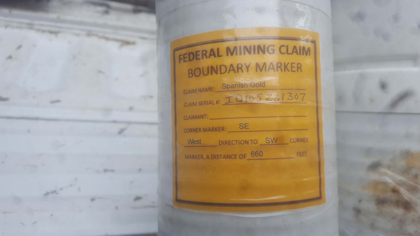
- Mining claim serial #: ID106735117
Map to Claim
Coordinates
Marker Degrees, Minutes, Seconds
NW 43°51’05.2920″N, -115°50’09.6720″W
NE 43°51’05.2920″N, -115°50’00.5640″W
SE 43°50’51.8280″N, -115°50’00.5640″W
SW 43°50’51.8280″N, -115°50’09.6720″W
Marker Latitude & Longitude
NW 43.85147’N, -115.83602’W
NE 43.85147’N, -115.83349’W
SE 43.84773’N, -115.83349’W
SW 43.84773’N, -115.83602’W
Maps


Images


Overview
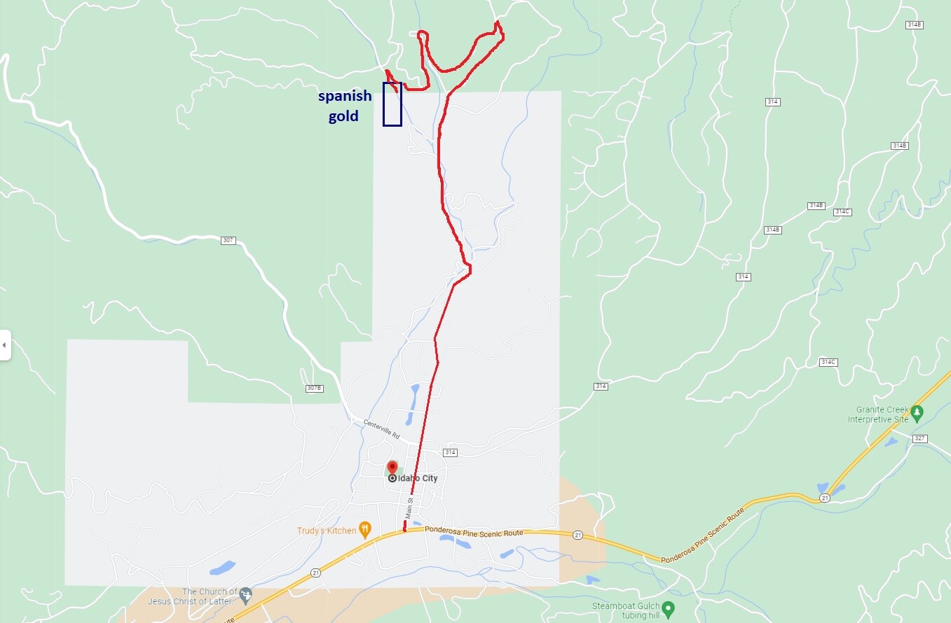
Driving Directions:
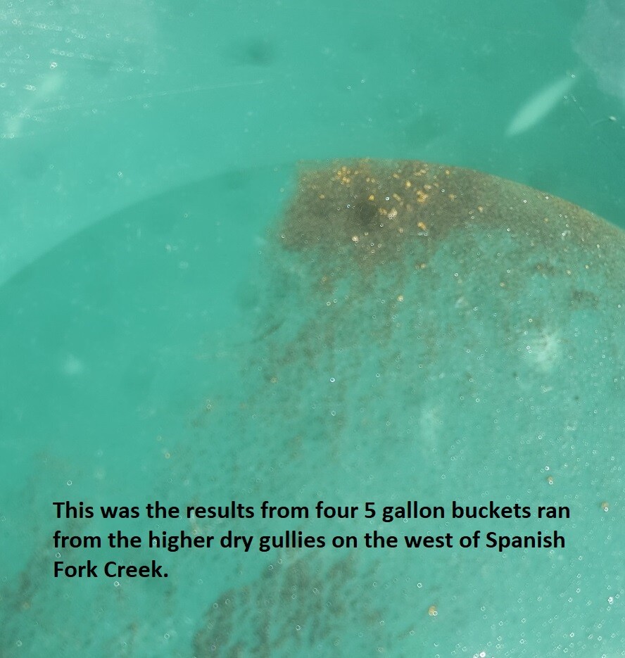
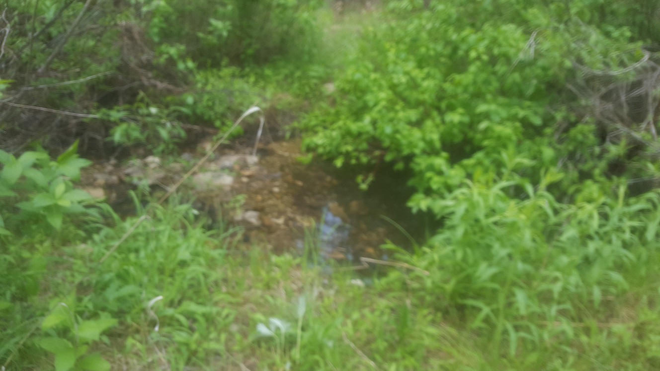
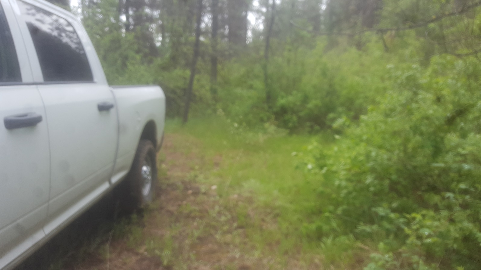
Driving Directions: The claim is “physically” located within a mile or on the outskirts of Idaho City. From Boise, travel north on HWY 21 to Idaho City (approximately 34 miles from I-84). Turn left (north) onto Main Street in Idaho City. Stay on this road all the way through town and keep following it straight. At 2.2 miles (from HWY 21) there is a HARD left turn (it is the first left after the road starts climbing past the rustic private area). This is technically called NF379G, but I haven’t see any markers for it. You will stay on this for about 0.7 of a mile and take the fork to the left. You will see intimidating signs about it being a private road, keep out, but these were placed by the state mineral lease owners & is accessible for this claim. In a couple hundred feet, as the road drops into Spanish Fork Creek, there is another HARD left that follows down Spanish Fork Cr. & to the mining claim. I have posted on this road showing where the north boundary to the claim is located. There is a wide spot to pull out just past this sign, and the road is more of a trail until it reaches private property. There is also a LARGE flat area on the other side of the creek, which could be easily cleared to park a camp trailer or running bigger equip. There is also an abandoned road on the other side of the creek (past the flat open bench), which extends up into the flat drainages that feed into Spanish Fork, with these gullies having round cobble (glacial till) and color being present.
Show Me The Gold