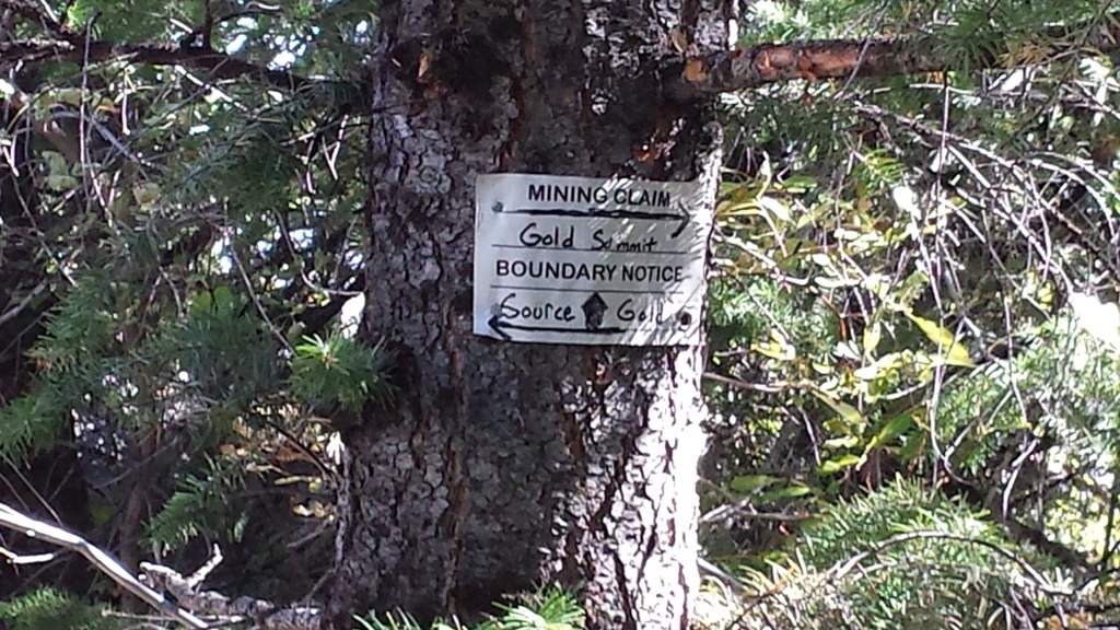
Source Gold
Silver City Sold
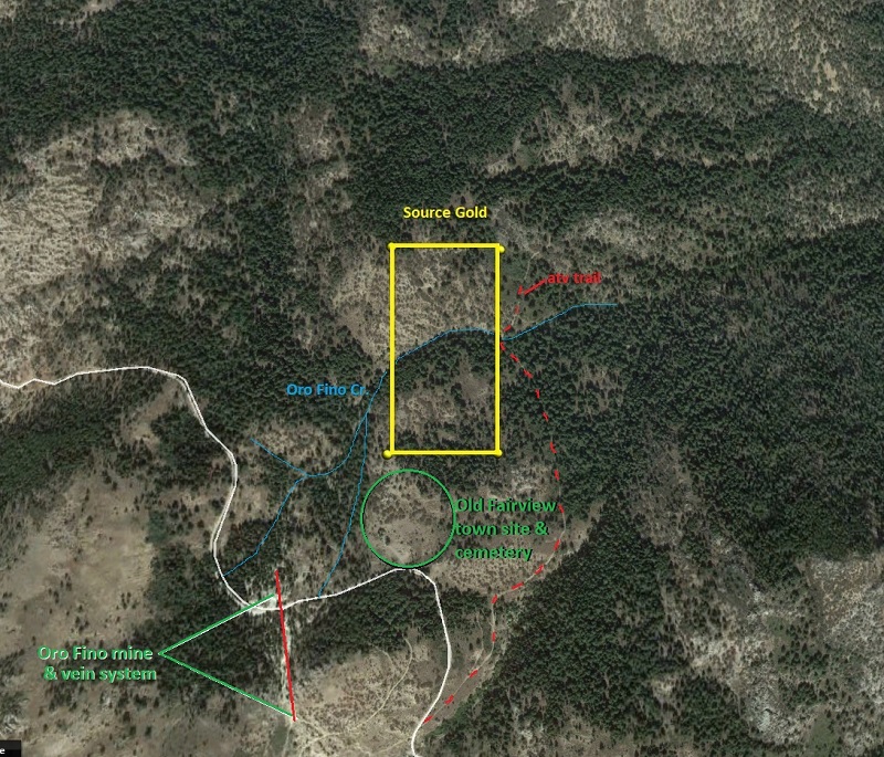
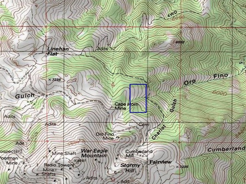
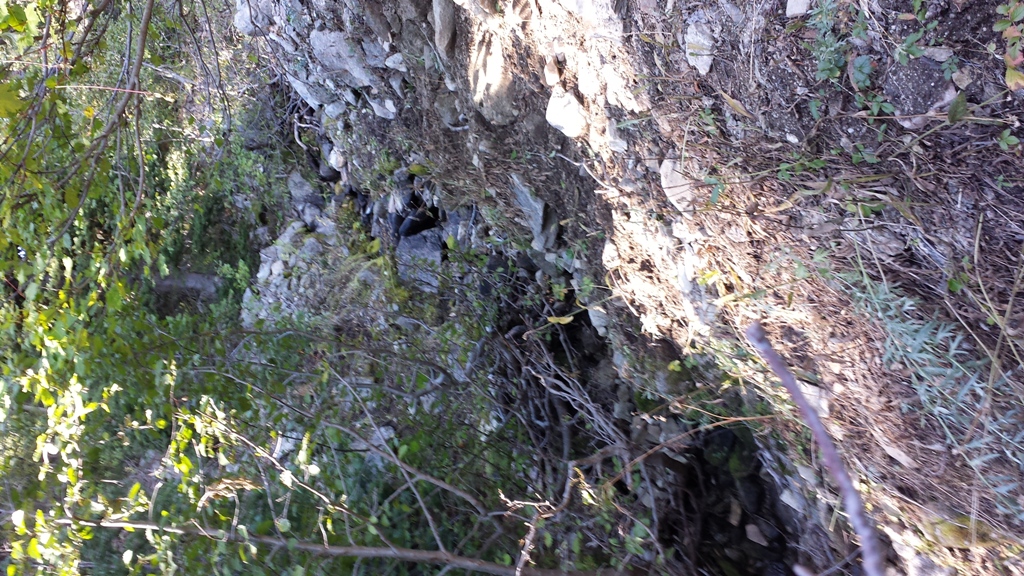
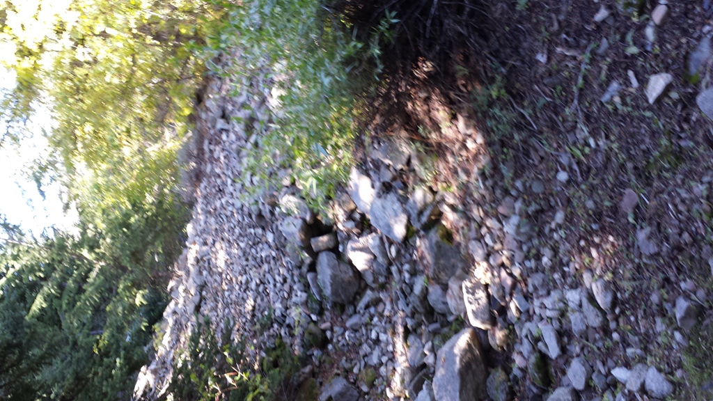
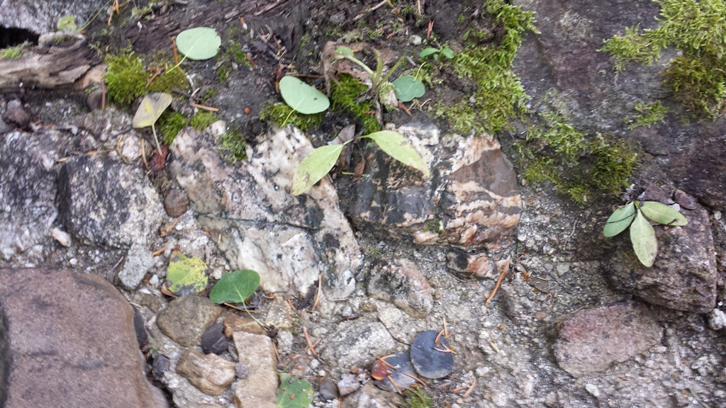
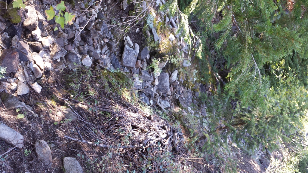
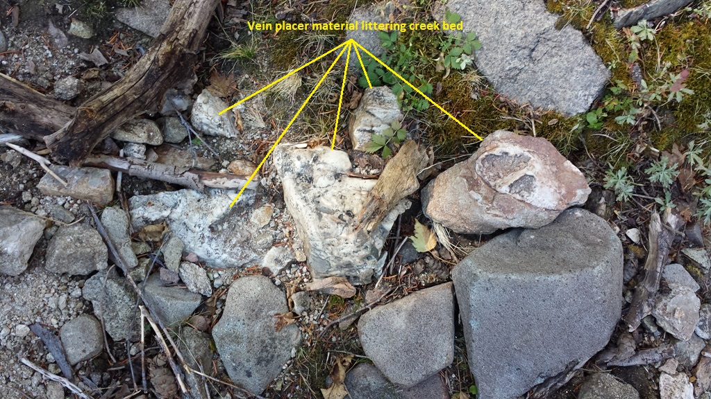
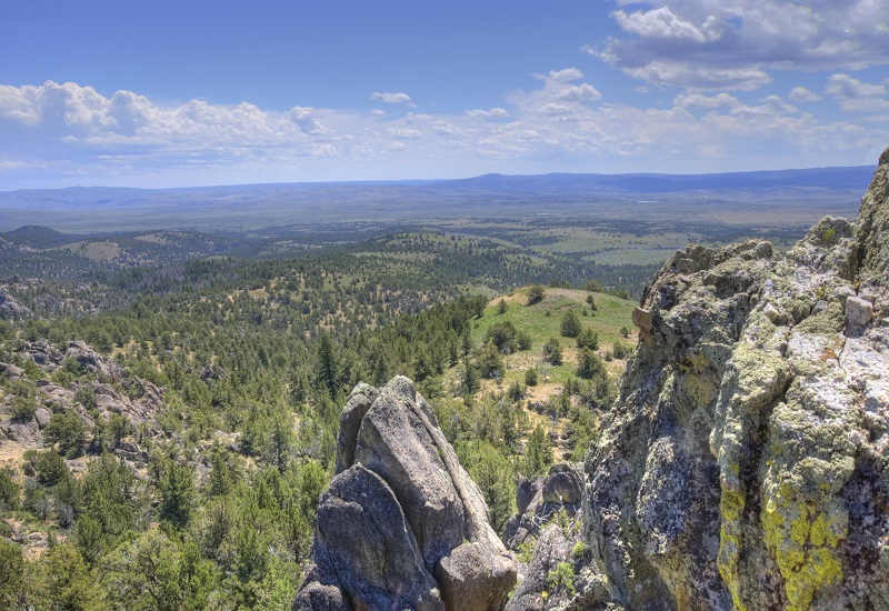
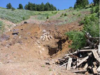
These War Eagle mining claims are positioned over the extremely rich placer deposits right at the foot of some of the riches gold producers of the Silver City region. Many of the gullies on the west side of War Eagle, were washed to expose the lode veins and work the rich deposits below the mines. However on this east side of War Eagle Mountain, while there are tailing remanence and old workings from the mine shafts, the drainages themselves are not washed to the hardrock, which have extremely nice yields left behind. For many years this area had been secured for the lode deposits (hard-rock mining) operations for the deep earth mining that were being sought after, not messing with the placer surface deposits. After Silver Falcon’s operation failed, it opened up this area to placer deposit recovery. As mentioned, these placer claims reside downstream & abutting some of the high yielding gold producing lode sites, which are patented (private), and would encourage you to review the geological survey report illustrating the recorded values for those mines. From metal detecting gram size gold and even nice specimens within vein rock have been pulled from just a couple hours playing. With these creeks being at the headwaters (close to the top of War Eagle), they are easier to work in the early summer with a high-banker, or an excellent area for dry washing, metal detecting or other means in late summer, when the water is down.
Geological Report Links
https://www.idahogeology.org/product/b-11
https://www.idahogeology.org/product/t-83-4
https://www.idahogeology.org/pub/Pamphlets/P-138.pdf
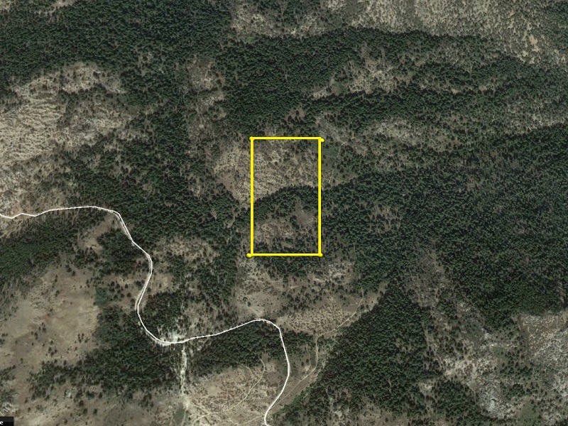
- Acreage: 20 acres
- River footage: 750 feet of Oro Fino Creek
- Placer/lode: placer
- Location: Owyhee County, Township 5S, Range 3W, Section 04 SE 1/4
- Mining claim serial #: Claim Serial IMC 217646
Map to Claim
Coordinates
NW Corner 43.0167833°N, -116.6965200°W
NE Corner 43.0167833°N, -116.6940667°W
SE Corner 43.0133400°N, -116.6940667°W
SW Corner 43.0133400°N, -116.6965200°W
NW Corner 43°01’00.4200”N, -116°41’47.4720”W
NE Corner 43°01’00.4200”N, -116°41’38.6400”W
SE Corner 43°00’48.0240”N, -116°41’38.6400”W
SW Corner 43°00’48.0240”N, -116°41’47.4720”W
Maps
War Eagle Claims


Source Gold Maps

Images
Source Gold


War Eagle Claim Area Images


Overview
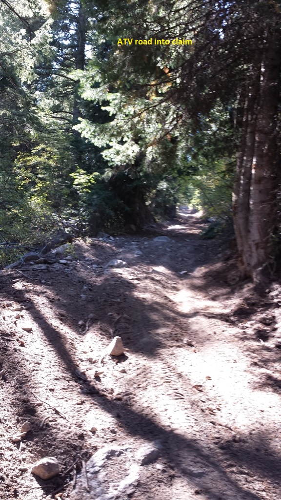
Driving Directions: Driving Directions: From Nampa, travel south on HWY 45 approximately 14 miles to the HWY 78 junction (road will naturally head east on HWY 78), head east on HWY 78 to approximately 4.5 miles past Murphy to the Silver City turnout, head southwest on the Silver City Road for approximately 18 & ½ miles (which is past the New York Summit pass & as you are heading down towards Silver City) turning left at Slaughterhouse Gulch. Take this main road for approximately 2.5 miles (stay on the main road, and left at the major forks), which is approximately 800’ past the Fairview cemetery. From this location, turn left down Chariot Gulch on the atv trail, and at this point atv or foot travel would be necessary. From this junction you will travel approximately 2650 feet (about ½ mile), and the Source Gold mining claim is located from where the atv trail crosses Oro Fino Creek upstream to the west.