Price: $4,000
Sale PendingSecesh Claims
Overview
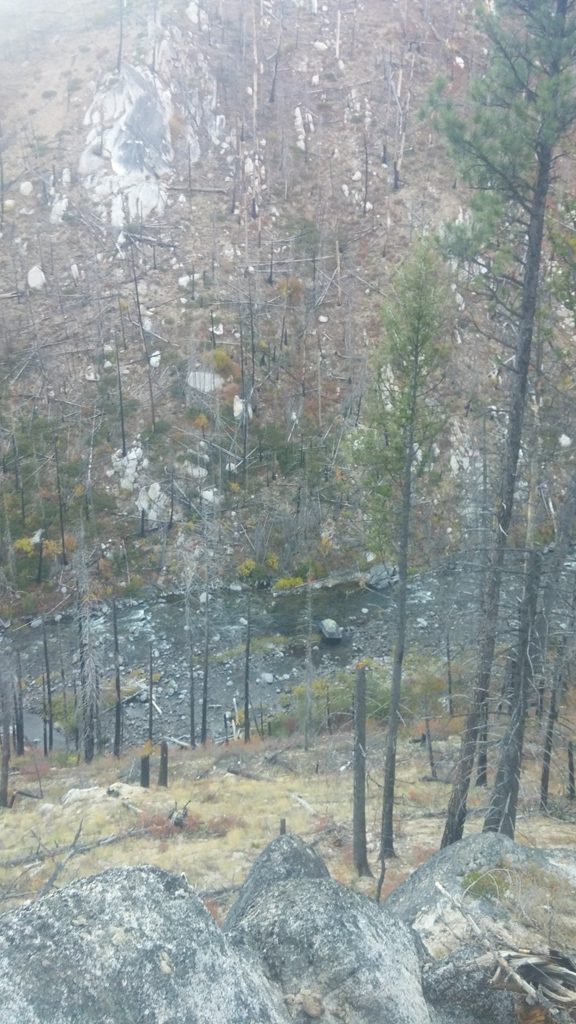
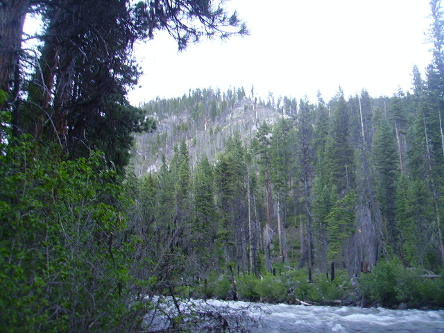
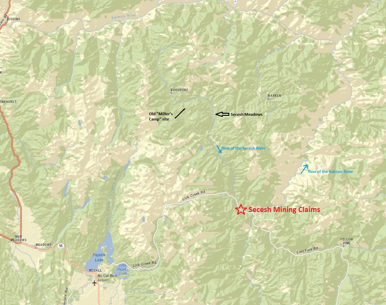
These two placer mining claims are located on the historic gold bearing Secesh River, northeast of McCall, Idaho. Sit nestled right off well maintained Forest Service Road NF -48, with adjacent campgrounds, access to both sides of the river, and a well designated pack trail across both the claims. The Secesh River hold a rich gold bearing history, from the early discoveries at Miller’s Camp, and through the Secesh Meadows placer deposits upstream of these claims (see more details below). The McCall area is one of Idaho’s most beloved resort/recreation locations. Several mountain lakes with remote terrain for skiing, fishing, hunting, hiking, boating and hot springs which supply plenty of opportunities for fun when you aren’t working your gold claim.
With these two claims being adjacent to each other, we can offer a bundle price of $4,000 for both claims. (individual prices listed below).


Secesh Placers
- Acreage: 20 acres
- River footage: 1350’ Secesh River
- Placer/lode: placer
- Unpatented/patented: unpatented
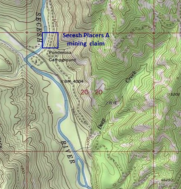
- Location: Valley County, Township 20N, Range 6E, Sec. 17, SW ¼
- Mining claim serial #: IMC217219
Map to Claim
Coordinates
NW 45.068893’N, -115.758821’W
NE 45.068893’N, -115.756382’W
SE 45.065369’N, -115.756382’W
SW 45.065369’N, -115.758821’W
NW 45°04’08.0148″N, -115°45’31.7556″W
NE 45°04’08.0148″N, -115°45’22.9752″W
SE 45°03’55.3284″N, -115°45’22.9752″W
SW 45°03’55.3284″N, -115°45’31.7556″W
Secesh Placers A
- Acreage: 10 acres
- River footage: 660’ Secesh River
- Placer/lode: placer
- Unpatented/patented: unpatented
- Location: Valley County, Township 20N, Range 6E, Sec. 20, NW ¼
- Mining claim serial #: IMC217350
Map to Claim
Coordinates
NW 45.065369’N, -115.758821’W
NE 45.065369’N, -115.756382’W
SE 45.063607’N, -115.756382’W
SW 45.063607’N, -115.758821’W
NW 45°03’55.3284″N, -115°45’31.7556″W
NE 45°03’55.3284″N, -115°45’22.9752″W
SE 45°03’48.9852″N, -115°45’22.9752″W
SW 45°03’48.9852″N, -115°45’31.7556″W
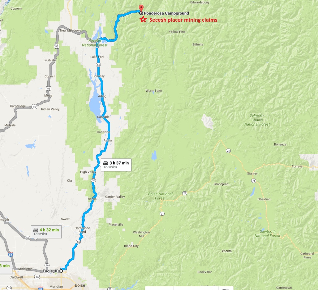


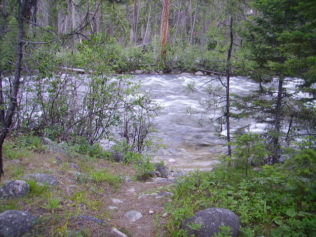

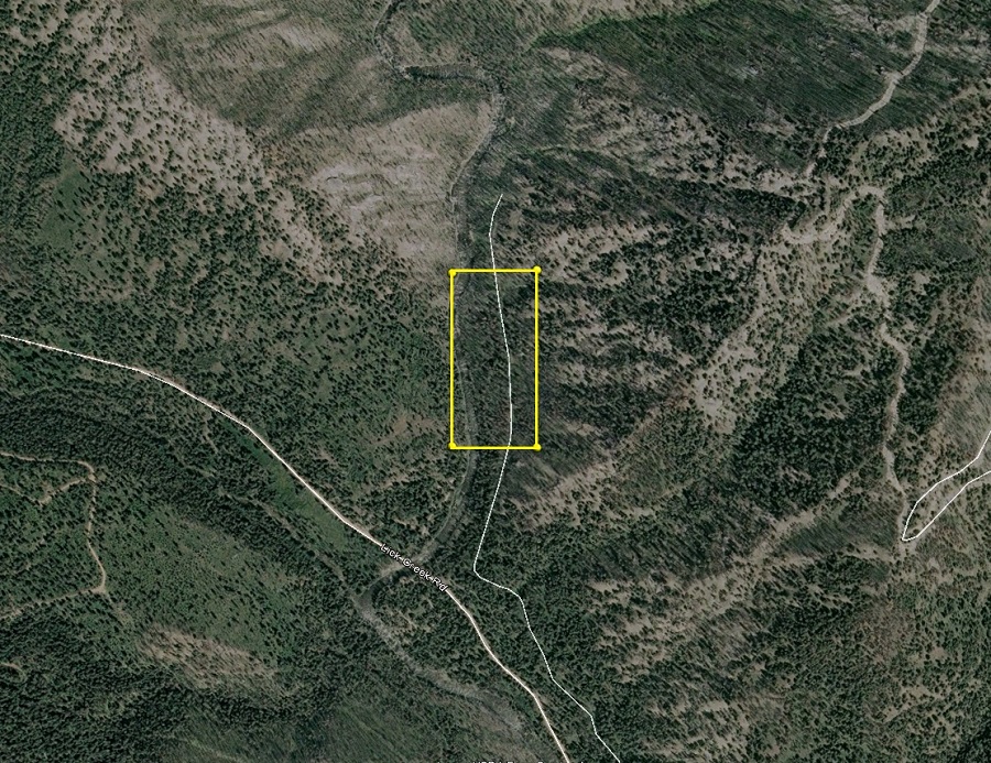
Driving Directions from Boise: Take HWY 55 (from State Street aka HWY 44), north out of Boise to McCall (which is approximately 95 miles). In McCall, turn right (east) on Railroad Ave. for about two blocks, then left on Davis Ave. for about ¼ mile, then a right on Lick Creek Road. Stay on Lick Creek road, the name of the road will change to NF-48, which you will stay on for approximately 28 miles to the bridge at the Secesh River. The Secesh Placers A claim is up the Secesh River approximately 200’, and the 20 acre Secesh Placers claim abuts the 10 acre and is farther upstream. Staking has been placed on the corners of the claim, marking the boundaries.
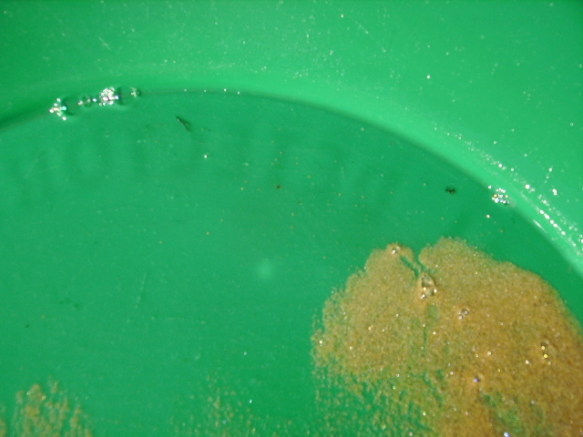
Show me the Gold
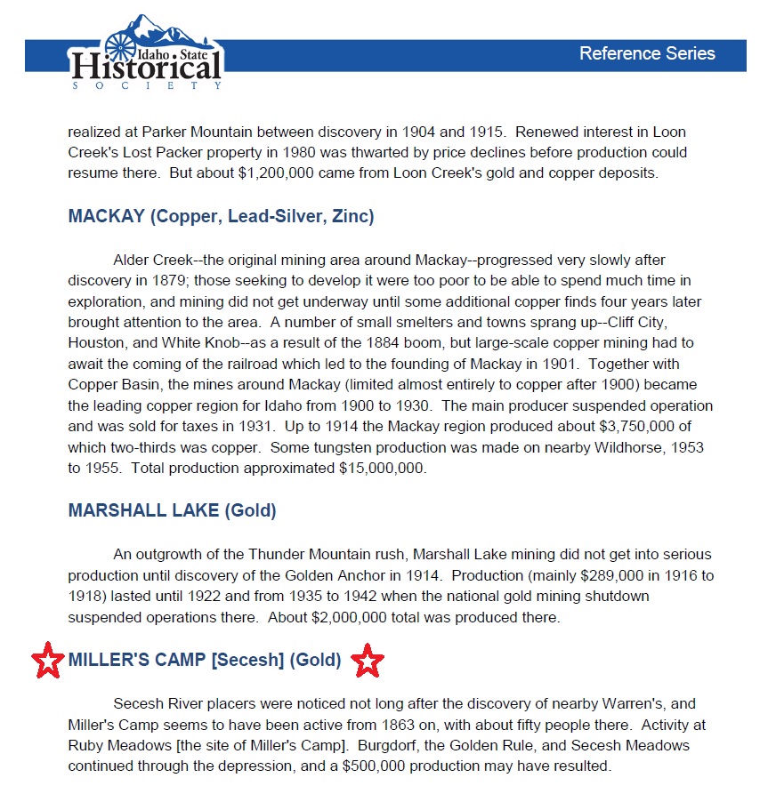
The Secesh River placers were discovered around 1863. Miller’s Camp had about fifty miners working to pull out gold, a small number compared to the rush around Idaho City. Historical estimates are around $500,000 worth of gold being pulled from Ruby Meadows (site of Miller’s Camp), Burgdorf, the Golden Rule and Secesh Meadows. That’s around $32.5 MILLION in current market values! While the upper end of the Secesh River, through the Secesh Meadows (Burgdorf through Warren) was worked extensively in these early operations, downstream the Secesh River flows through a narrower steep mountain pass for many miles, before opening up again in the area of IGM claims. This lower end is virtually untouched from those previous workings, yet with high yields of chunky gold.


Favorite links for the Secesh gold history