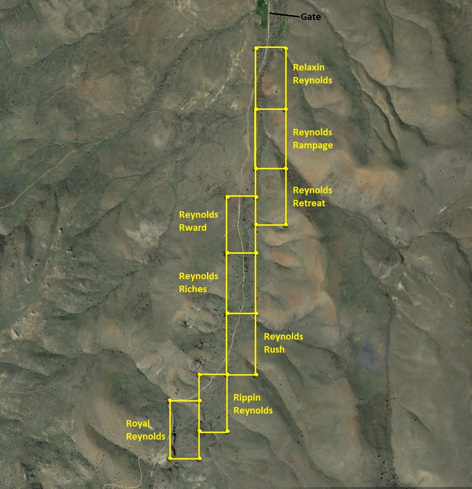
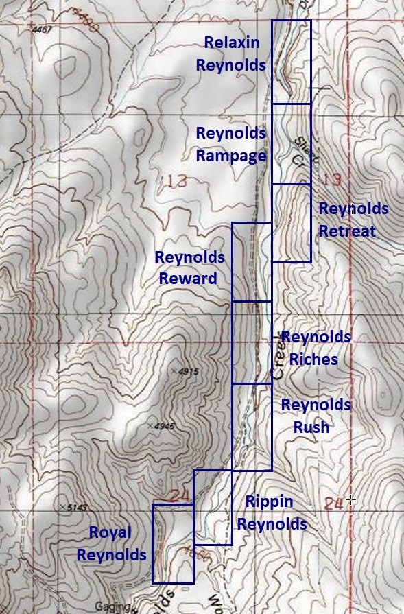
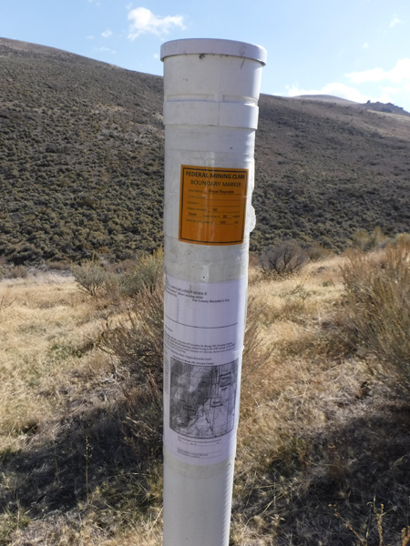
Reynolds Creek Claims
Reynolds Creek Sold
Overview
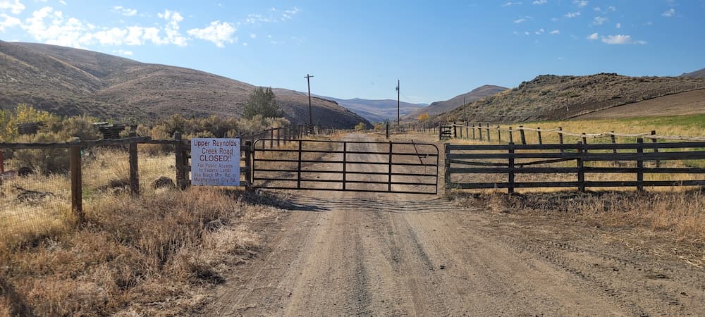
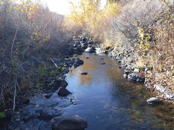
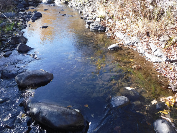
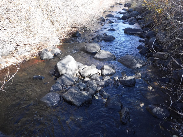
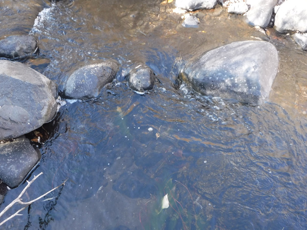
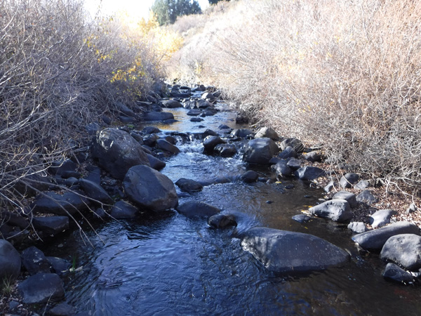
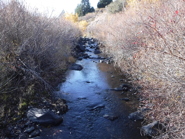
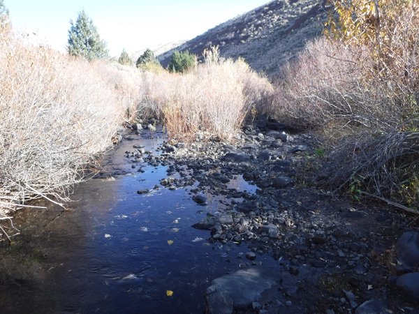
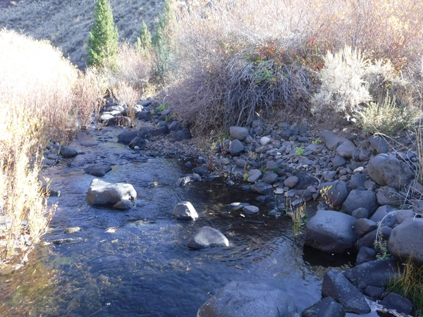
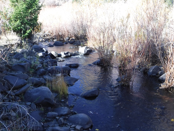
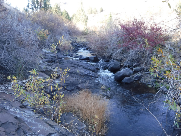
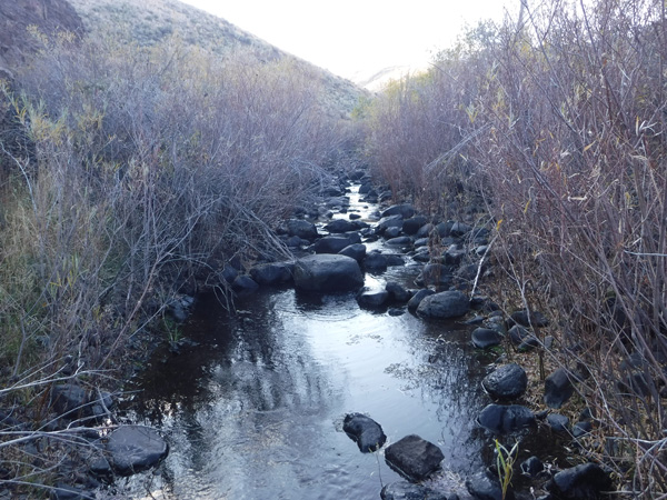
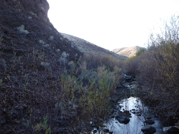
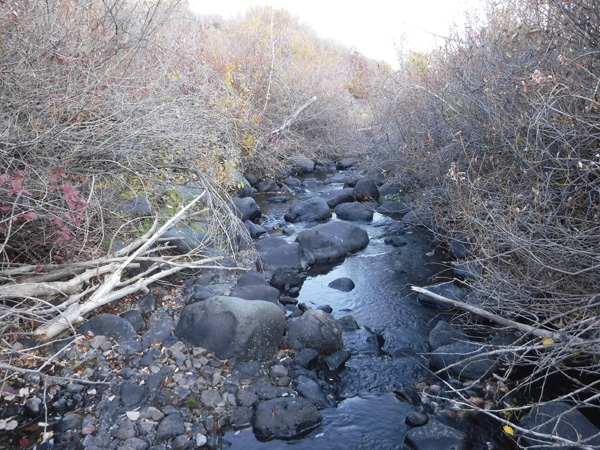
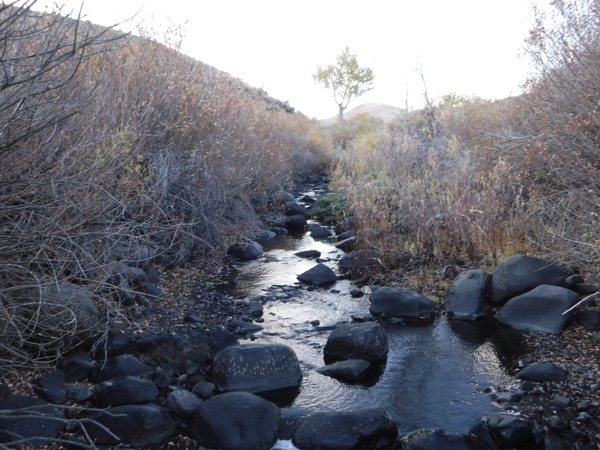
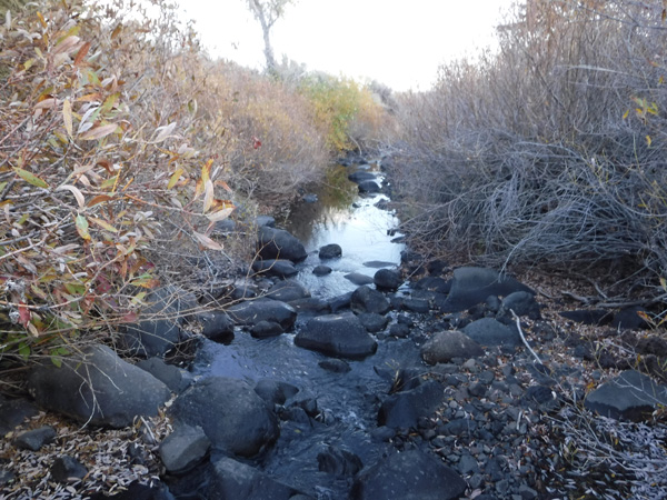
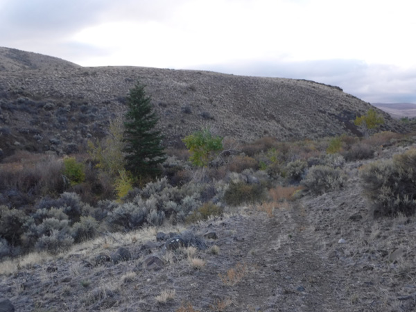
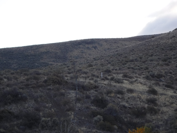
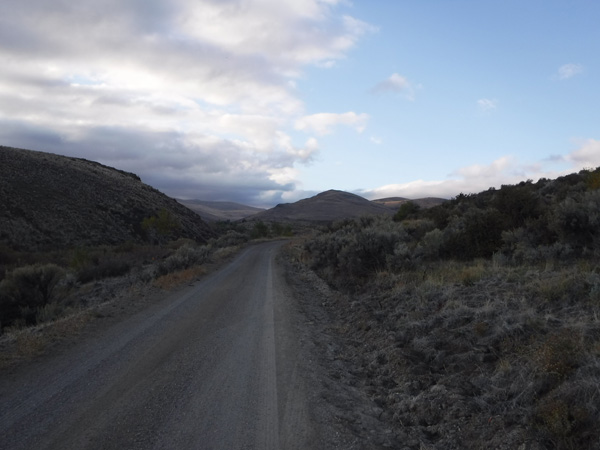
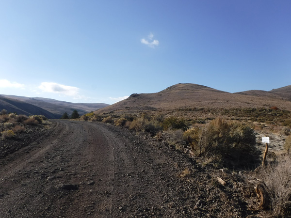
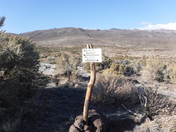
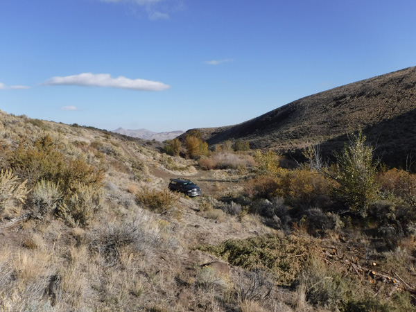
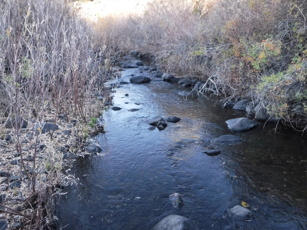
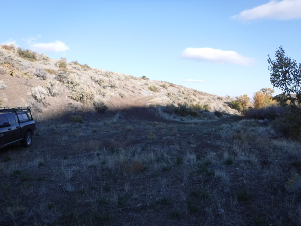
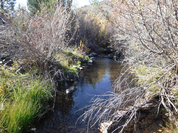
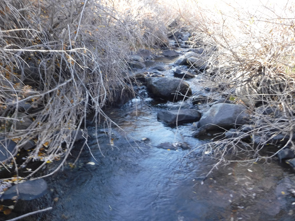
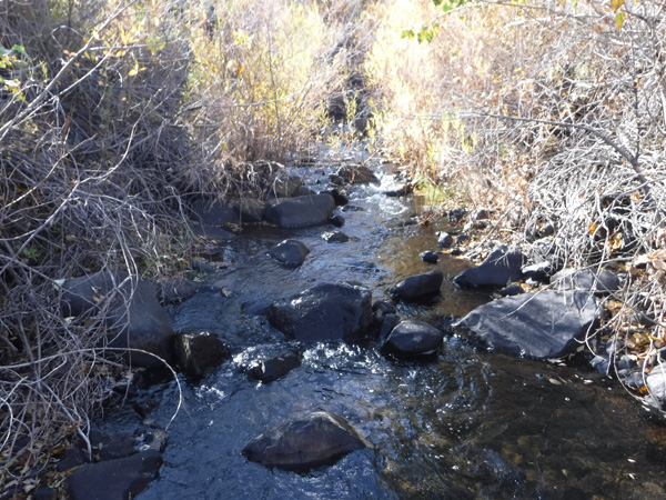
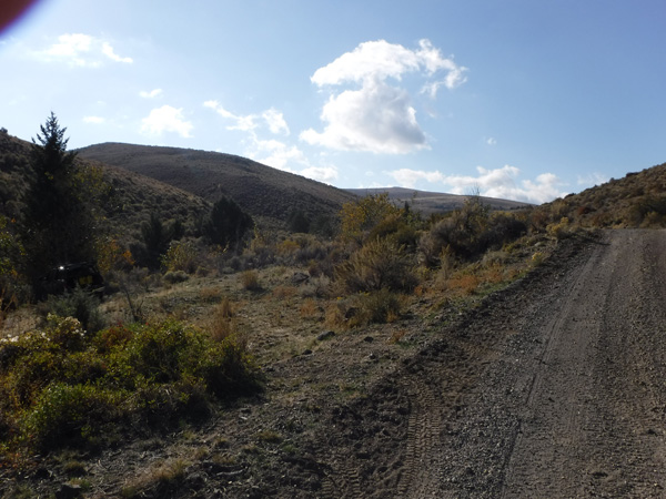
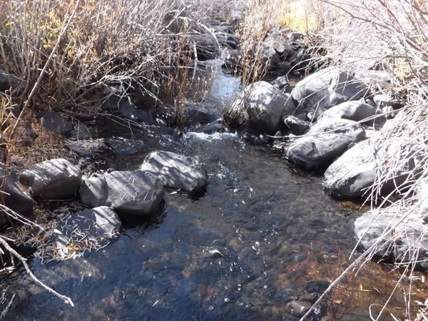
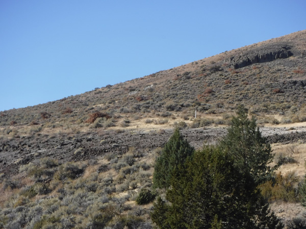
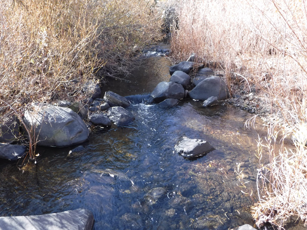
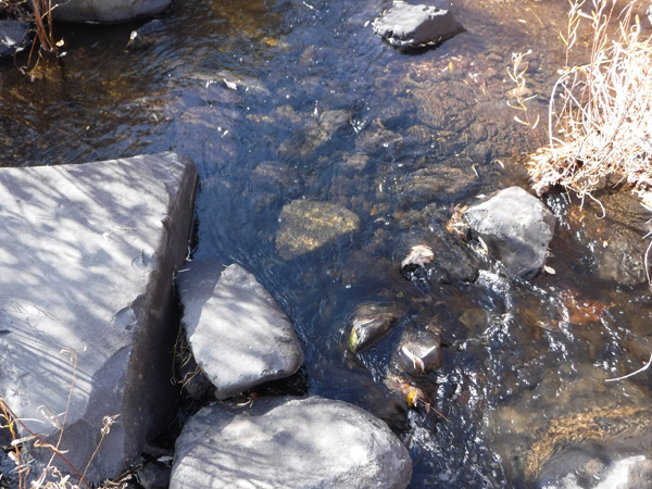
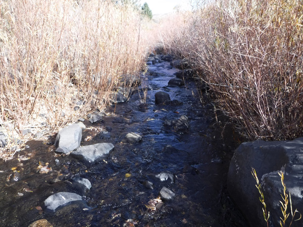
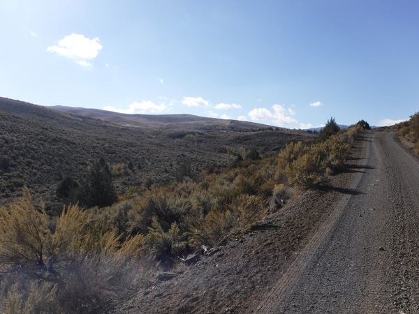
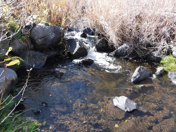
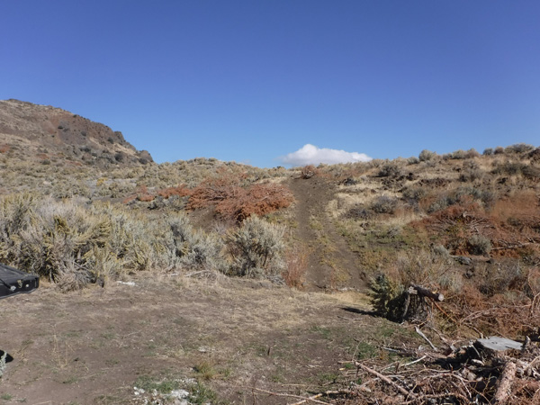
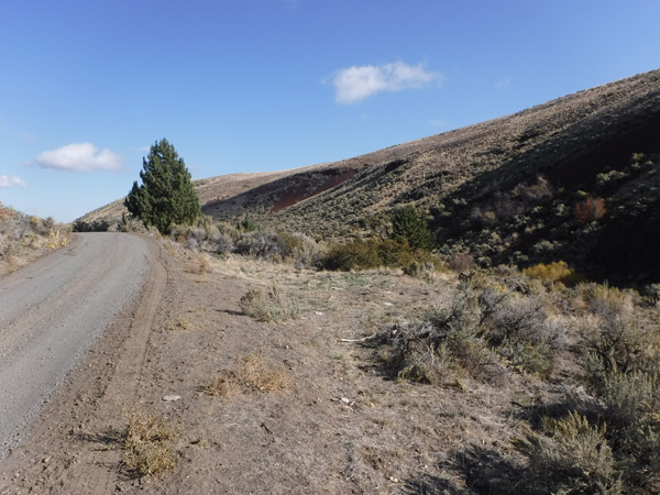
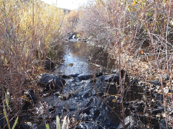
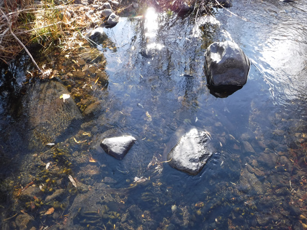
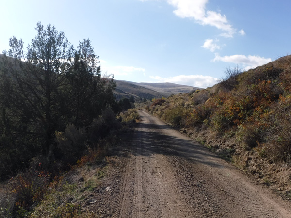
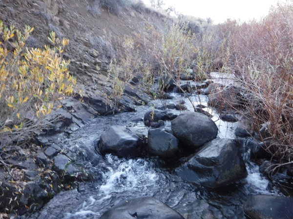
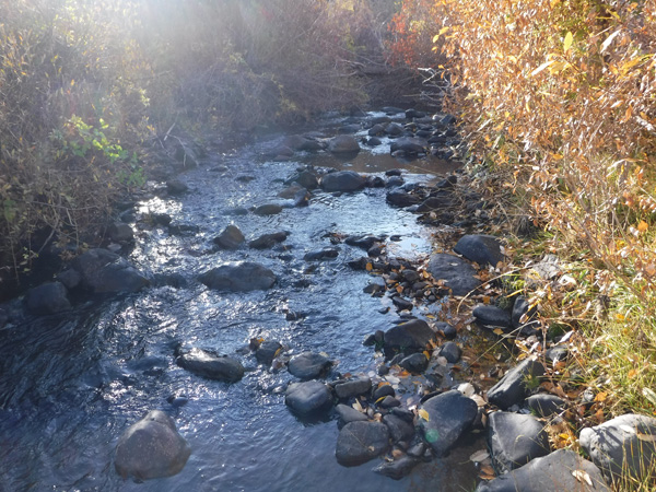
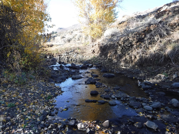
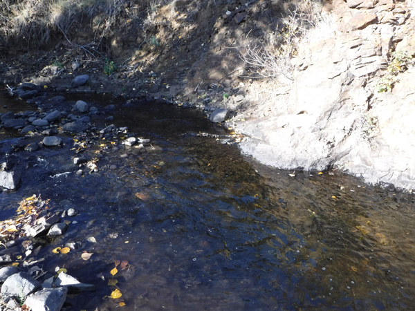
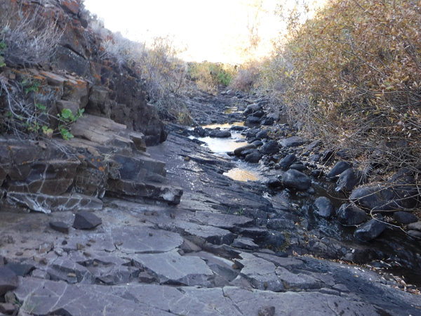
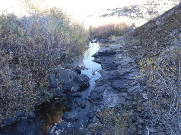
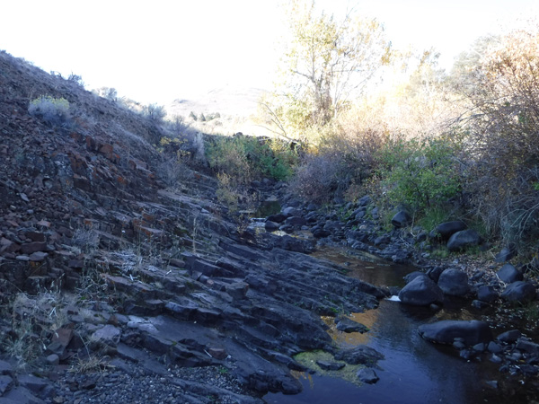
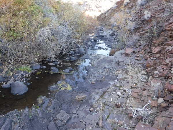
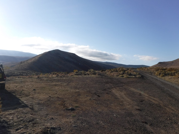
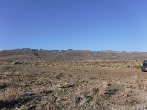
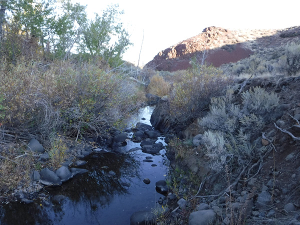
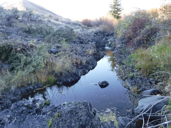
Reynolds Creek (which is a year round creek) is a gold bearing tributary of the Silver City region. These claims reside off of the north face of the Owyhee mountains, with a lower elevation of 4600 feet. This means that earlier in the spring or later in the fall, these sites are going to be accessible. Even during the milder winters, you will be able to access the sites through the winter. The other unique thing about these claims, is there is a gate over the road (chained but not locked), with a sign informing the general public that there is no access. However, this road has an easement from the BLM (which automatically gives public access from the federal side) to Elmore County to maintain this road. Again, as it is a county road, there are also no restrictions to the public. The county does not want the responsibility of maintaining it past the rural town of Reynolds and so has allowed the locals to place the gate. Under both Federal and State law, mining claim owners have “rights” to be able to use this road to access their claims. So the gate offers exceptional seclusion and privacy from the general public while working the claims.
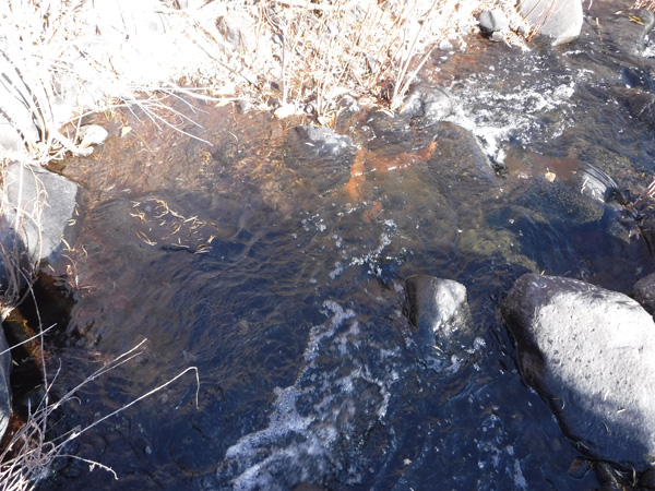
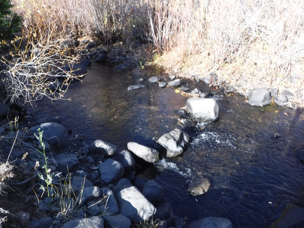
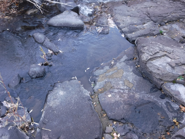
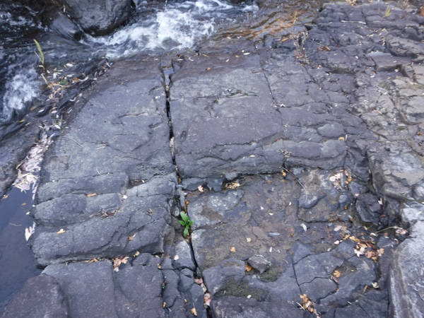
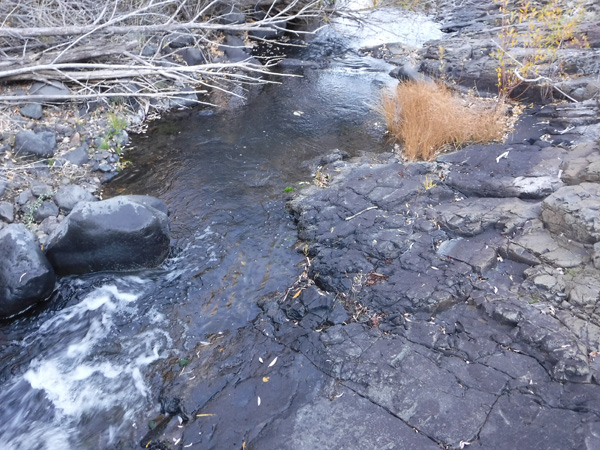
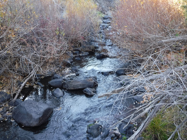
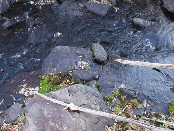
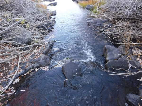
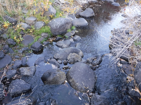
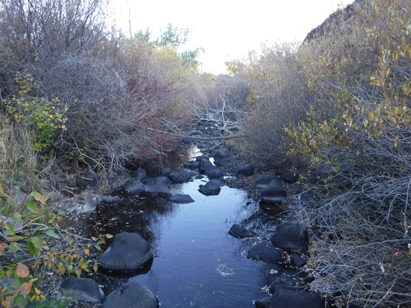
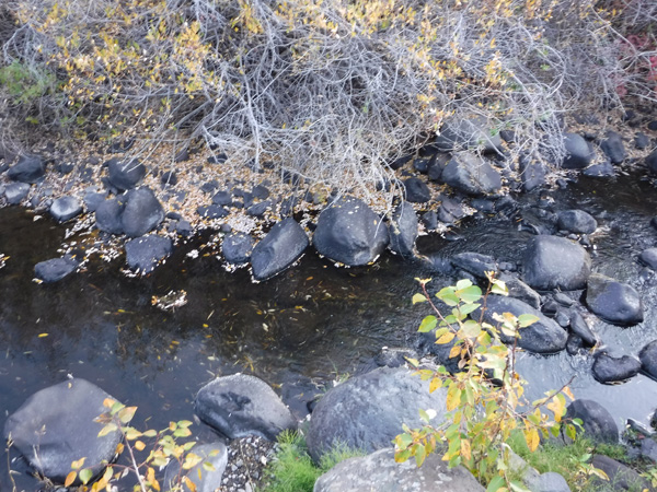
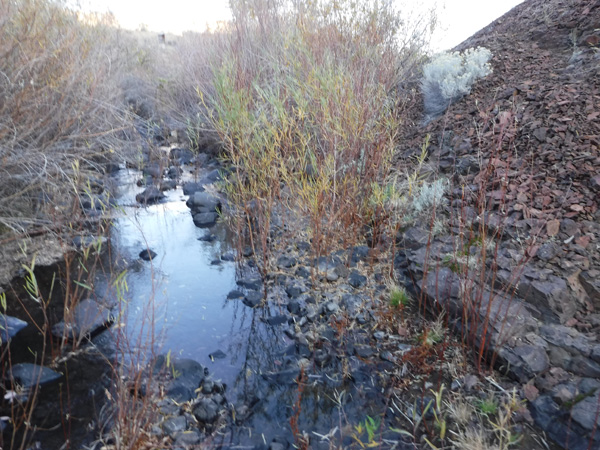
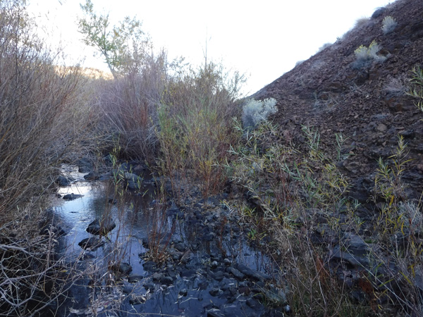
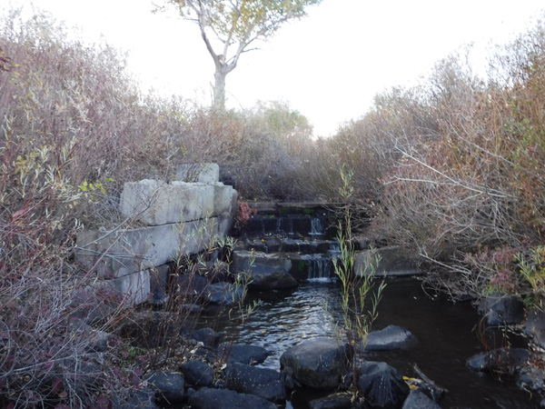
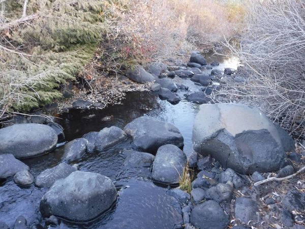
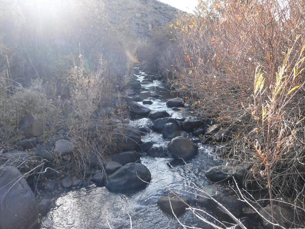
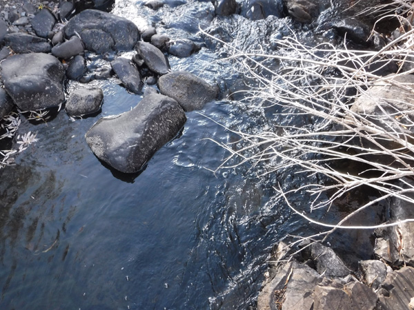
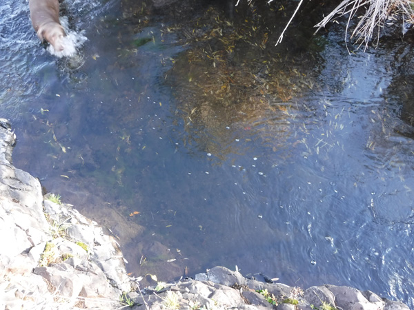
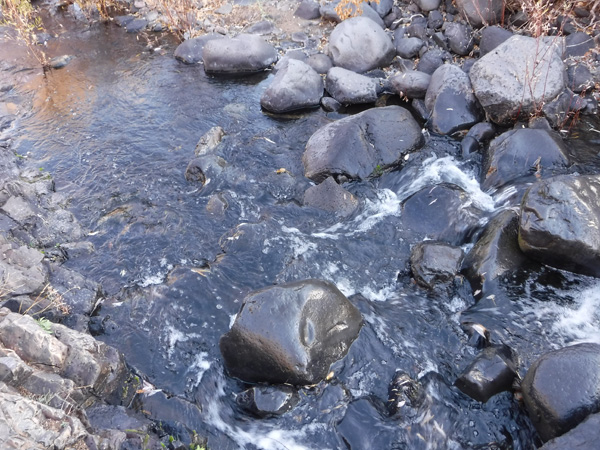
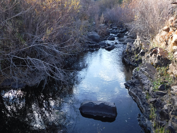
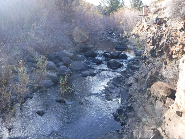
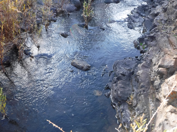
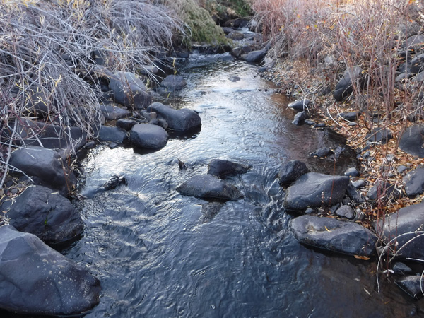
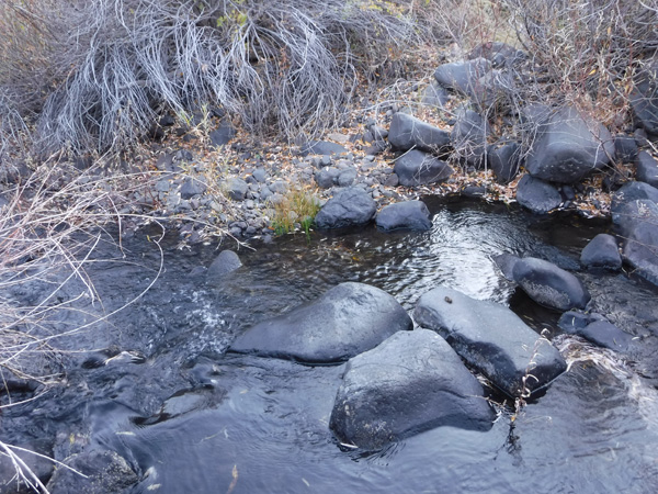
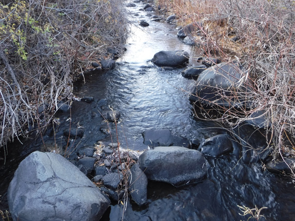
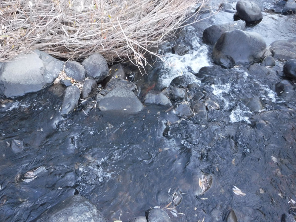
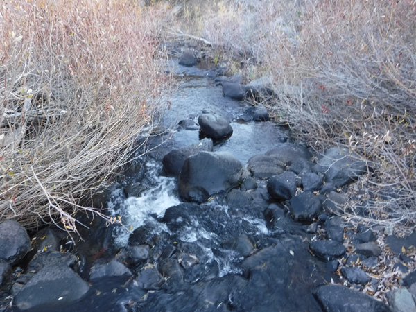
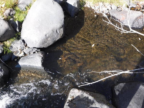
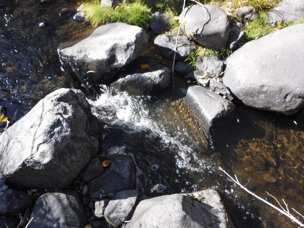
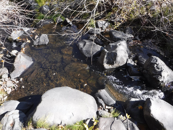
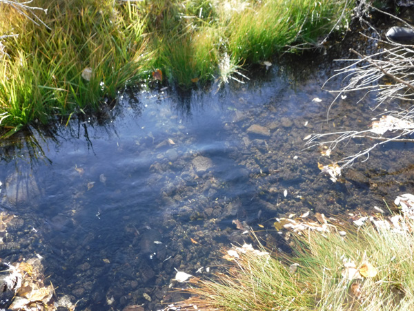
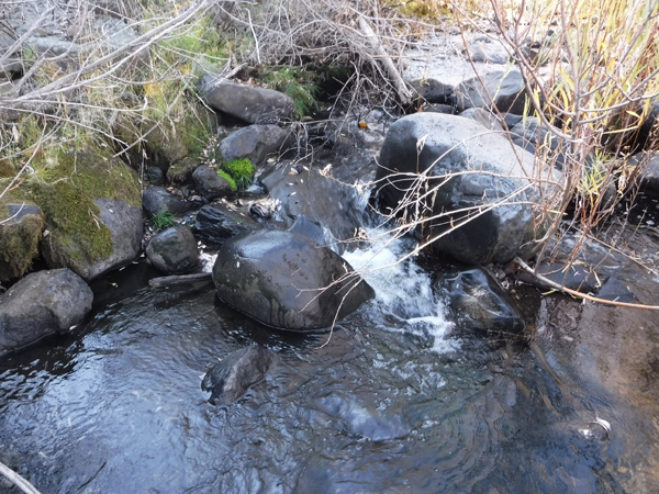
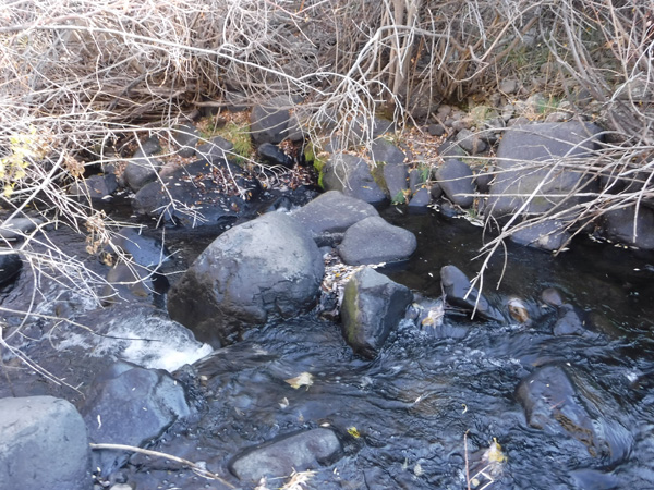
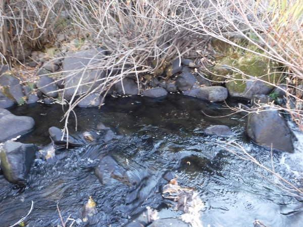
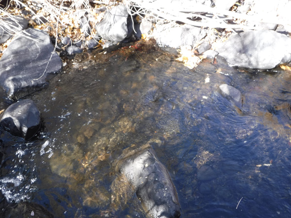
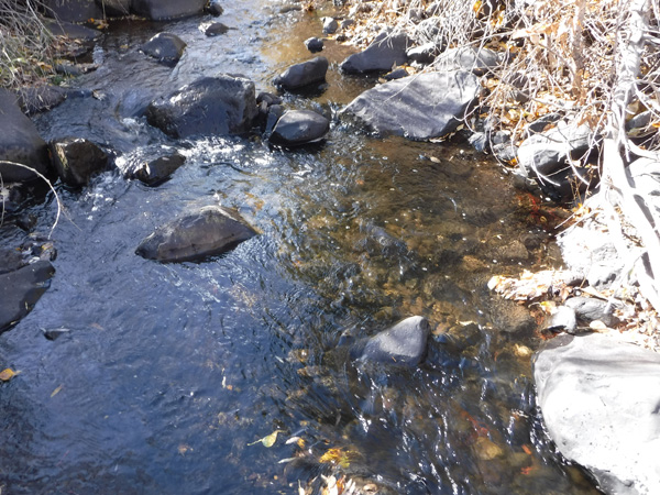
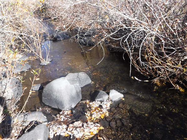
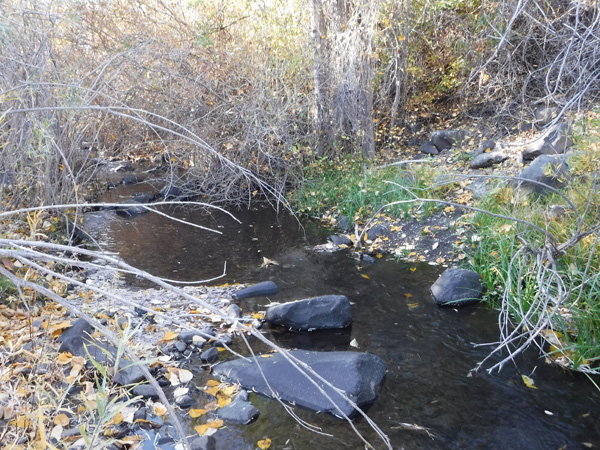
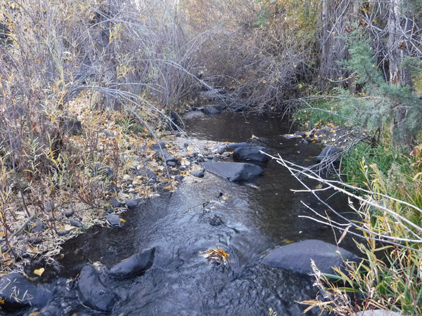
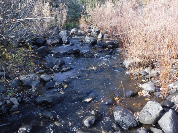
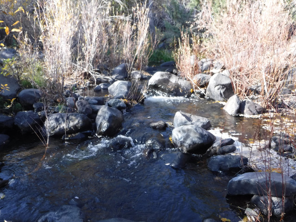
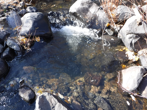
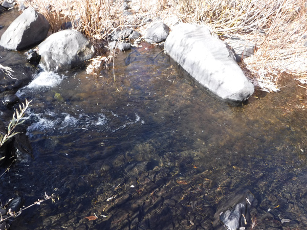
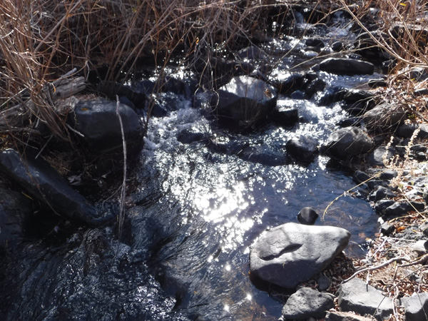
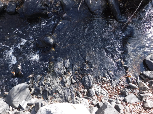
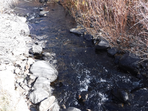
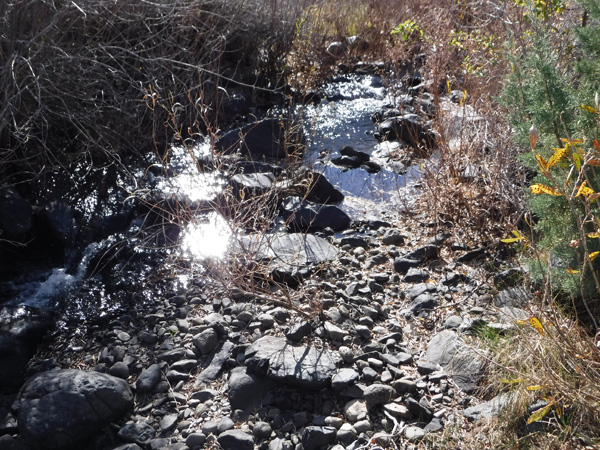
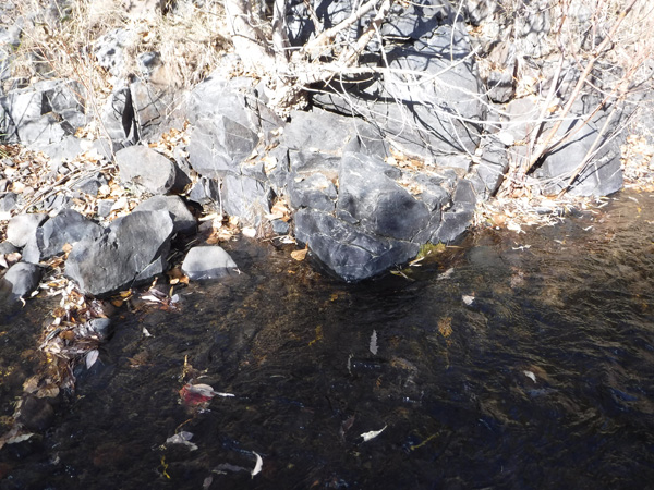
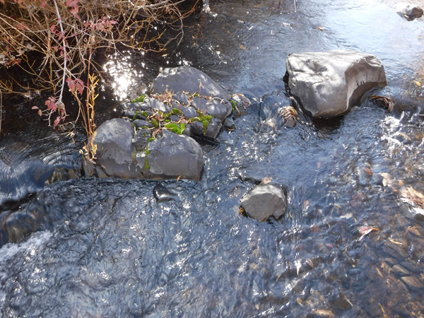
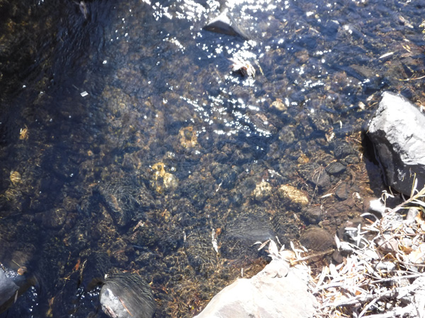
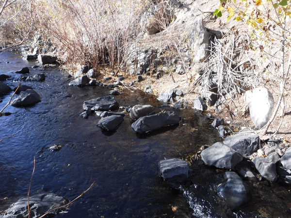
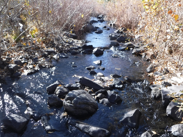
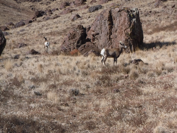
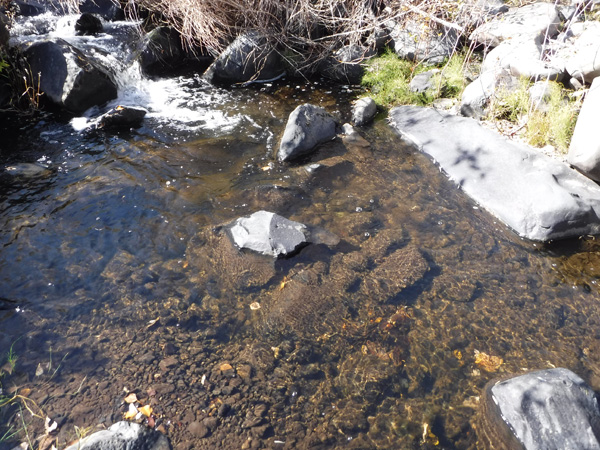
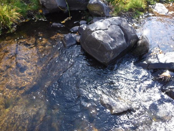
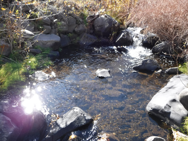
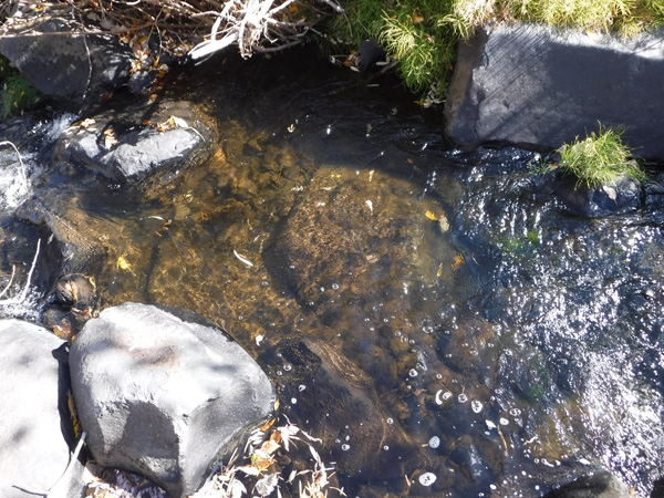
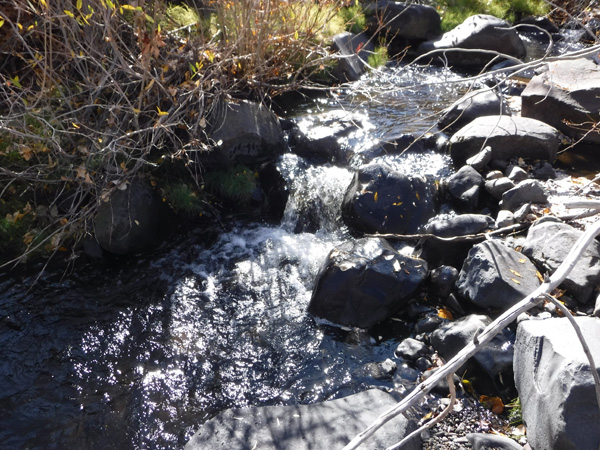
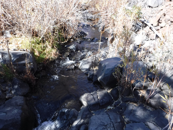
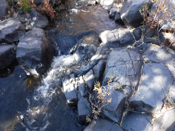
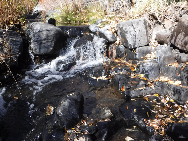
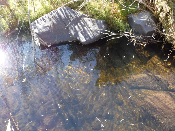
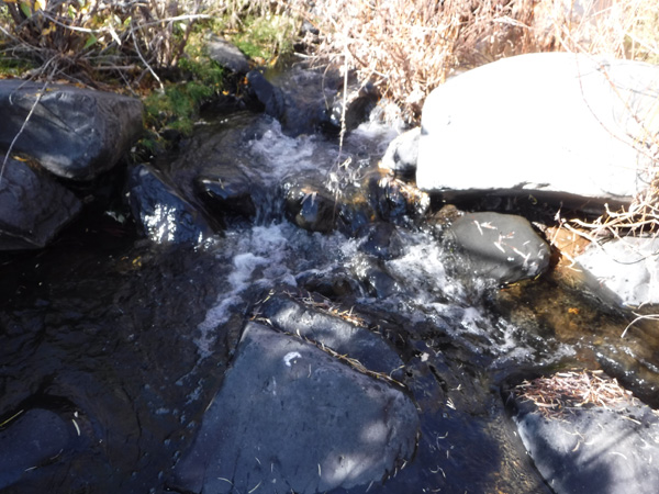
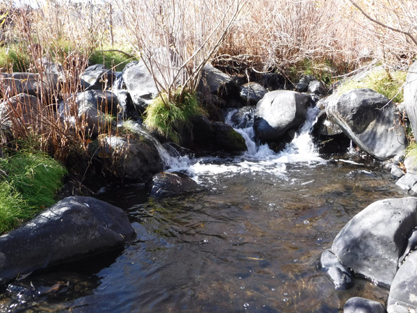
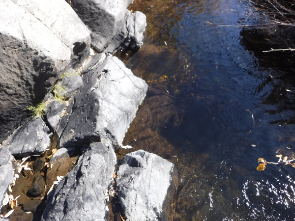
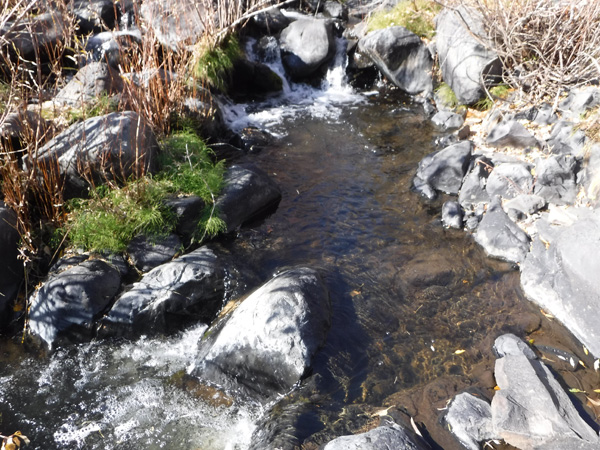
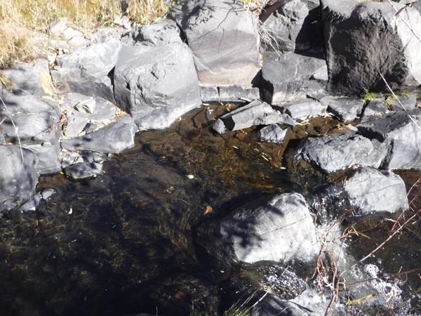
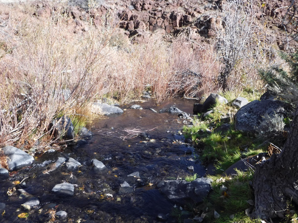
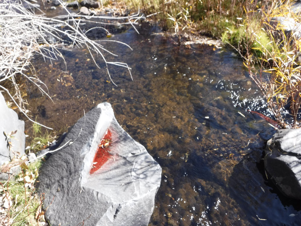
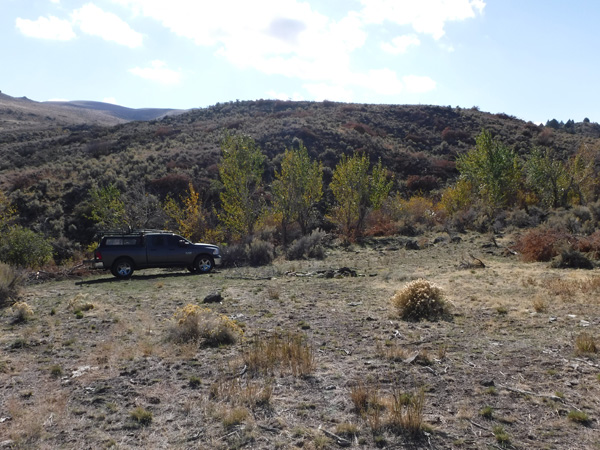
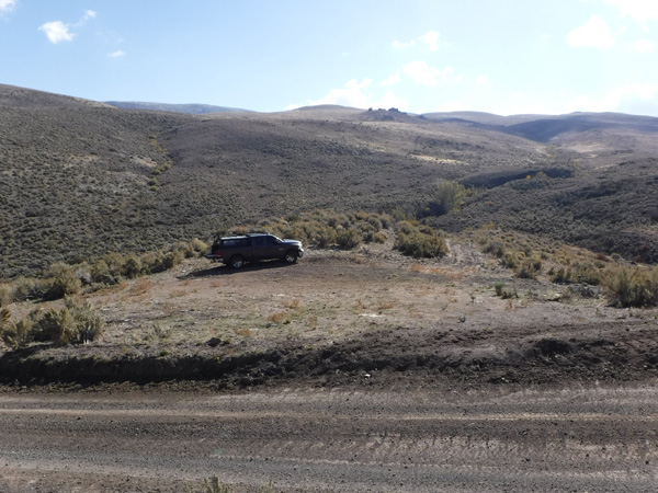
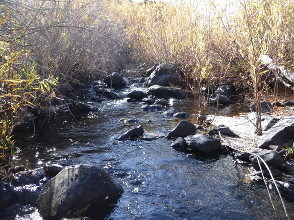
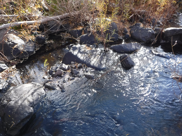
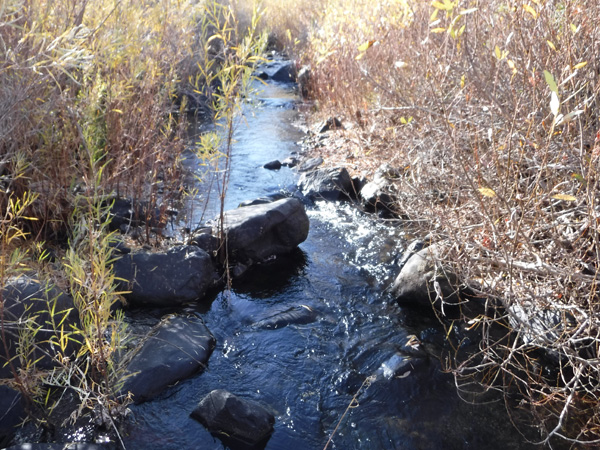
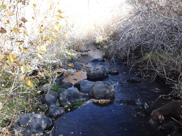
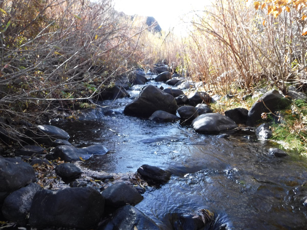
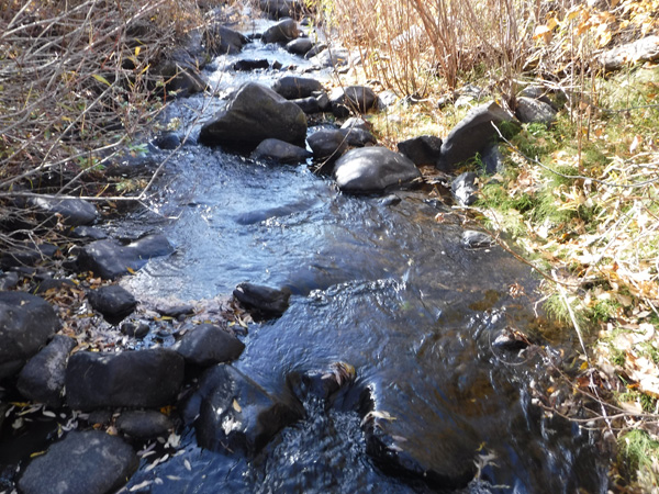
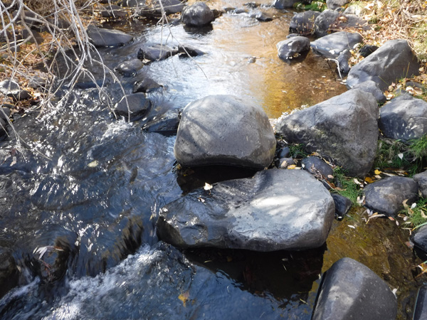
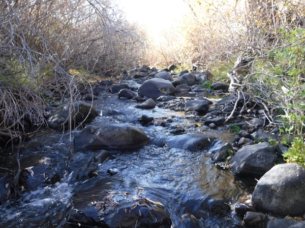
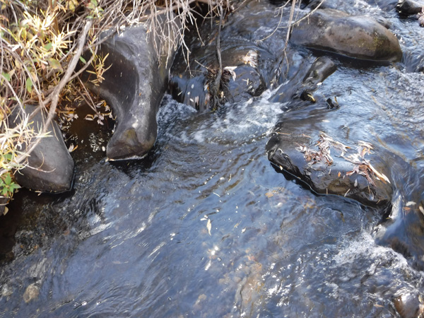
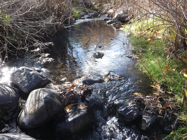
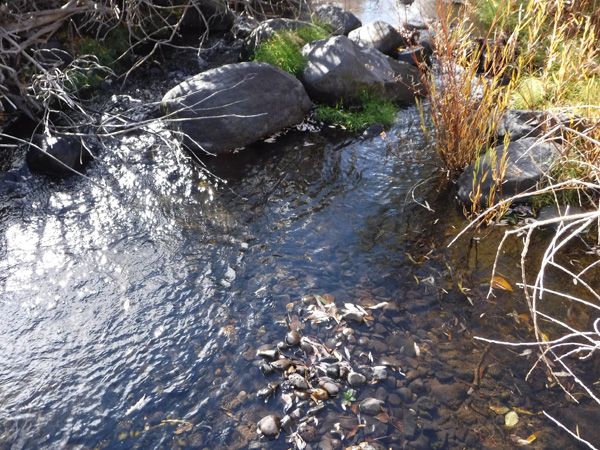
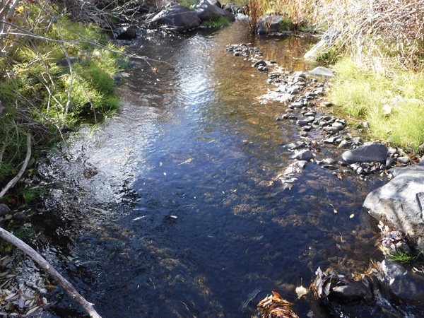
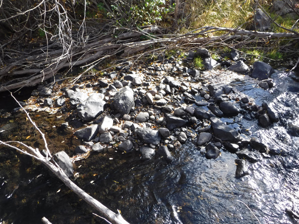
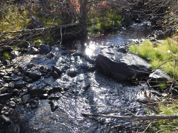
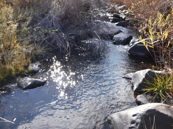
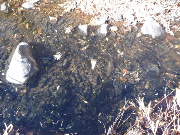
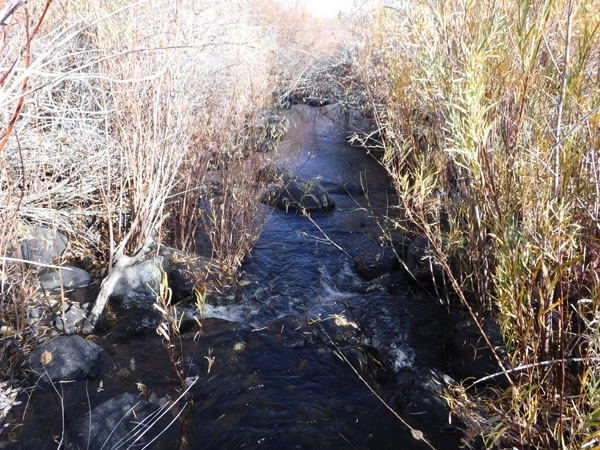
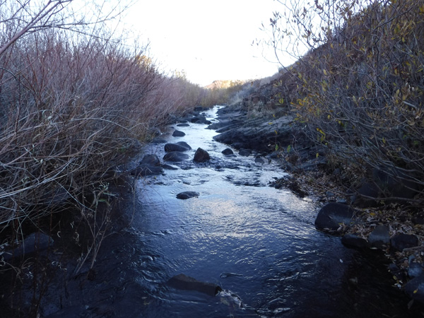
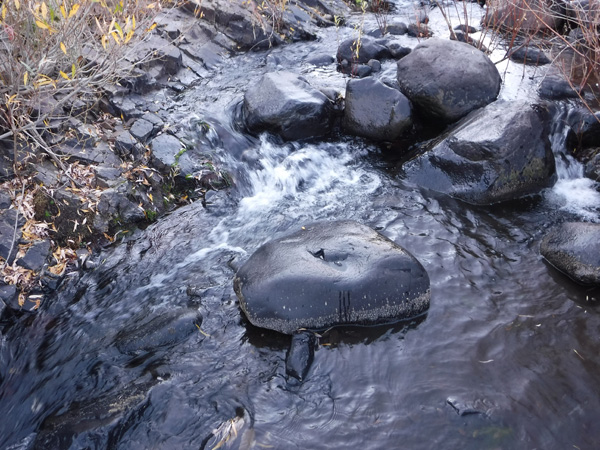
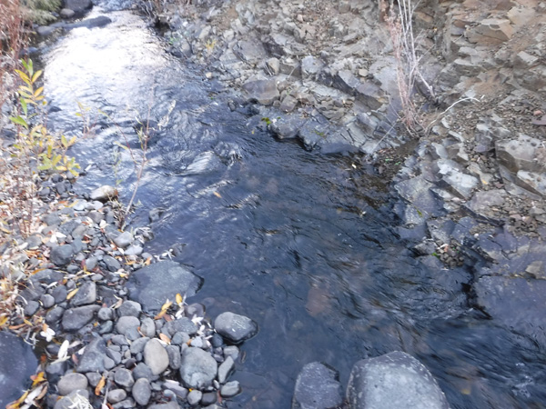
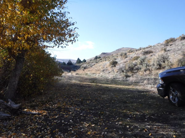
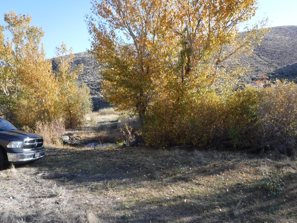
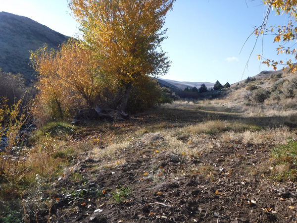
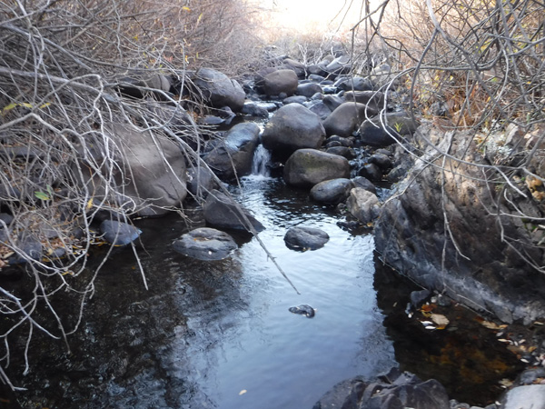
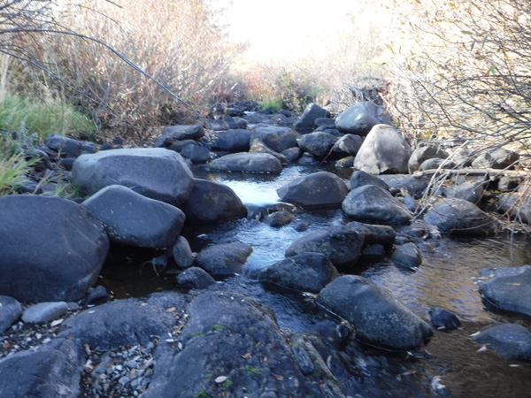
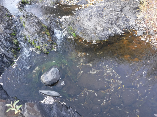
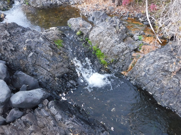
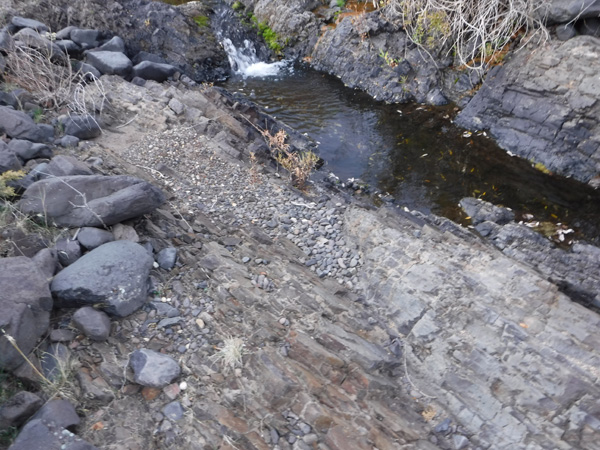
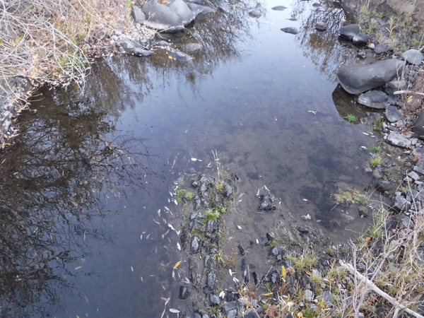
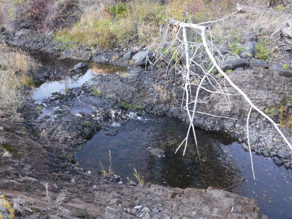
Bedrock is extremely shallow throughout this portion of Reynolds Creek. As you can see from the photos, there are MANY areas of exposed bedrock throughout all of these mining claims. These pictures were taken in late fall when the water is at its lowest, but still showing AMPLE water for gold recovery. With gold being significantly heavier (than all other elements), having exposed bedrock like this are sought after mining sites. I would also point out that each of these sites has existing flat areas, which is suitable for camping areas. Some (please review the pictures) are rougher than others, where some MINOR work would be needed to make them to your needs, but flatter terrain.
We will honor and offer bundle packages of $250 off each additional mining claim for multiple sales.
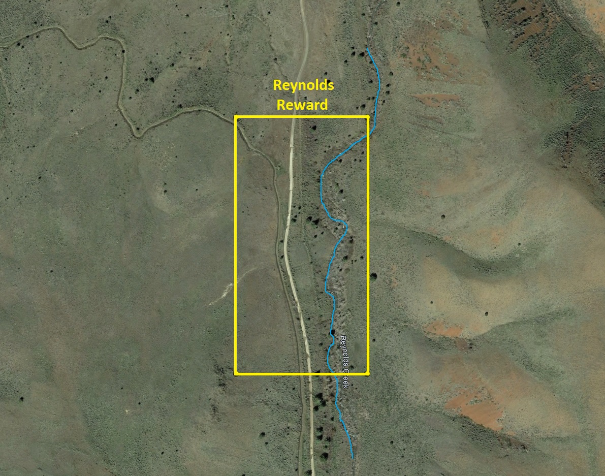
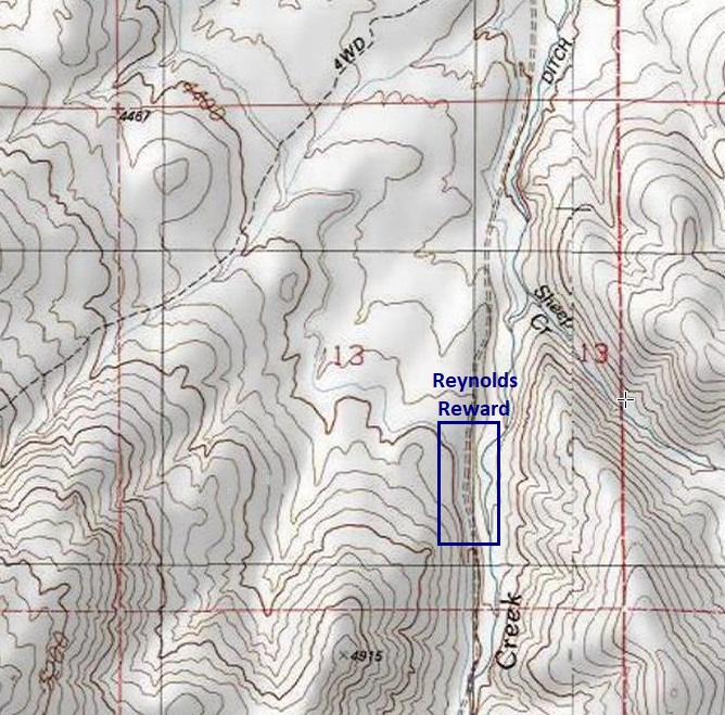
Reynolds Reward
Sold
- Acreage: 20 acre unpatented placer claim
- River footage: 1450’ Reynolds Creek - Areas to make camp “on” the claim
- Location: Idaho County, Township 3S, Range 4W, Sec. 13, SE ¼
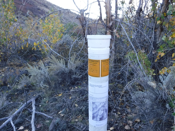
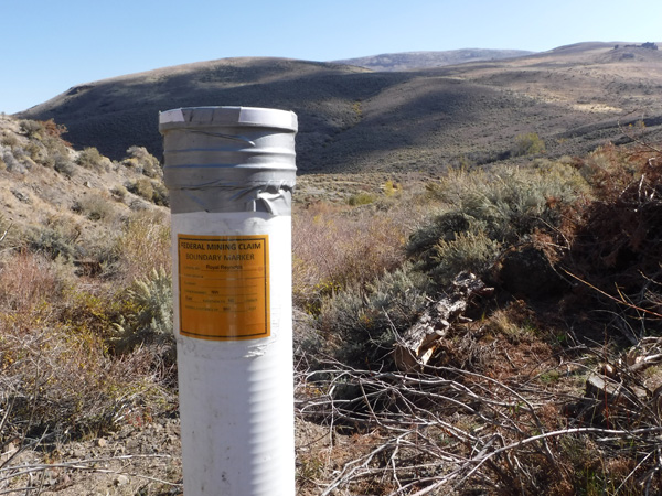
- Mining claim serial #: ID106326611
Map to Claim
Coordinates
Marker Degrees, Minutes, Seconds
NW 43°09’37.0440″N, -116°45’22.6800″W
NE 43°09’37.0440″N, -116°45’13.8240″W
SE 43°09’24.4080″N, -116°45’13.8240″W
SW 43°09’24.4080″N, -116°45’22.6800″W
Marker Latitude/Longitude
NW 43.16029’N, -116.75630’W
NE 43.16029’N, -116.75384’W
SE 43.15678’N, -116.75384’W
SW 43.15678’N, -116.75630’W
Aerial & Topo Images
Images

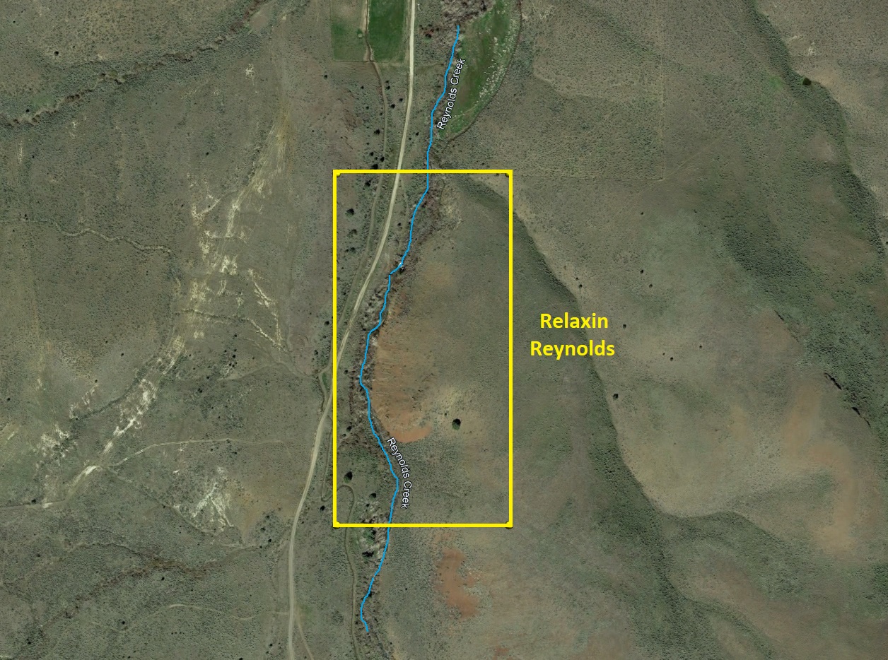
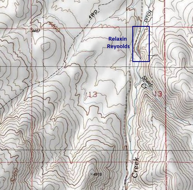
Relaxin Reynolds
Sold
- Acreage: 20 acre unpatented placer claim
- River footage: 1400’ Reynolds Creek - Large area to make camp “on” the claim
- Location: Idaho County, Township 3S, Range 4W, Sec. 13, NE ¼
- Mining claim serial #: ID106326608
Map to Claim
Coordinates
Marker Degrees, Minutes, Seconds
NW 43°10’10.5960″N, -116°45’13.8240″W
NE 43°10’10.5960″N, -116°45’04.6080″W
SE 43°09’56.8800″N, -116°45’04.6080″W
SW 43°09’56.8800″N, -116°45’13.8240″W
Marker Latitude/Longitude
NW 43.16961’N, -116.75384’W
NE 43.16961’N, -116.75128’W
SE 43.16580’N, -116.75128’W
SW 43.16580’N, -116.75384’W
Aerial & Topo Images
Images
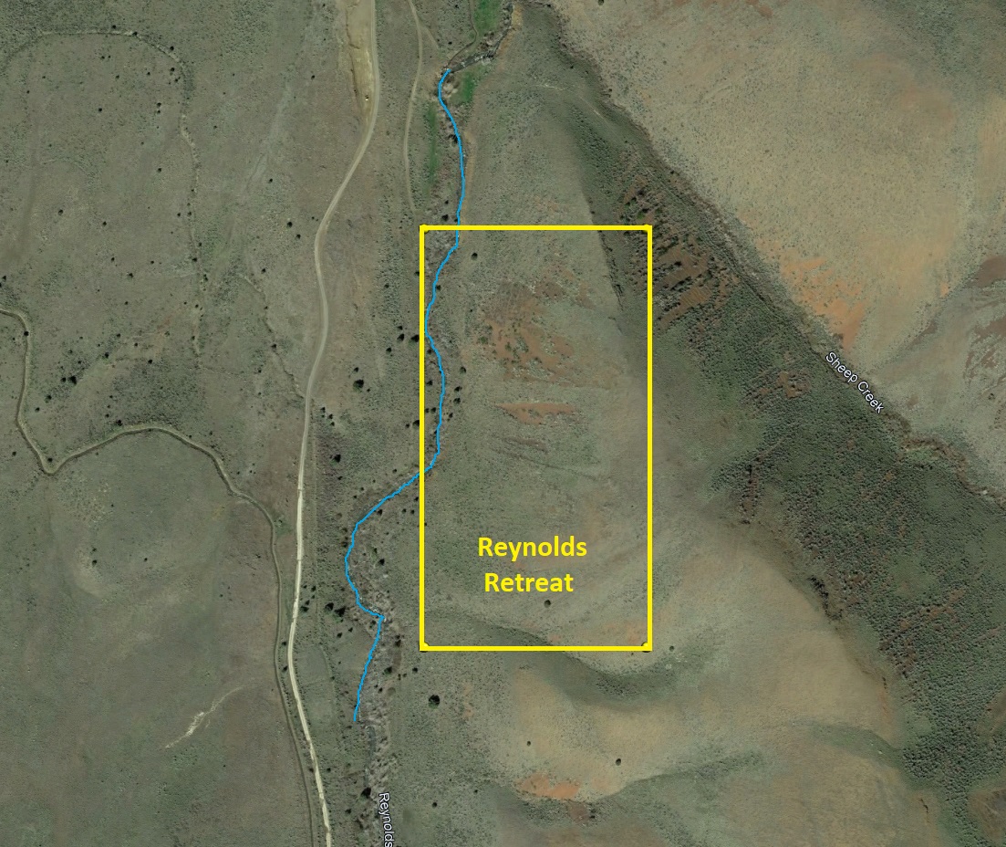
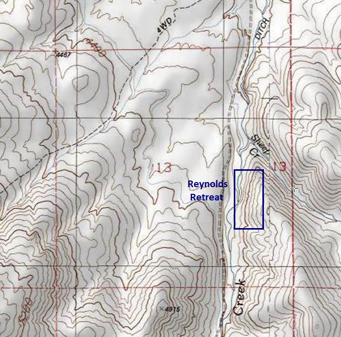
Reynolds Retreat
Sold
- Acreage: 20 acre unpatented placer claim
- River footage: 800’ Reynolds Creek - Large camping areas on the claim
- Location: Idaho County, Township 3S, Range 4W, Sec. 13, SE ¼
- Mining claim serial #: ID106326610
Map to Claim
Coordinates
Marker Degrees, Minutes, Seconds
NW 43°09’43.4520″N, -116°45’13.8240″W
NE 43°09’43.4520″N, -116°45’04.6080″W
SE 43°09’30.8160″N, -116°45’04.6080″W
SW 43°09’30.8160″N, -116°45’13.8240″W
Marker Latitude/Longitude
NW 43.16207’N, -116.75384’W
NE 43.16207’N, -116.75128’W
SE 43.15856’N, -116.75128’W
SW 43.15856’N, -116.75384’W
Aerial & Topo Images
Images
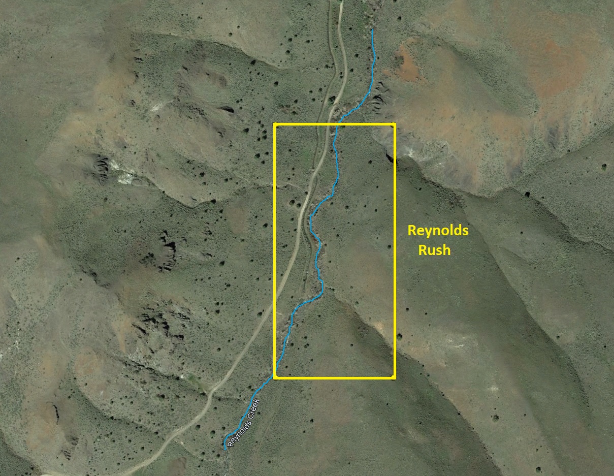
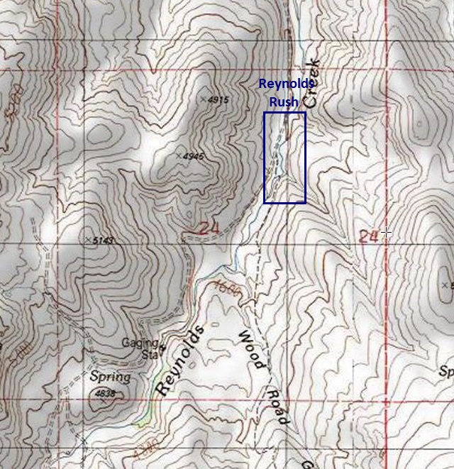
Reynolds Rush
Sold
- Acreage: 20 acre unpatented placer claim
- River footage: 1400’ Reynolds Creek - Areas to make camp “on” the claim
- Location: Idaho County, Township 3S, Range 4W, Sec. 24 NE ¼
- Mining claim serial #: ID106326613
Map to Claim
Coordinates
Marker Degrees, Minutes, Seconds
NW 43°09’10.7640″N, -116°45’22.6800″W
NE 43°09’10.7640″N, -116°45’13.8240″W
SE 43°08’56.9040″N, -116°45’13.8240″W
SW 43°08’56.9040″N, -116°45’22.6800″W
Marker Latitude/Longitude
NW 43.15299’N, -116.75630’W
NE 43.15299’N, -116.75384’W
SE 43.14914’N, -116.75384’W
SW 43.14914’N, -116.75630’W
Aerial & Topo Images
Images
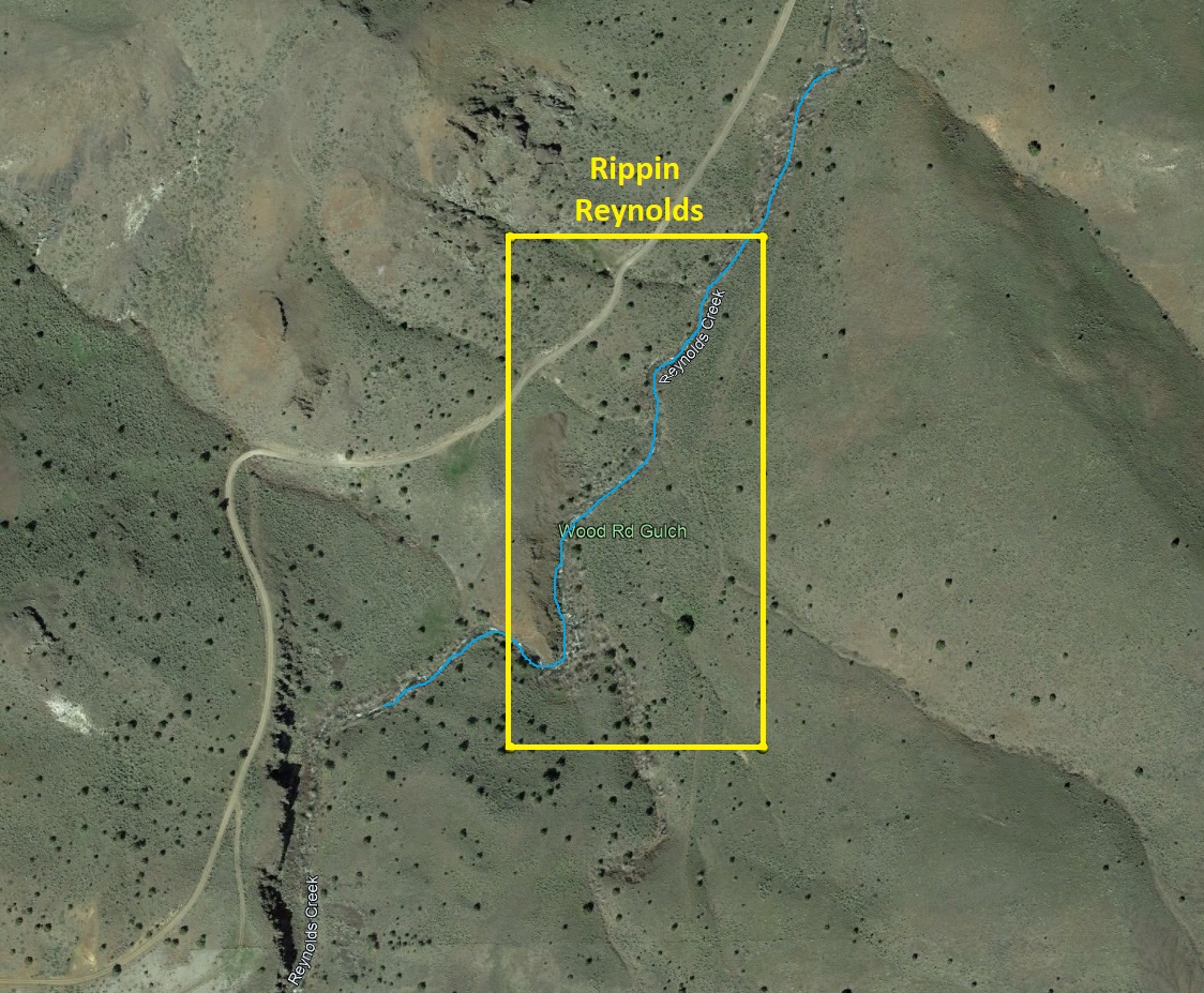
Rippin Reynolds
Sold
- Acreage: 20 acre unpatented placer claim
- River footage: 1300’ Reynolds Creek - Areas to make camp “on” the claim
- Location: Idaho County, Township 3S, Range 4W, Sec. 24 NE & SE ¼s
- Mining claim serial #: ID106326614
Map to Claim
Coordinates
Marker Degrees, Minutes, Seconds
NW 43°08’56.9040″N, -116°45’31.3200″W
NE 43°08’56.9040″N, -116°45’22.6800″W
SE 43°08’44.1600″N, -116°45’22.6800″W
SW 43°08’44.1600″N, -116°45’31.3200″W
Marker Latitude/Longitude
NW 43.14914’N, -116.75870’W
NE 43.14914’N, -116.75630’W
SE 43.14560’N, -116.75630’W
SW 43.14560’N, -116.75870’W
Aerial & Topo Images
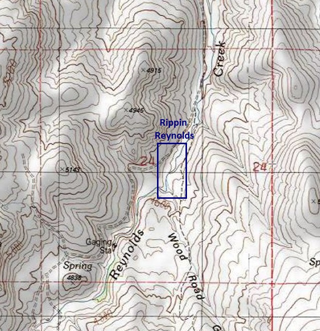
Images
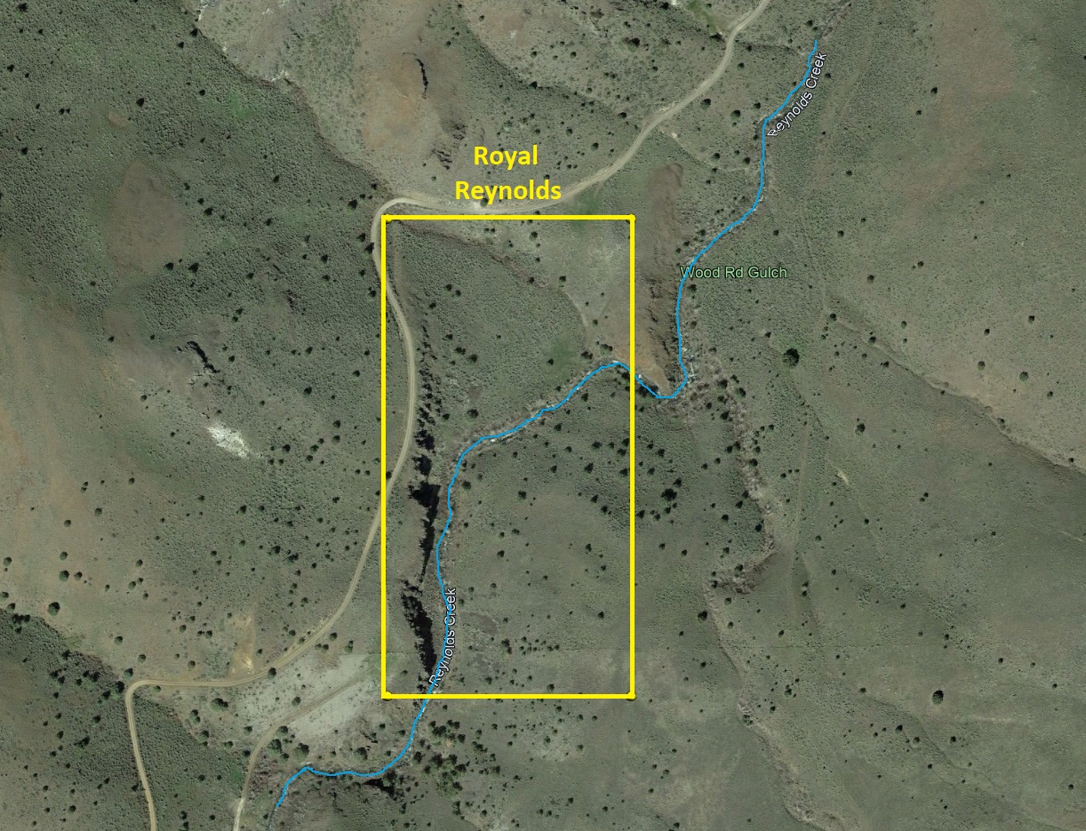
Royal Reynolds
Sold
- Acreage: 20 acre unpatented placer claim
- River footage: 1250’ Reynolds Creek - Large camping areas on claim
- Location: Idaho County, Township 3S, Range 4W, Sec. 24 SW ¼
- Mining claim serial #: ID106326615
Map to Claim
Coordinates
Marker Degrees, Minutes, Seconds
NW 43°08’51.0360″N, -116°45’40.4640″W
NE 43°08’51.0360″N, -116°45’31.3200″W
SE 43°08’37.9680″N, -116°45’31.3200″W
SW 43°08’37.9680″N, -116°45’40.4640″W
Marker Latitude/Longitude
NW 43.14751’N, -116.76124’W
NE 43.14751’N, -116.75870’W
SE 43.14388’N, -116.75870’W
SW 43.14388’N, -116.76124’W
Aerial & Topo Images
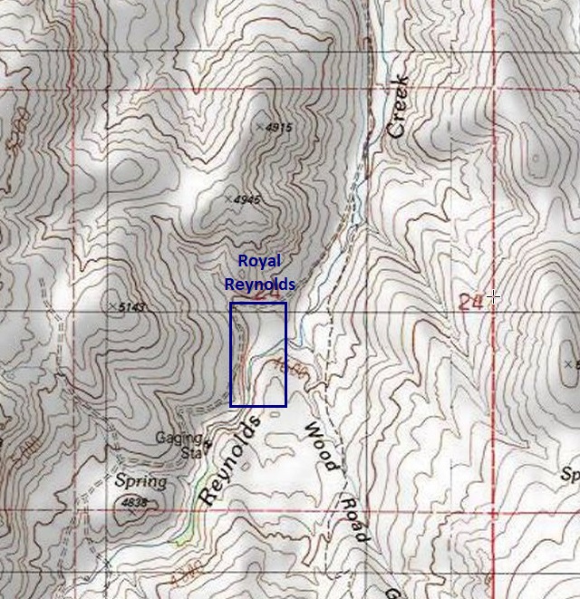
Images
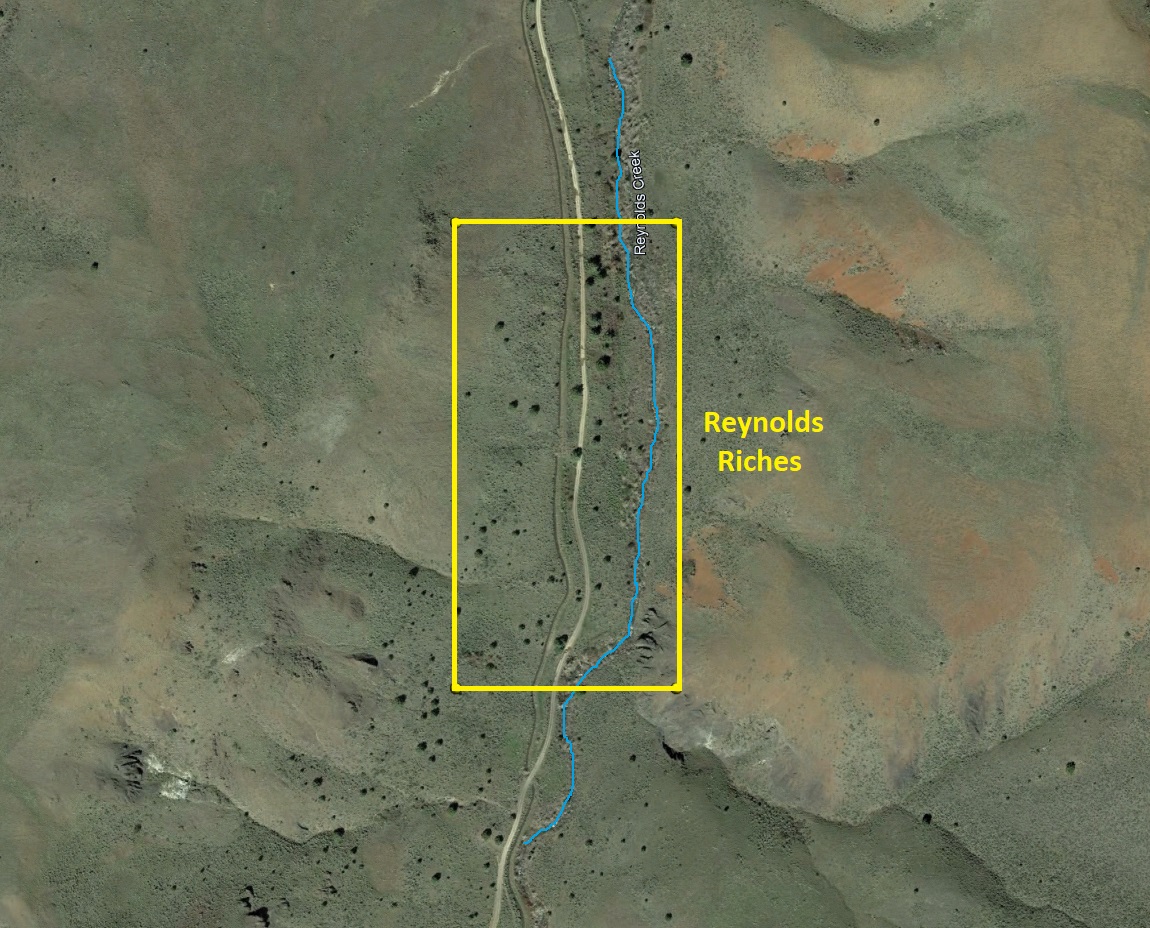
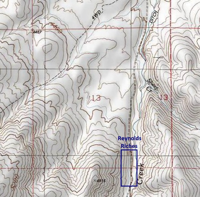
Reynolds Riches
Sold
- Acreage: 20 acre unpatented placer claim
- River footage: 1350’ Reynolds Creek - Large area to make camp “on” the claim
- Location: Idaho County, Township 3S, Range 4W, Sec 13, SE¼ & Sec 24 NE¼
- Mining claim serial #: ID106326612
Map to Claim
Coordinates
Marker Degrees, Minutes, Seconds
NW 43°09’24.4080″N, -116°45’22.6800″W
NE 43°09’24.4080″N, -116°45’13.8240″W
SE 43°09’10.7640″N, -116°45’13.8240″W
SW 43°09’10.7640″N, -116°45’22.6800″W
Marker Latitude/Longitude
NW 43.15678’N, -116.75630’W
NE 43.15678’N, -116.75384’W
SE 43.15299’N, -116.75384’W
SW 43.15299’N, -116.75630’W
Aerial & Topo Images
Images
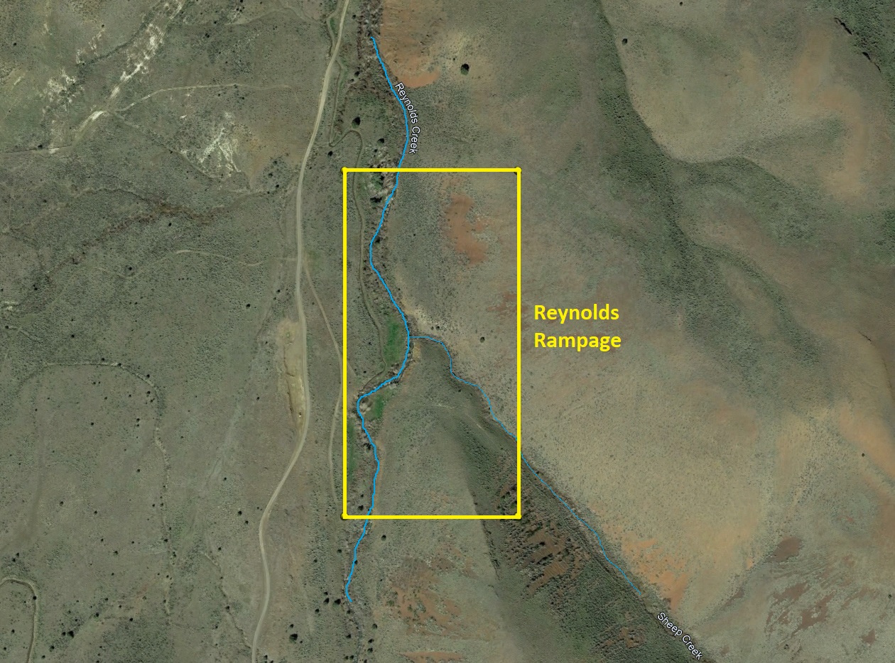
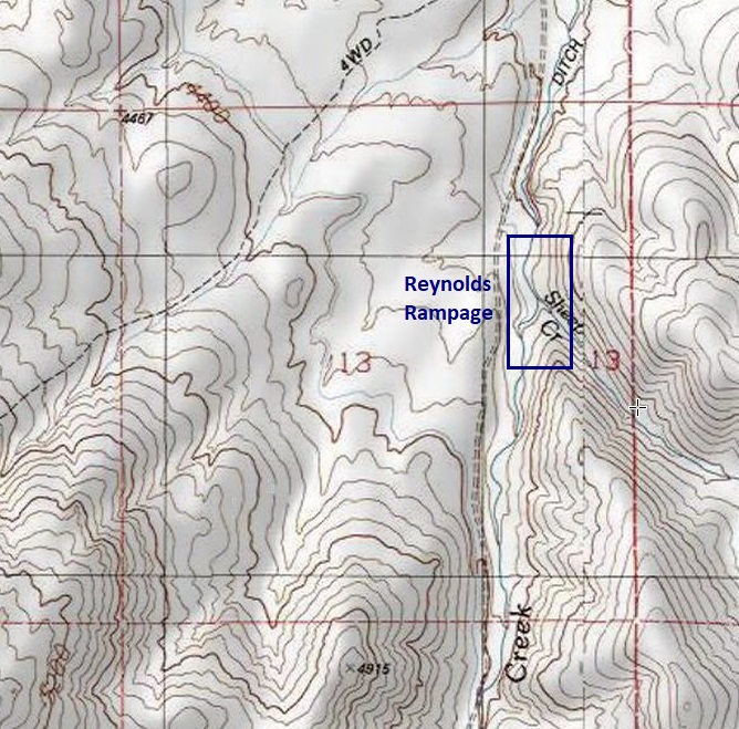
Reynolds Rampage
Sold
- Acreage: 20 acre unpatented placer claim
- River footage: 1450’ Reynolds Creek - Large camping areas on the claim
- Location: Idaho County, Township 3S, Range 4W, Sec. 13, NE ¼
- Mining claim serial #: ID106326609
Map to Claim
Coordinates
Marker Degrees, Minutes, Seconds
NW 43°09’56.8800″N, -116°45’13.8240″W
NE 43°09’56.8800″N, -116°45’04.6080″W
SE 43°09’43.4520″N, -116°45’04.6080″W
SW 43°09’43.4520″N, -116°45’13.8240″W
Marker Latitude/Longitude
NW 43.16580’N, -116.75384’W
NE 43.16580’N, -116.75128’W
SE 43.16207’N, -116.75128’W
SW 43.16207’N, -116.75384’W
Aerial & Topo Images
Images
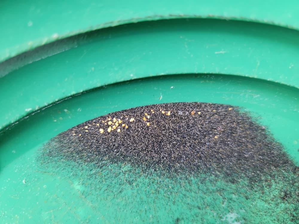
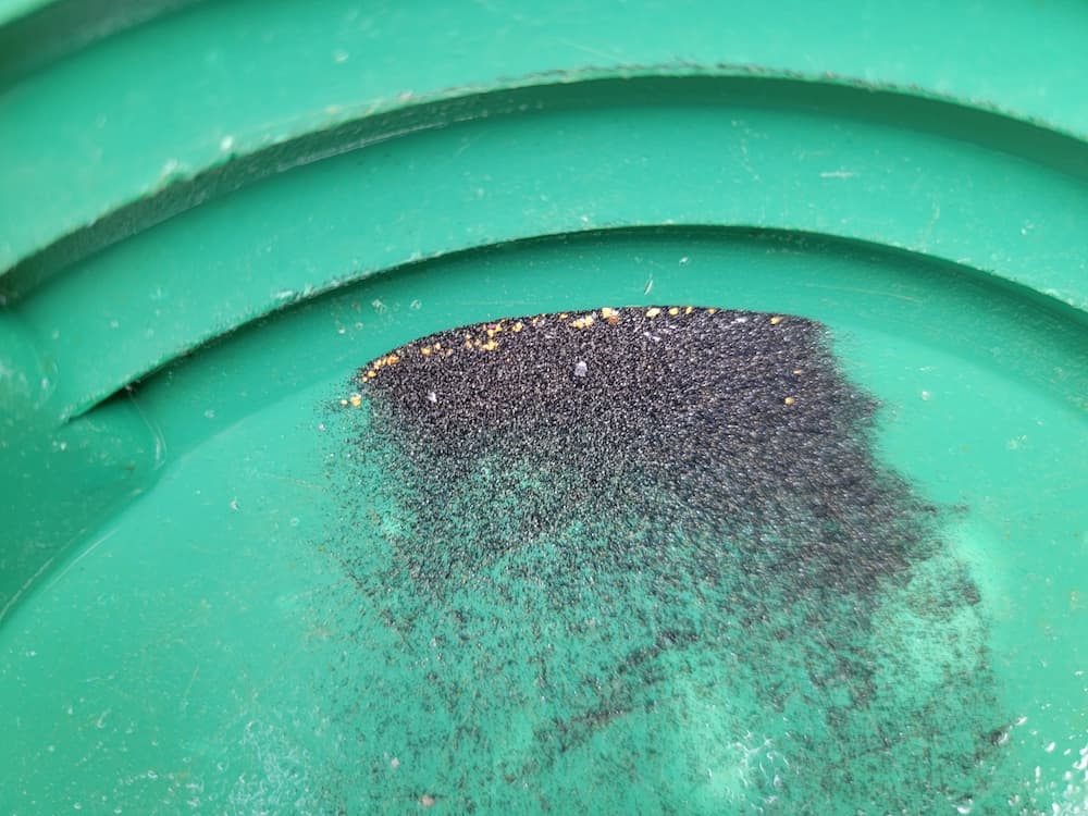
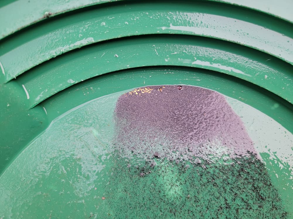
Show Me The Gold
These samples were collected using just a simple high-banker for 3-4 hours at only a depth of around 2.5 feet. This means, with gold being one of the heaviest specific gravity elements, the deeper one goes, BOTH the yield and the size of pieces increases exponentially.
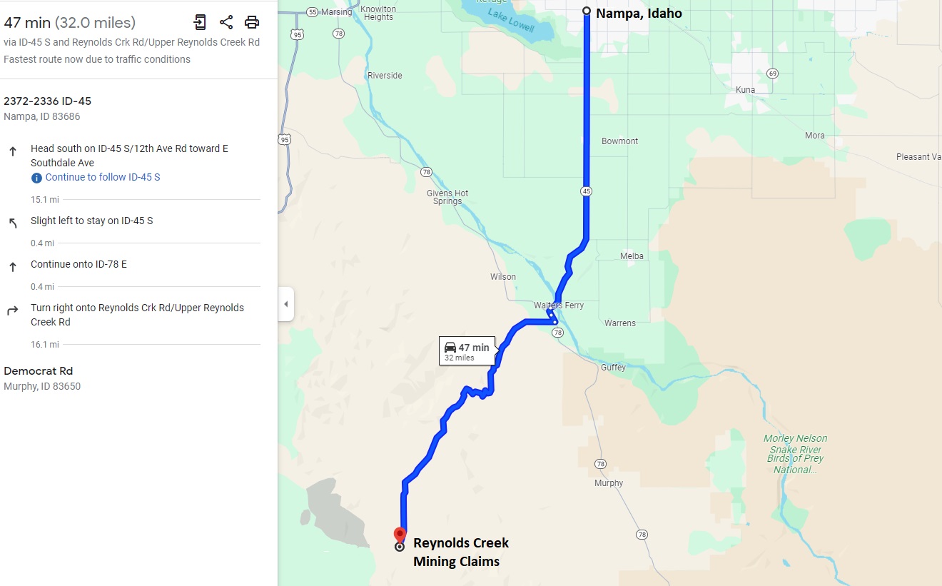
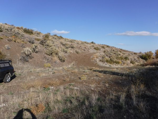
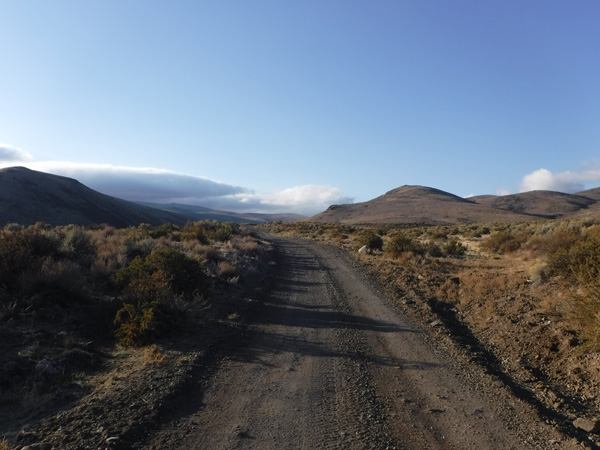
Driving Directions: From Nampa, travel south on HWY 45 approximately 14 miles to the HWY 78 junction, road will naturally curve left (southeast) onto HWY 78. In 0.4 of a mile make a right onto Reynolds Creek Road. You will stay on this for 16.0 miles until you reach a gate. The gate is not locked, but needs closed behind you. The mining claims start at approximately 800’ (0.16 of a mile) past the gate, and extend up Reynolds Creek Road for another 2 miles.