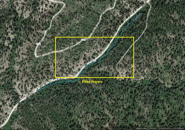
Pikes Fork
Crooked River Sold
Overview
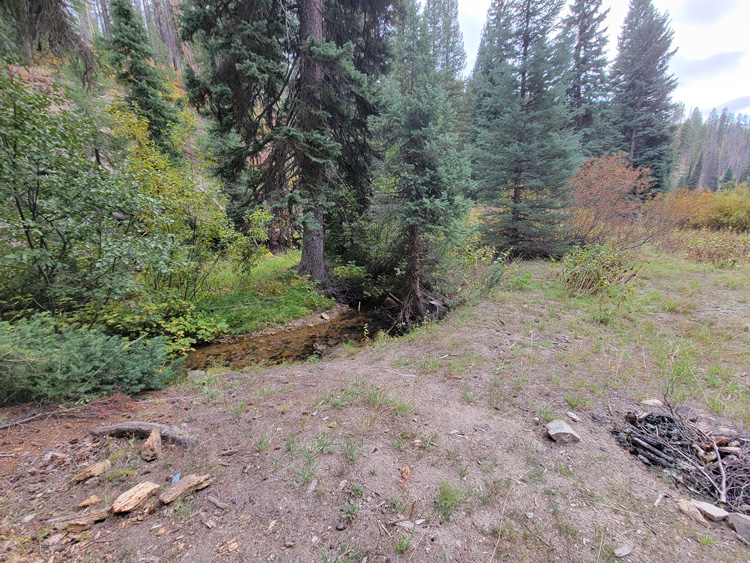
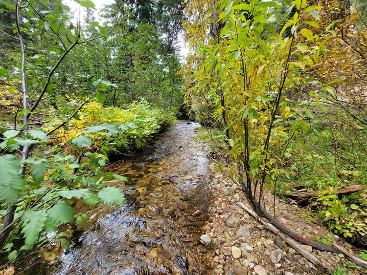
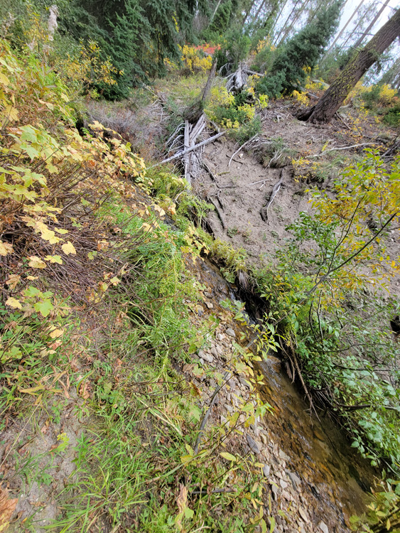
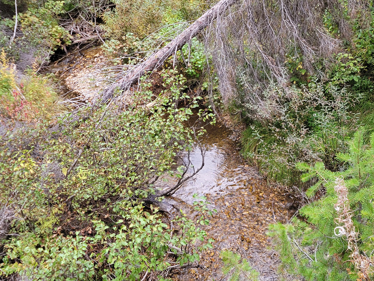
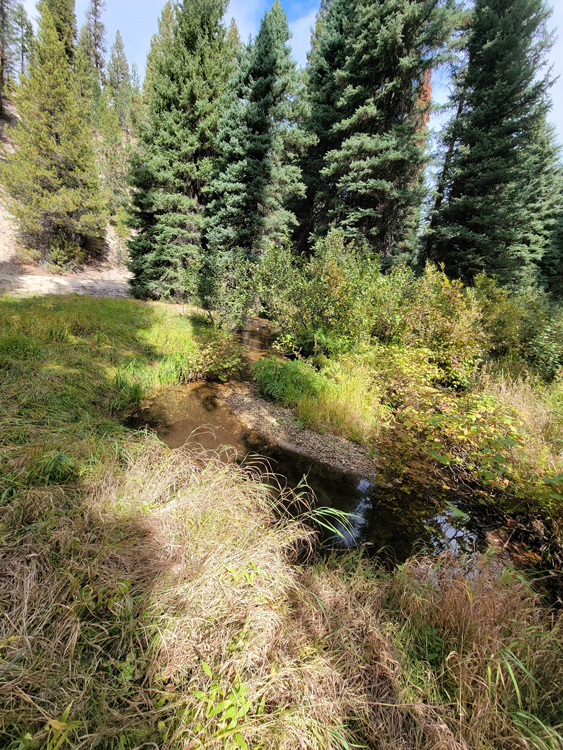
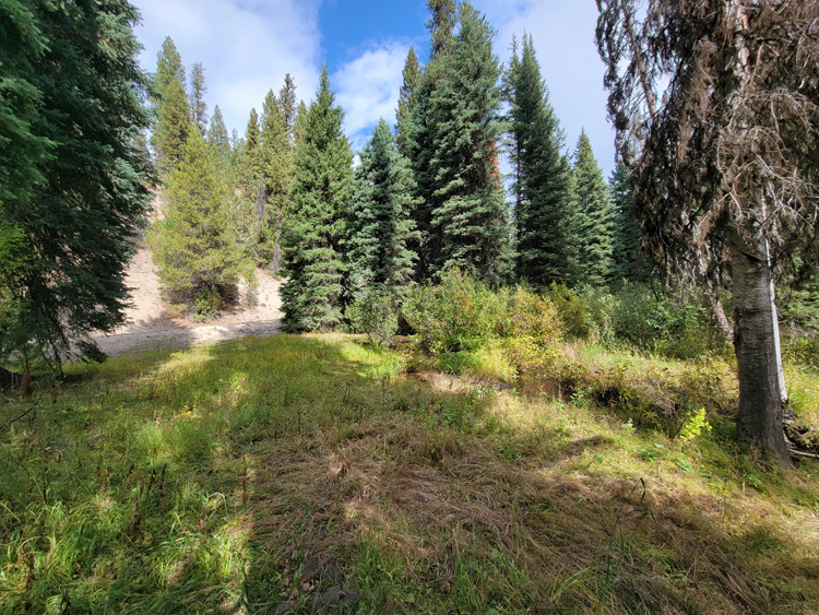
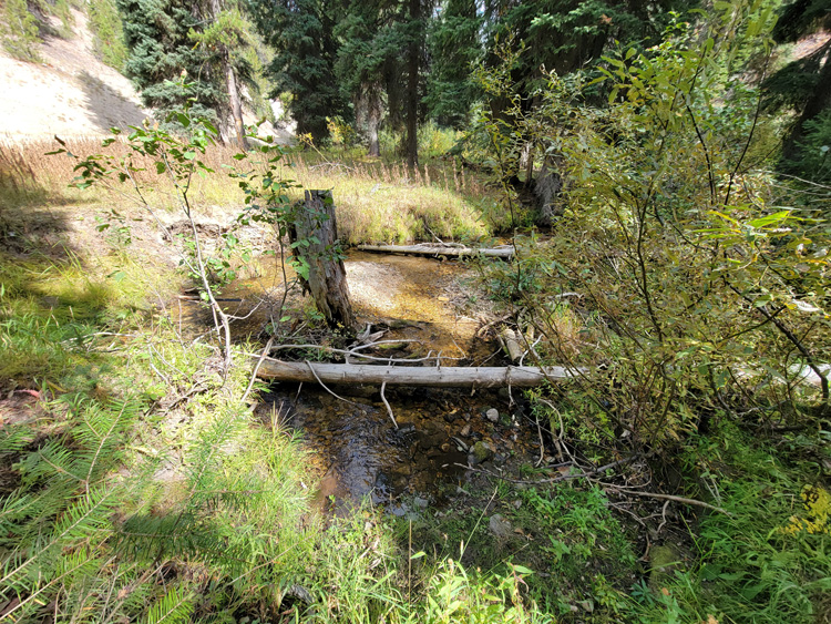
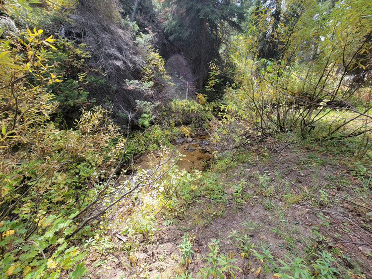
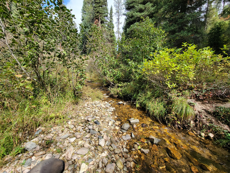
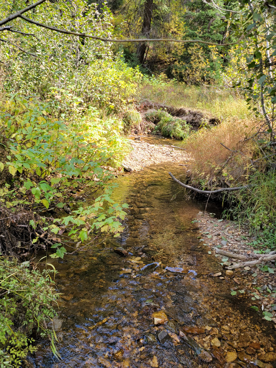
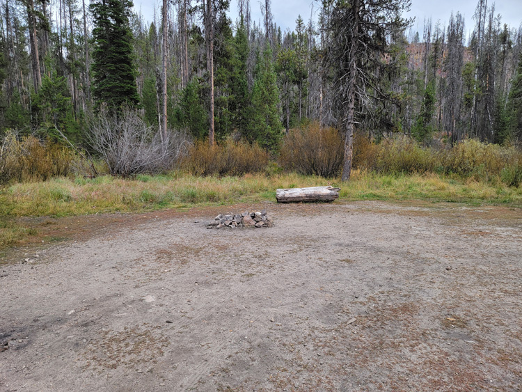
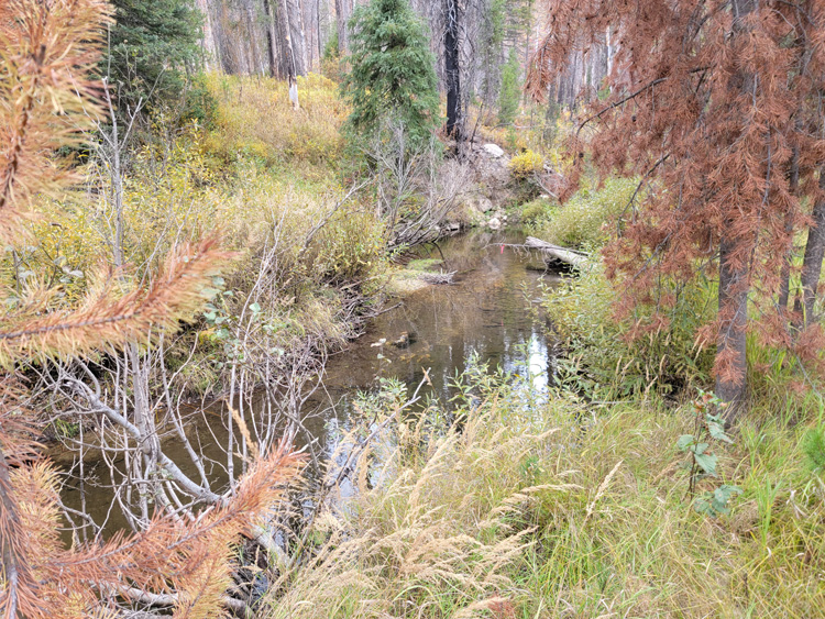
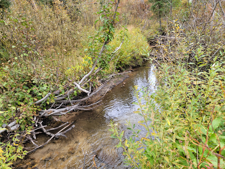
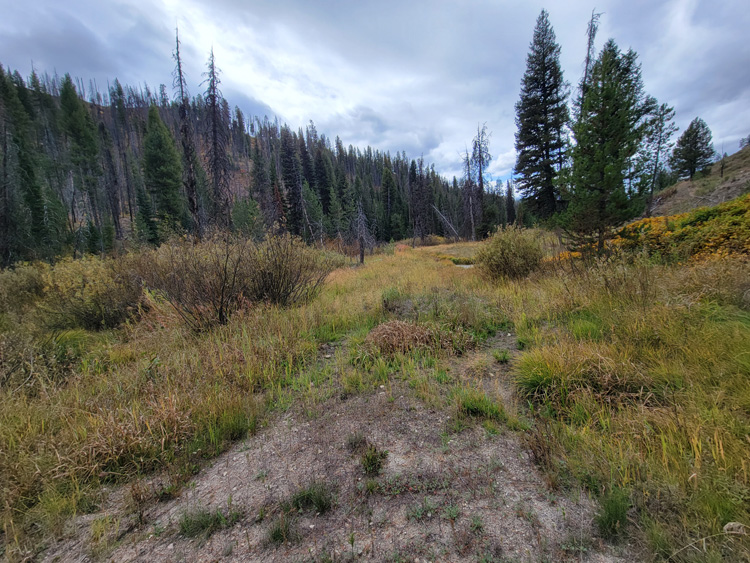
Pikes Fork is a historically rich tributary of the Crooked River drainage system. At the confluence of Pike Fork and Banner Creek, you can see the remanence of the old bucket dredging activity several hundred feet up into Pikes Fork. However, upstream at these mining claims, the terrain became too narrow to allow for this kind of mining, leaving this drainage a nice undisturbed yet great place to be working mostly virgin gold, with exceptional recovery rates. I would also note that I used to teach panning classes at this confluence, as it was an easy place for people to find color just by simple panning methods. These pictures where taken in the fall, so as you can see, there is ample year-round water, with a well graded road going across ALL of these mining claims. A couple of these have some very nice existing camping areas on them, but I also took pictures of flat areas next to the road on several claims, as it appears that camping spots could easily be established. There is a mile gap between “Pikes Pride” and “Pikes Riches” as there are other people’s established mining claims spread out all throughout Pikes Fork.
We will offer bundle offers of $250 off each additional mining claim.
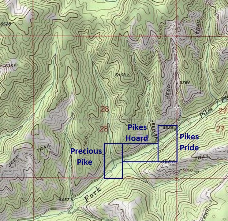


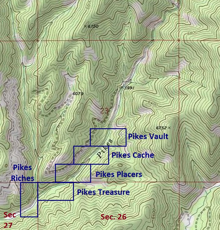
Pikes Riches
Sold
- Acreage: 20 acre unpatented placer claim
- River footage: 1000‘ of Pikes Fork - Large camping area on claim
- Location: Boise County, Township 8N, Range 8E, Sec. 27, NE ¼
- Mining claim serial #: ID106320682
Map to Claim
Coordinates
Marker Degrees, Minutes, Seconds
NW 44°00’29.7720”N, -115°29’27.8520″W
NE 44°00’29.7720”N, -115°29’18.7440″W
SE 44°00’17.1000”N, -115°29’18.7440″W
SW 44°00’17.1000”N, -115°29’27.8520″W
Marker Latitude & Longitude
NW 44.00827°N, -115.49107°W
NE 44.00827°N, -115.48854°W
SE 44.00475°N, -115.48854°W
SW 44.00475°N, -115.49107°W
Aerial & Topo Images

Images


Pikes Treasure
Sold
- Acreage: 20 acre unpatented placer claim
- River footage: 1250‘ of Pikes Fork - Large camping area adjacent to clai
- Location: Boise County, Township 8N, Range 8E, Sec. 26, NW ¼
- Mining claim serial #: ID106320683
Map to Claim
Coordinates
Marker Degrees, Minutes, Seconds
NW 44°00’29.7720”N, -115°29’18.7440″W
NE 44°00’29.7720”N, -115°29’00.8520″W
SE 44°00’23.1840”N, -115°29’00.8520″W
SW 44°00’23.1840”N, -115°29’18.7440″W
Marker Latitude & Longitude
NW 44.00827°N, -115.48854°W
NE 44.00827°N, -115.48357°W
SE 44.00644°N, -115.48357°W
SW 44.00644°N, -115.48854°W
Aerial & Topo Images

Images


Pikes Placers
Sold
- Acreage: 20 acre unpatented placer claim
- River footage: 950‘ of Pikes Fork
- Location: Boise County, Township 8N, Range 8E, Sec. 23, SW ¼
- Mining claim serial #: ID106320684
Map to Claim
Coordinates
Marker Degrees, Minutes, Seconds
NW 44°00’36.4320”N, -115°29’09.9240″W
NE 44°00’36.4320”N, -115°28’51.7080″W
SE 44°00’29.7720”N, -115°28’51.7080″W
SW 44°00’29.7720”N, -115°29’09.9240″W
Marker Latitude & Longitude
NW 44.01012°N, -115.48609°W
NE 44.01012°N, -115.48103°W
SE 44.00827°N, -115.48103°W
SW 44.00827°N, -115.48609°W
Aerial & Topo Images
Images


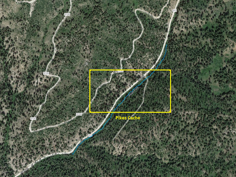
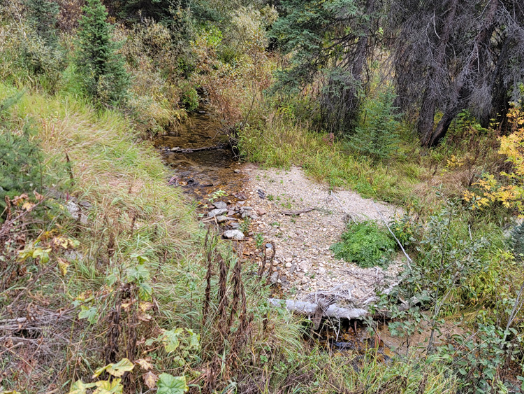
Pikes Cache
Sold
- Acreage: 20 acre unpatented placer claim
- River footage: 950‘ of Pikes Fork - Smaller pullout for camping
- Location: Boise County, Township 8N, Range 8E, Sec. 23, SW ¼
- Mining claim serial #: ID106320685
Map to Claim
Coordinates
Marker Degrees, Minutes, Seconds
NW 44°00’43.3080”N, -115°29’00.8520″W
NE 44°00’43.3080”N, -115°28’42.6000″W
SE 44°00’36.4320”N, -115°28’42.6000″W
SW 44°00’36.4320”N, -115°29’00.8520″W
Marker Latitude & Longitude
NW 44.01203°N, -115.48357°W
NE 44.01203°N, -115.47850°W
SE 44.01012°N, -115.47850°W
SW 44.01012°N, -115.48357°W
Aerial & Topo Images
Images


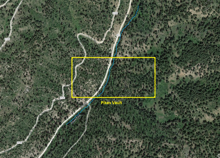
Pikes Vault
Sold
- Acreage: 20 acre unpatented placer claim
- River footage: 800‘ of Pikes Fork - Large flat areas to make camp
- Location: Boise County, Township 8N, Range 8E, Sec. 23, SW & SE ¼s
- Mining claim serial #: ID106320686
Map to Claim
Coordinates
Marker Degrees, Minutes, Seconds
NW 44°00’49.5360”N, -115°28’51.7080″W
NE 44°00’49.5360”N, -115°28’33.4560″W
SE 44°00’43.3080”N, -115°28’33.4560″W
SW 44°00’43.3080”N, -115°28’51.7080″W
Marker Latitude & Longitude
NW 44.01376°N, -115.48103°W
NE 44.01376°N, -115.47596°W
SE 44.01203°N, -115.47596°W
SW 44.01203°N, -115.48103°W
Aerial & Topo Images
Images


Precious Pike
Sold
- Acreage: 20 acre unpatented placer claim
- River footage: 1000‘ of Pikes Fork - 2 large camping areas on claim
- Location: Boise County, Township 8N, Range 8E, Sec. 28, SE ¼
- Mining claim serial #: ID106320679
Map to Claim
Coordinates
Marker Degrees, Minutes, Seconds
NW 43°59’50.7480”N, -115°31’07.9680″W
NE 43°59’50.7480”N, -115°30’57.9240″W
SE 43°59’38.2920″N, -115°30’57.9240″W
SW 43°59’38.2920″N, -115°31’07.9680″W
Marker Latitude & Longitude
NW 43.99743°N, -115.51888°W
NE 43.99743°N, -115.51609°W
SE 43.99397°N, -115.51609°W
SW 43.99397°N, -115.51888°W
Aerial & Topo Images

Images


Pikes Hoard
Sold
- Acreage: 20 acre unpatented placer claim
- River footage: 1550‘ of Pikes Fork
- Location: Boise County, Township 8N, Range 8E, Sec. 28, SE ¼
- Mining claim serial #: ID106320680
Map to Claim
Coordinates
Marker Degrees, Minutes, Seconds
NW 43°59’50.7480”N, -115°30’57.9240″W
NE 43°59’50.7480”N, -115°30’39.8520″W
SE 43°59’43.9800″N, -115°30’39.8520″W
SW 43°59’43.9800″N, -115°30’57.9240″W
Marker Latitude & Longitude
NW 43.99743°N, -115.51609°W
NE 43.99743°N, -115.51107°W
SE 43.99555°N, -115.51107°W
SW 43.99555°N, -115.51609°W
Aerial & Topo Images

Images


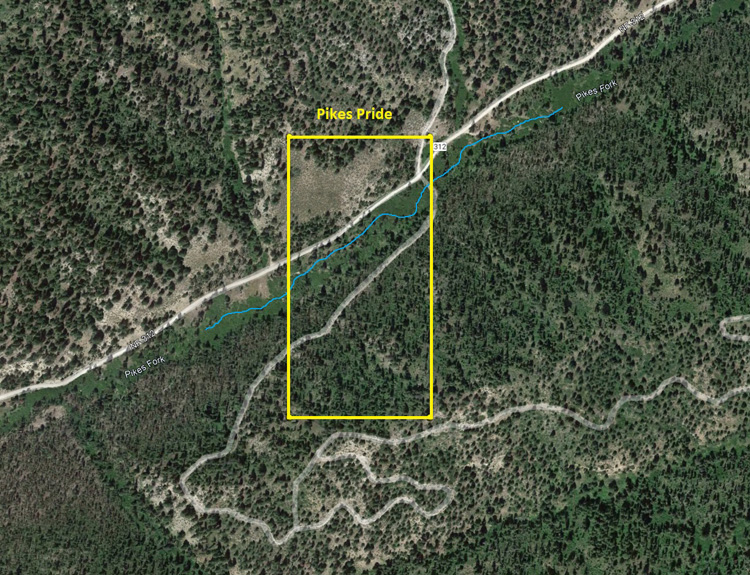
Pikes Pride
Sold
- Acreage: 20 acre unpatented placer claim
- River footage: 950‘ of Pikes Fork - Large camping area adjacent to claim
- Location: Boise County, Township 8N, Range 8E, Sec. 28, SE ¼
- Mining claim serial #: ID106320681
Map to Claim
Coordinates
Marker Degrees, Minutes, Seconds
NW 43°59’57.5160”N, -115°30’39.8520″W
NE 43°59’57.5160”N, -115°30’30.4200″W
SE 43°59’43.9800″N, -115°30’30.4200″W
SW 43°59’43.9800″N, -115°30’39.8520″W
Marker Latitude & Longitude
NW 43.99931°N, -115.51107°W
NE 43.99931°N, -115.50845°W
SE 43.99555°N, -115.50845°W
SW 43.99555°N, -115.51107°W
Aerial & Topo Images
Images


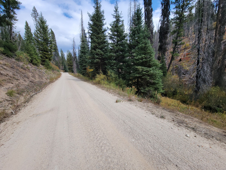
Show Me The Gold
Driving Directions: The claims are located 23 miles outside the historic town of Idaho City. Driving directions to the claims: from Boise, travel north on HWY 21 to approximately 18 miles past Idaho City to the Jackson Peak Lookout turnout (Edna Creek Campground is at this junction). Turn right (east) on Crooked River Road (NF 384) for approximately 4 miles. Turn left (north) at the Jackson Peak turnoff onto NF 312. You will stay on this road for 1.1 miles turning right at the Pikes Fork Junction (which is still NF 312). You will continue on NF 312 for another 1.8 miles until you reach the Precious Pike mining claim. The next two mining claims extend up Pikes Fork for an additional 0.6 of a mile. Pikes Riches mining claim is about 1.0 mile from Pikes Pride and the remaining of the mining claims extend up NF 312 for an additional 0.9 of a mile. There are markers along the road showing the boundaries between the mining claims.
