Price: $3,250 - $6,500
SoldOphir Creek Claims
Overview
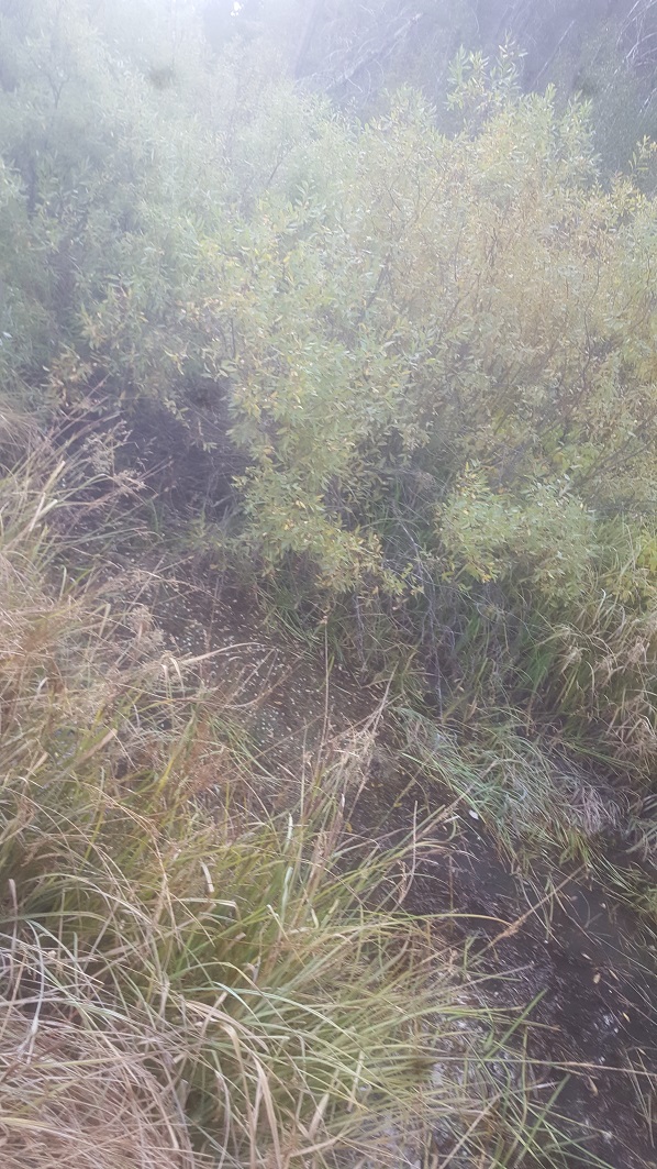
“Ophir Creek” is one of those top historically well-known gold bearing tributaries of the Boise Basin as a source of phenomenal color in the center of prime gold country. The surrounding mountains which are littered with lode mines and other adits illustrates multiple accounts of Ophir Creek having cut many of these veins, with rich deposits laying within its gravels. However, as another bonus, the surrounding area (even high up on the hills) is also known for its glacial till (appears in the form of river cobble), which blanket over many sections around Placerville. Ophir Creek is also a tributary that is open to dredging, for that fun feature and option.
These two 20 acre placer mining claims also have a couple unique & outstanding features about them; they have the type of terrain conducive for bringing in heavy equipment for a midscale trommel operation, as well as decent pay layer material found on-site and each of these claims can be increased in size to capture roughly 34.8 acres each (or roughly 70 acres combined).
I would note, that our company also owns the 100 acres abutting to the north on Ophir Creek, where we are in the process of developing a plan for a mid-scale trommel operation…this is how serious we are about the great gold mining opportunity this area has.
These claims are positioned only 2 miles outside of Placerville (with limited services), or about a 30-minute drive to either Idaho City or Garden Valley with full services.
Bundle Price of $6,500 for both claims (Royal Ophir and Ophir Paydirt)
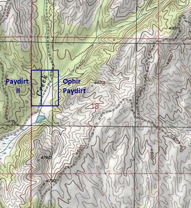
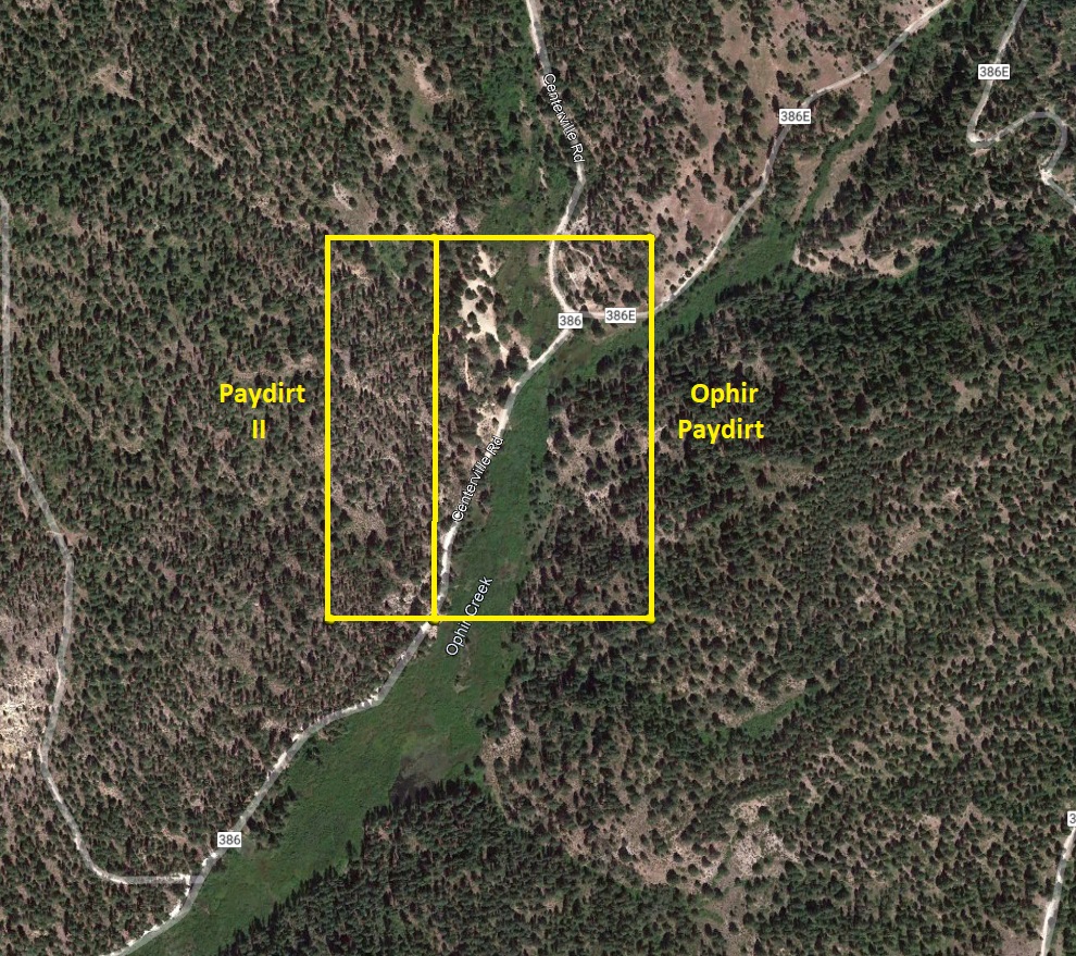
Aerial & Topo Images
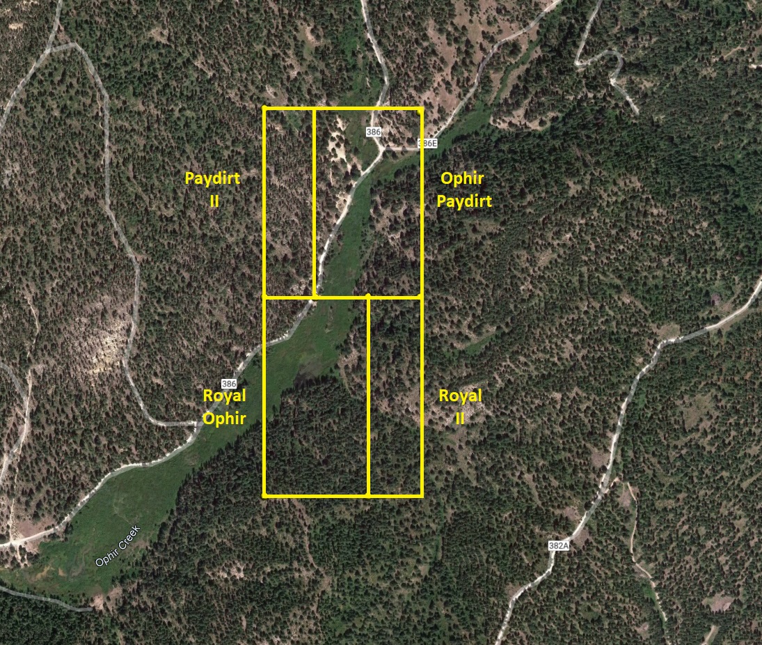
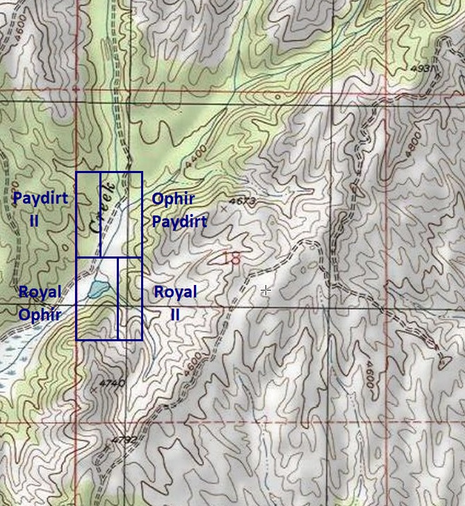
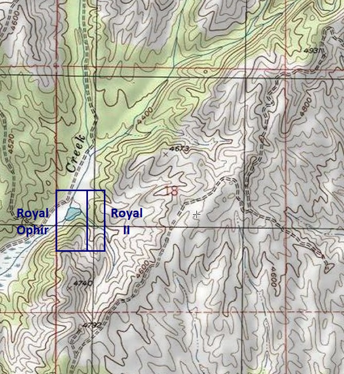
Royal Ophir
- Acreage: 34.89 acre unpatented placer claims
- River footage: 900’ of Ophir Creek
- Location: Boise County, Township 7N, Range 5E, Sec. 18, SW ¼
- Mining claim serial #: ID105798571
Map to Claim
Coordinates
Marker Degrees, Minutes, Seconds
NW 43°56’39.2640″N, -115°55’08.9400”W
NE 43°56’39.2640″N, -115°54’53.8200”W
SE 43°56’25.3680″N, -115°54’53.8200”W
SW 43°56’25.3680″N, -115°55’08.9400”W
Marker Latitude & Longitude
NW 43.94424°N, -115.91915°W
NE 43.94424°N, -115.91495°W
SE 43.94038°N, -115.91495°W
SW 43.94038°N, -115.91915°W
Aerial & Topo Images
Images


Ophir Paydirt
- Acreage: 34.81 acre unpatented placer claims
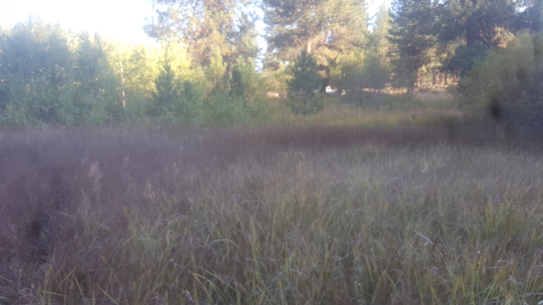
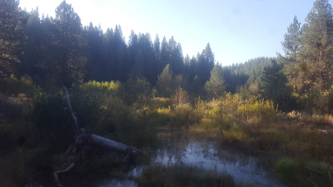
- River footage: 1400’ of Ophir Creek & 350’ gold bearing trib. - Large camping area “on” northern end along with existing ponds
- Location: Boise County, Township 7N, Range 5E, Sec. 18, NW ¼
- Mining claim serial #: ID105798570
Map to Claim
Coordinates
Marker Degrees, Minutes, Seconds
NW 43°56’52.1880″N, -115°55’08.9400”W
NE 43°56’52.1880″N, -115°54’53.8200”W
SE 43°56’39.2640″N, -115°54’53.8200”W
SW 43°56’39.2640″N, -115°55’08.9400”W
Marker Latitude & Longitude
NW 43.94783°N, -115.91915°W
NE 43.94783°N, -115.91495°W
SE 43.94424°N, -115.91495°W
SW 43.94424°N, -115.91915°W
Aerial & Topo Images
Images


Show me the Gold
These samples were collected from doing a short 3 hour sampling (using suction high-banker), but there is quite a bit more additional color I have collected on Ophir Creek, with having owned several miles of this drainage over many years. There is some amalgam present, but mostly clean color. Within the concentrates I have also found a LOT of PGMs, so be mindful of what you throw away.


Geological Reports
1915 Report
https://pubs.usgs.gov/bul/0640e/report.pdf
1947 Report
https://pubs.usgs.gov/bul/0944c/report.pdf (See pages 282 & 283)
Driving directions to the claim: from Placerville, head northeast on NF 615 (towards Garden Valley), about 500’ as you head out of town, turn right (east) onto NF 349. Take this up and over the hill for approximately 0.4 of a mile, and turn left (before reaching the bottom of the draw) onto NF 386. You will stay on this road which follows along the northwest side of Ophir Creek for approximately 2 miles to the claims. If you get to where the road crosses Ophir Cr draw, (at the fork), this is the northern end (but “on”) “Ophir Paydirt”. Signage has been posted along the road, showing where the mining claim boundaries are positioned. West of the fork on the northern end of Ophir Paydirt is a massive camping area “on” the claim.
