NW Placerville Commercial Operation
Woof Creek Sold
Overview
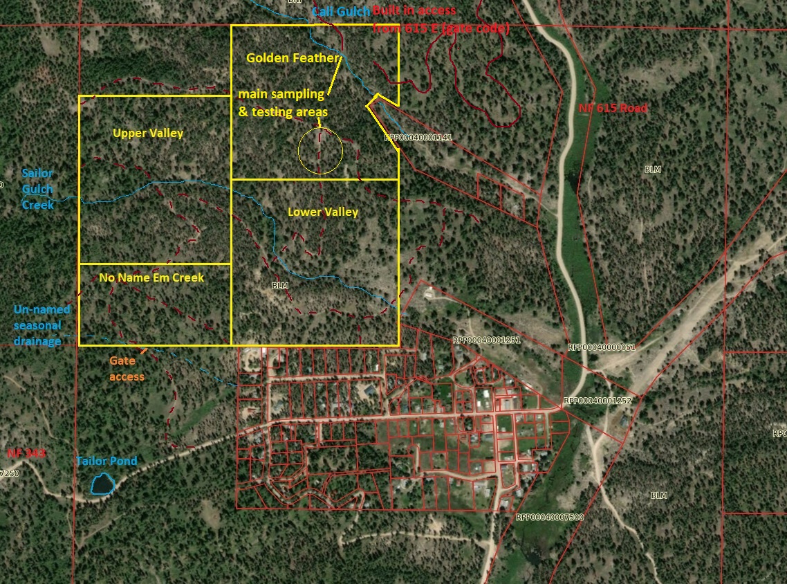
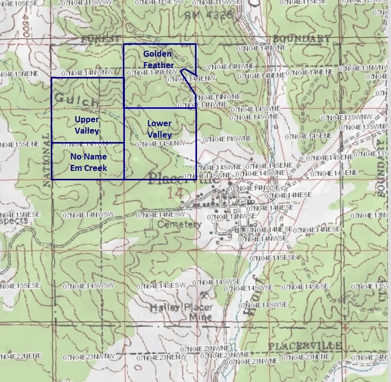
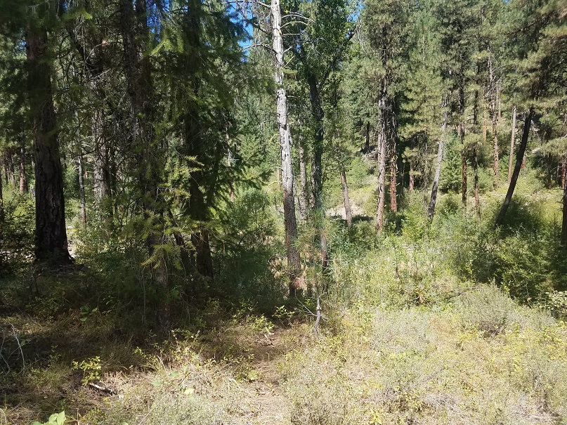
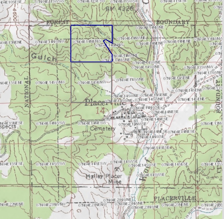
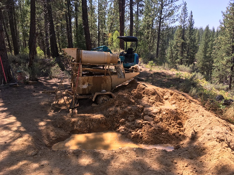
This 139.41 acre commercial size mining operation is positioned northwest and abutting the historic gold mining town of Placerville. There are two major drainages (California Gulch & Sailor Gulch) that cross these claims, along with a decent size seasonal drainage (across the “No Name Em” mining claim).
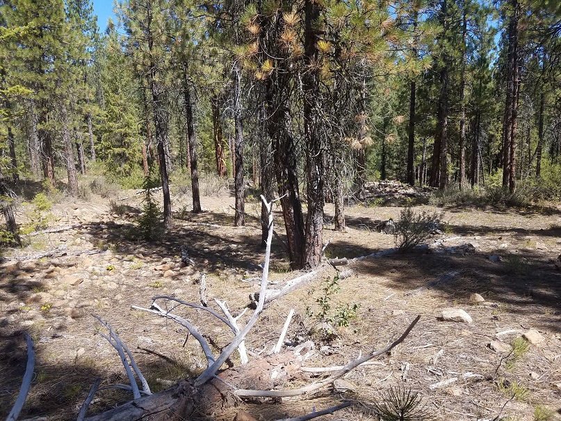
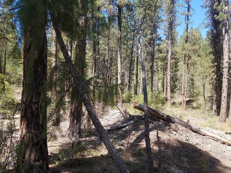
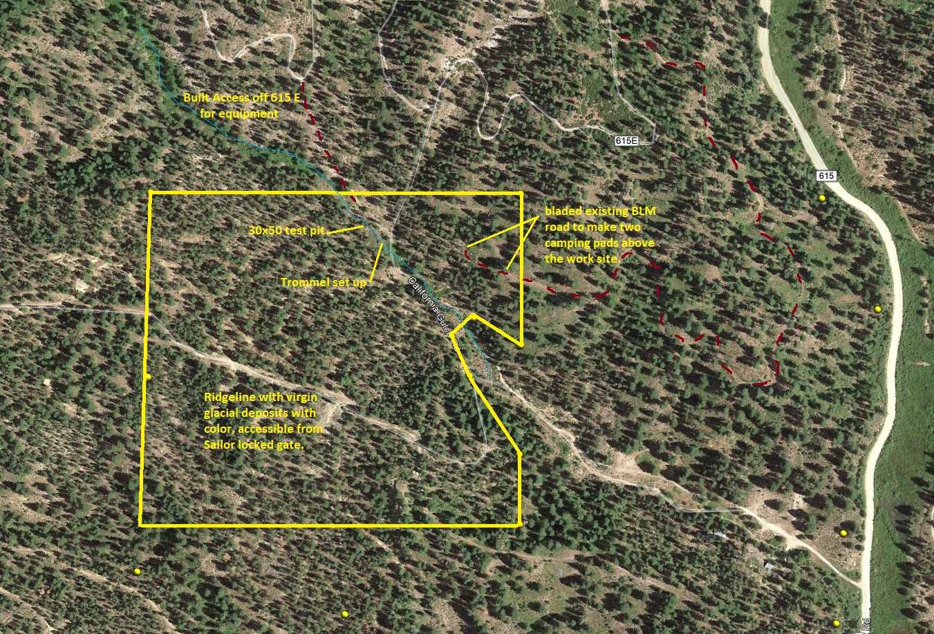
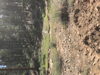
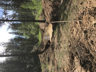
On all of the claims, there is evidence of some old sluicing and hydraulic workings, as well as hills where these virgin deposits are still waiting to be explored. The terrain around this area is comprised mostly of roly hills, making transporting heavy equipment pretty easy to traverse. An approved exploratory plan was developed for this site (includes the whole 139.41 acres), with the main test area on the “Golden Feather” mining claim, being less than two acres. Although, the actual work site of disturbed ground (including ponds, material that was processed from the pit and access roads), during the operation was under a ½ of an acre. Other virgin deposits have been discovered on the claims but this area was primarily where a majority of the sampling was conducted. There are existing BLM roads which wind around throughout the full length of all of the mining claims, making it extremely versatile for access & equipment staging. On the No Name Em Creek, Upper Valley & Lower Valley access, it is gated off, where the seller will receive key access. For the south end (upper bluff) of Golden Feather it can also be accessed from this same road. California Gulch (northern end of Golden Feather), it can be accessed from NF 615E, gate code is used (for claimant only) when it is closed for seasonal use to the general public.
These claims are on BLM land, who’s currently one of the easiest management agencies to work with in Idaho for mining plans. While the work site has been reclomated, it is our intention to transfer the approved plan, which is still in good standing, with the sale of this claim. The bond for the work that was approved through the plan is $2,100 (which gets paid to the BLM directly), or there is the option of doing a Surety Bond (roughly 10% the bond cost). If the approved exploratory plan is not entirely to your operational needs, plans can easily be amended through the BLM geologist (contact information will be provided). Also, while the owner would prefer to sell all 4 of these mining claims along with the plan to a single buyer, if the claim(s) are broken out in individually, the seller wants the plan to go with the Golden Feather mining claim.
Full services are available at either Idaho City or Garden Valley for restocking (fuel or groceries) just 30 minutes from the site. Or there is cell reception and small market 5 minutes away in Placerville.
No Name Em Creek
Sold
- Acreage: 20 acre unpatented placer claim
- River footage:
- Location: Boise County, Township 7N, Range 4E, Sec. 14, NW ¼
- Mining claim serial #: IMC225518
Map to Claim
Coordinates
Marker Latitude & Longitude
NW 43.94647’N, -115.95906’W
NE 43.94647’N, -115.95411’W
SE 43.94452’N, -115.95411’W
SW 43.94452’N, -115.95906’W
Marker Degrees, Minutes, Seconds
NW 43°56’47.2920″N, -115°57’32.6160″W
NE 43°56’47.2920″N, -115°57’14.7960″W
SE 43°56’40.2720″N, -115°57’14.7960″W
SW 43°56’40.2720″N, -115°57’32.6160″W
Aerial & Topo Images

Images


Upper Valley
Sold
- Acreage: 40 acre unpatented placer claim
- River footage:
- Location: Boise County, Township 7N, Range 4E, Sec. 14, NW ¼
- Mining claim serial #: IMC225519
Map to Claim
Coordinates
Marker Latitude & Longitude
NW 43.94987’N, -115.95906’W
NE 43.94987’N, -115.95411’W
SE 43.94647’N, -115.95411’W
SW 43.94647’N, -115.95906’W
Marker Degrees, Minutes, Seconds
NW 43°56’59.5320″N, -115°57’32.6160″W
NE 43°56’59.5320″N, -115°57’14.7960″W
SE 43°56’47.2920″N, -115°57’14.7960″W
SW 43°56’47.2920″N, -115°57’32.6160″W
Aerial & Topo Images

Images


Lower Valley
Sold
- Acreage: 40 acre unpatented placer claim
- River footage:
- Location: Boise County, Township 7N, Range 4E, Sec. 14, NW ¼
- Mining claim serial #: IMC225520
Map to Claim
Coordinates
Marker Latitude & Longitude
NW 43.94811’N, -115.95411’W
NE 43.94811’N, -115.94913’W
SE 43.94452’N, -115.94913’W
SW 43.94452’N, -115.95411’W
Marker Degrees, Minutes, Seconds
NW 43°56’53.1960″N, -115°57’14.7960″W
NE 43°56’53.1960″N, -115°56’56.8680″W
SE 43°56’40.2720″N, -115°56’56.8680″W
SW 43°56’40.2720″N, -115°57’14.7960″W
Aerial & Topo Images

Images


Golden Feather
Sold
- Acreage: 39.41 acre unpatented placer claim
- River footage:
- Location: Boise County, Township 7N, Range 4E, Sec. 14, NW ¼
- Mining claim serial #: IMC225521
Map to Claim
Coordinates
Marker Latitude & Longitude
NW 43.95135’N, -115.95411’W
NE 43.95135’N, -115.94913’W
C 43.94978’N, -115.94913’W
D 43.95015’N, -115.94977’W
E 43.94996’N, -115.95007’W
F 43.94879’N, -115.94913’W
SE 43.94811’N, -115.94913’W
SW 43.94811’N, -115.95411’W
Marker Degrees, Minutes, Seconds
NW 43°57’04.8600″N, -115°57’14.7960″W
NE 43°57’04.8600″N, -115°56’56.8680″W
C 43°56’59.2080″N, -115°56’56.8680″W
D 43°57’00.5400″N, -115°56’59.1720″W
E 43°56’59.8560″N, -115°57’00.2520″W
F 43°56’55.6440″N, -115°56’56.8680″W
SE 43°56’53.1960″N, -115°56’56.8680″W
SW 43°56’53.1960″N, -115°57’14.7960″W
Aerial & Topo Images
Images

Show me the Gold
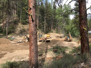
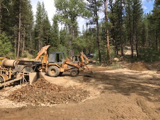
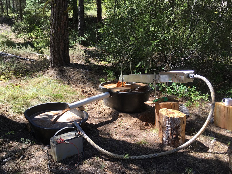
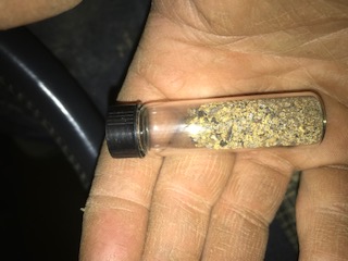
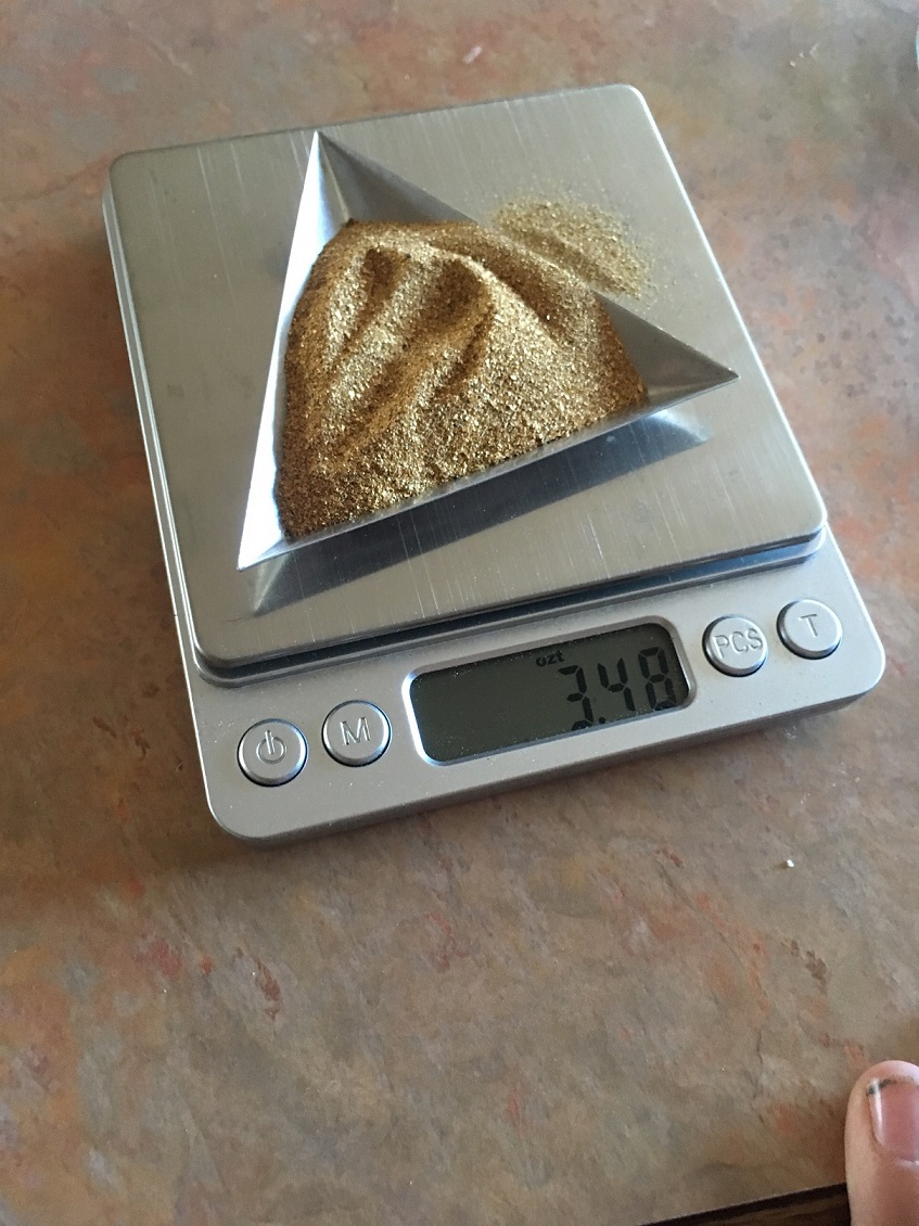
In Califonia Gulch, a total of 1,000 yards from approximately 1/8th of an acre was processed, which was just old fine tailings from what was left behind from the hydraulic mining. A 24” trommel using 6’ of gold hog mats (on the upper sluice) and angle iron riffles, and #3 expanded for the lower sluice, was used for the recovery, with two backhoes for the digging and loading. From this sample run, a total of 8.45 ozt of gold was recovered, mostly ranging from 50-100 mesh in size, but also a few nice pickers, which showed averages just over 0.258 grams per yard. Using a “Thermo Scientific Niton XL2” (for precious metals), gold purity ranged from .800 to .910 (19 to 22 karat) and PGMs were present in most of the scans (especially when melting down the remaining concentrates, after removing most of the visible gold).
On the top of the ridge separating between California Gulch and Sailor Gulch, the material the deposit consisted of glacial till. Which was mainly composed of 3”-6” cobble (20%), 1”-3” gravels (30%), and 1” minus decomposed granite (50%). Clay is present and carries low values of gold. Roughly 6 sample holes were tested comprising of roughly a yard to 30 yards per test, with results varying between 0.30gpy to 1.30 gpy, with some areas being virgin and untouched in nature. In this upper ridge area, there are also large hills 15 to 20 feet high, which also appear to be untouched glacial till deposit. There is evidence even high up top of older workings. Although, even on these flat worked areas, when samples were collected on top of bedrock, there was good chunky gold right below the surface on bedrock.
In California Gulch, amalgam (mercury with gold) was present as well as patches of untouched and clean gold. All of the gold from the upper ridge was clean with no amalgam/mercury present.
The topsoil overburden seemed to be around 6” to 12” thick, but again, we discovered multiple exposed areas of this glacial deposit throughout the claim, with large cobble being present even at the ridge tops, with all the pan samples collected showing decent color, but need further exploration to determine size and value


Quartzburg link pg. 253
https://pubs.usgs.gov/bul/0846d/report.pdf
Placerville link pg. 1
https://www.idahogeology.org/pub/Bulletins/B-22.pdf
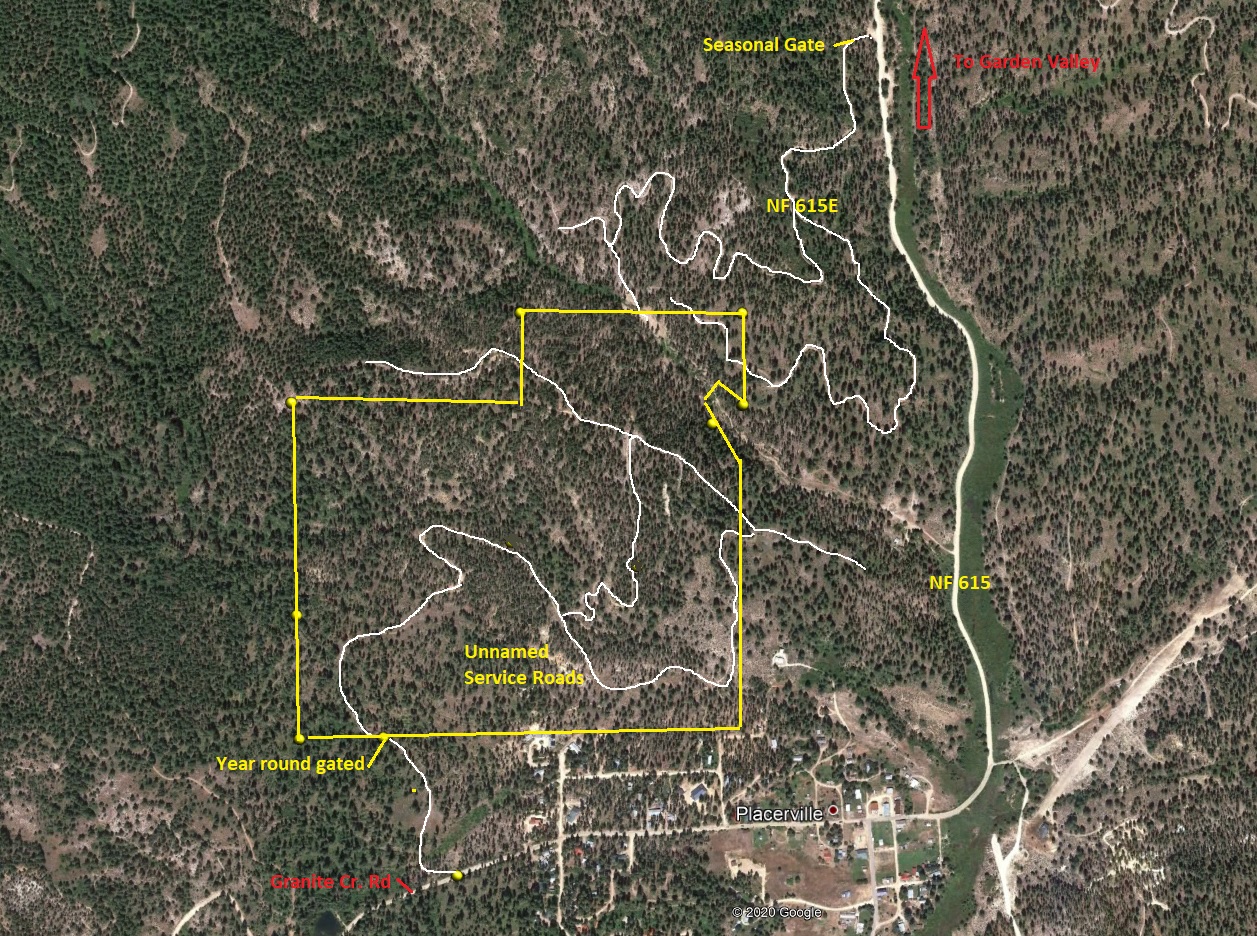
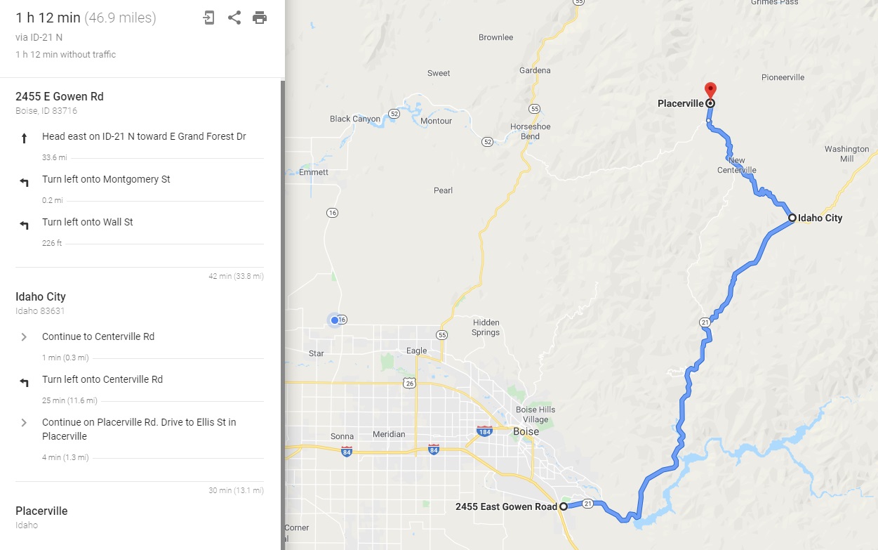
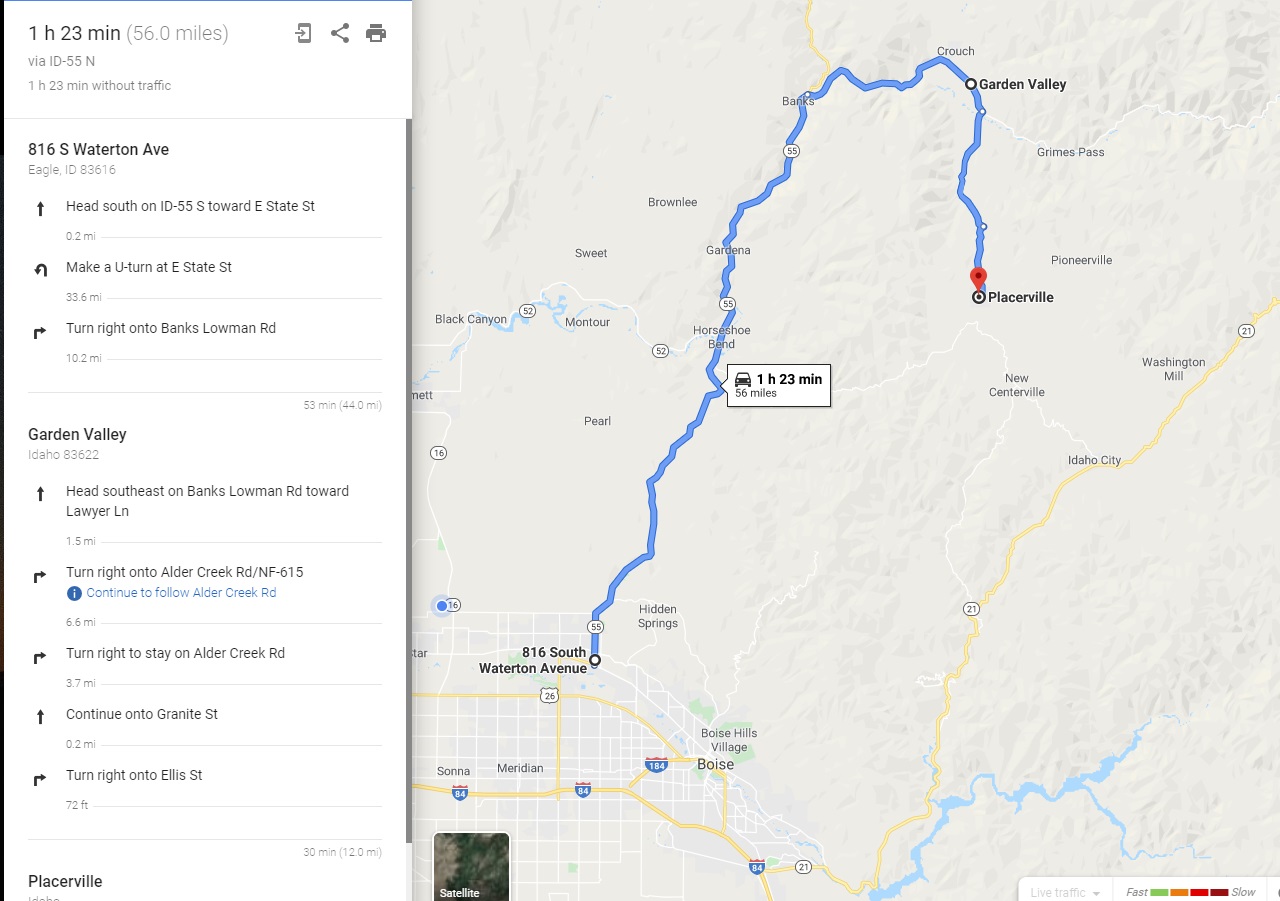
Driving directions: This mining claim is abutting the town of Placerville which has three main ways of getting to it; 1) Harris Creek Road (from Horseshoe Bend), 2) Centerville Road/NF-307 (from Idaho City) or 3) Alder Creek Road/NF-615 (from Garden Valley). From Boise, it takes about an hour to an hour & 15 minutes get up to this claim as you are leaving town, really just depends on which side of Boise you are leaving from.
Directions Going through Idaho City – from Boise, travel north on HWY 21 to Idaho City (approximately 34 miles from I-84). Turn left (north) onto either Montgomery St or Main St in Idaho City. In about a ¼ of a mile turn left (west) onto Centerville Road. Continue on Centerville Road (which is gravel in the middle), for about 11.5 miles, and then turn right (north) at the Placerville junction (there is also a row of mailboxes here). Travel north up NF-615 for about 1.3 miles. Until you reach the T intersection (fire station across the street) in Placerville.
To access “No Name Em Creek”, “Upper Valley”, “Lower Valley” & south side of “Golden Feather”, turn left at the T and travel on Granite Cr. Rd. for approximately ½ of a mile and turn right onto the unnamed BLM access road (just past the houses, but before reaching the pond). In about a ¼ of a mile, you will reach a gate (key will be given to the buyer).
To access the north side of “Golden Feather”, at the T in Placerville, turn right and continue down NF 615 for exactly 1 mile, and turn left onto NF 615E. This gate is locked half the year (gate code will be provided to buyer), for access to mine. There are two service roads which were graded to access Golden Feather and into California Gulch off of NF 615E.
Note: You can google maps the other two ways in, which is pretty easy to find & on main roads, just by plotting in “Placerville”. I would caution you that google maps after plotting Boise to Placerville, on the Idaho City side, will typically select turning onto Grimes Creek Road (avoiding Idaho City completely)…if you want to add 30 minutes (longer than it says) & one bumpy @$$ adventure to your trip, you are welcome to it, but would strongly recommend going through Idaho City.
Driving Maps