Muddy Creek Claims
Grimes Creek Sold
Overview
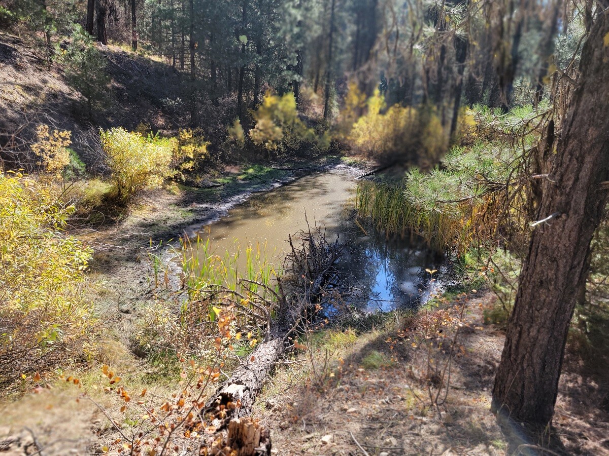
Muddy Creek (or as these claims are known as Muddy Gold #1 – #3) is a gold bearing tributary of Grimes Creek, with the “source” coming from multiple mines known vein sources within 200’ from the Muddy Gold #3 claim. Always bigger & more gold the closer to the source you can be with a placer claim. It was so productive that in the 1930s this drainage did see some bucket dredging. While some inexperienced miners might get discouraged about seeing old workings, areas like this are highly sought after with the amount of color that the drainage has (enough where even the old timers sought it out) and considering how poorly the recovery methods were back then, there is AMPLE to keep an operation viable for MANY years. However, in many sections of this drainage, large sections were skipped due to the drainage being narrower in nature. Muddy Creek is considered open to dredging and does have year round water flowing in the creek.
Muddy Gold #3
Sold
Price: $3,750
- Acreage: 15 acre unpatented placer claim
- River footage: 1,150’ of Muddy Creek - Areas to camp & ponds
- Location: Boise County, Township 8N, Range 5E, Sec. 34, NW ¼
- Mining claim serial #: ID106333408
Map to Claim
Coordinates
Marker Degrees, Minutes, Seconds
NW 43°59’34.9800″N, -115°51’18.0000”W
NE 43°59’34.9800″N, -115°51’08.7120”W
SE 43°59’25.6200″N, -115°51’08.7120”W
SW 43°59’25.6200″N, -115°51’18.0000”W
Marker Latitude & Longitude
NW 43.99305°N, -115.85500°W
NE 43.99305°N, -115.85242°W
SE 43.99045°N, -115.85242°W
SW 43.99045°N, -115.85500°W
Aerial & Topo Images


Images


Muddy Gold #1
Sold
- Acreage: 20 acre unpatented placer claim
- River footage: 1,500’ of Muddy Creek
- Location: Boise County, Township 8N, Range 5E, Sec. 34, SW ¼
- Mining claim serial #: ID106333406
Map to Claim
Coordinates
Marker Degrees, Minutes, Seconds
NW 43°58’59.8440″N, -115°51’10.8720”W
NE 43°58’59.8440″N, -115°51’01.2960”W
SE 43°58’46.4880″N, -115°51’01.2960”W
SW 43°58’46.4880″N, -115°51’10.8720”W
Marker Latitude & Longitude
NW 43.98329°N, -115.85302°W
NE 43.98329°N, -115.85036°W
SE 43.97958°N, -115.85036°W
SW 43.97958°N, -115.85302°W
Muddy Gold #2
Sold
- Acreage: 15 acre unpatented placer claim
- River footage: 1,050’ of Muddy Creek
- Location: Boise County, Township 8N, Range 5E, Sec. 34, SW ¼
- Mining claim serial #: ID106333407
Map to Claim
Coordinates
Marker Degrees, Minutes, Seconds
NW 43°59’09.3840″N, -115°51’15.0480”W
NE 43°59’09.3840″N, -115°51’05.1480”W
SE 43°58’59.8440″N, -115°51’05.1480”W
SW 43°58’59.8440″N, -115°51’15.0480”W
Marker Latitude & Longitude
NW 43.98594°N, -115.85418°W
NE 43.98594°N, -115.85143°W
SE 43.98329°N, -115.85143°W
SW 43.98329°N, -115.85418°W
High-banking spring of 2024


Driving directions to the claim: from Pioneerville (off NF-382/Grimes Pass Road)…now as the “actual” location of Pioneerville is (questionable as it is now) just one or two houses/old decaying buildings on the righthand (east) side, so if it’s hard to “pinpoint” where your mapping system will state the “true location” is, in general terms, continue heading north on the main NF-382 road (towards Grimes Pass) for about 0.13 of a mile (past some of the ONLY and main building structures), where you will see a significant Y in the road. Take the road on the left (aka NF-395A1 or Muddy Creek Rd), you will know you are on the correct road, as within about 750’ you will cross Grimes Creek. About 400’ past the Grimes Creek bridge, you will come to a second Y, and take the main Muddy Creek fork on the right (NF-395 A1). Continue on this about 0.5 of a mile until you reach the Muddy Gold #1 mining claim. The additional claims, Muddy Gold #2 starts about at 0.8 miles up from the Y (after the Grimes Cr bridge), and Muddy Gold #3 is approximately 1.3 miles (from the second Y). Signs are up along the road marking the claims on either end.

