
MF Payette River Claims
MF Payette Sold
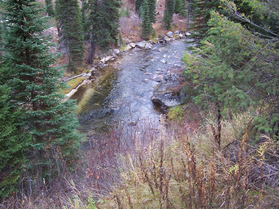
Overview
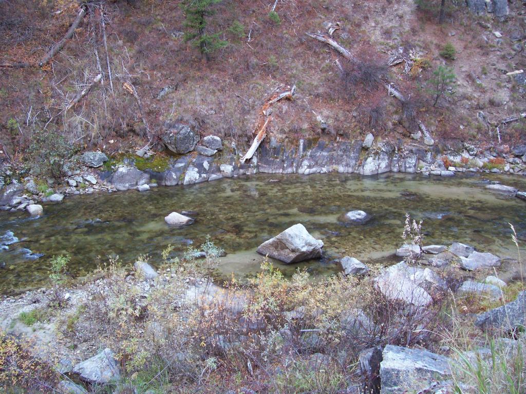
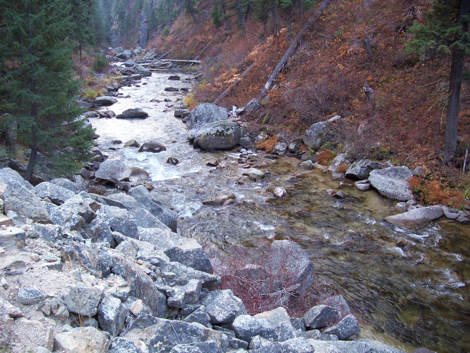
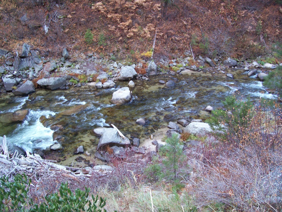
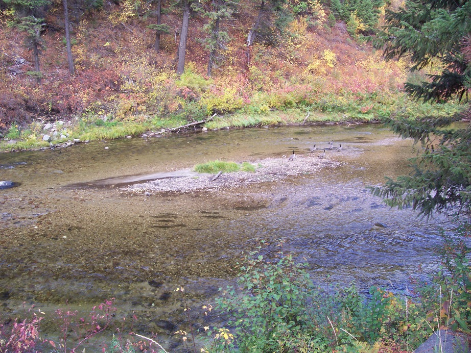
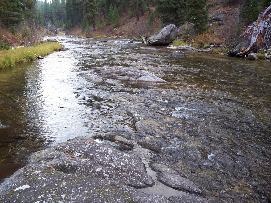
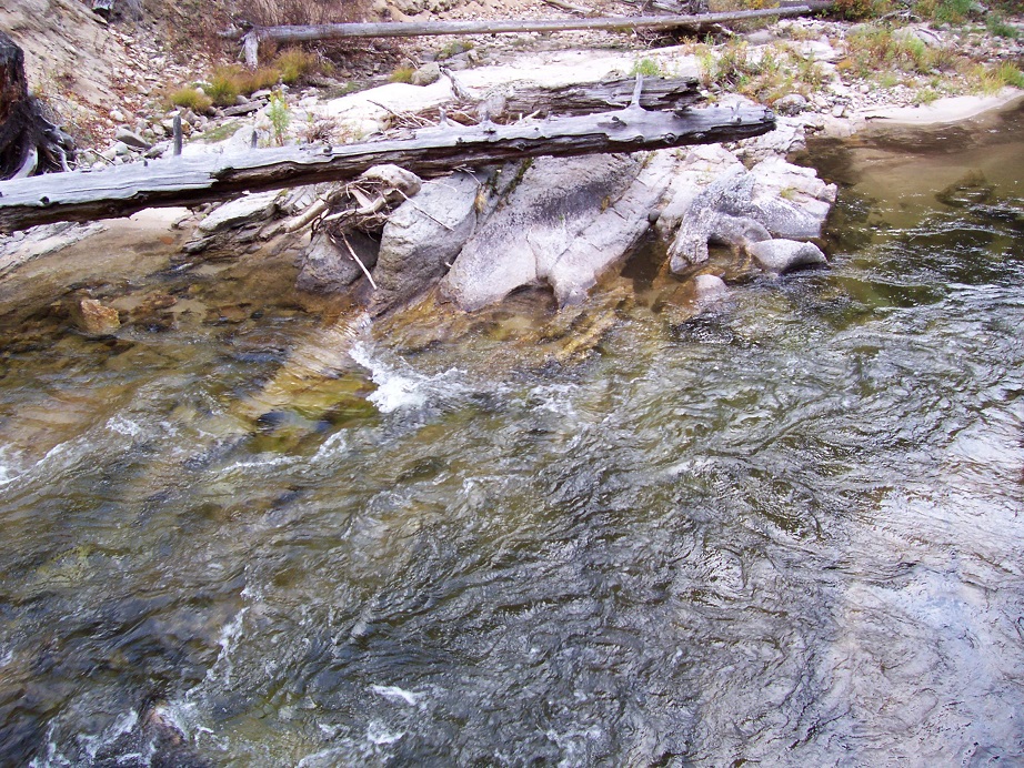
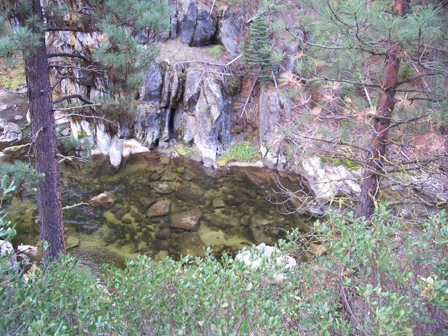
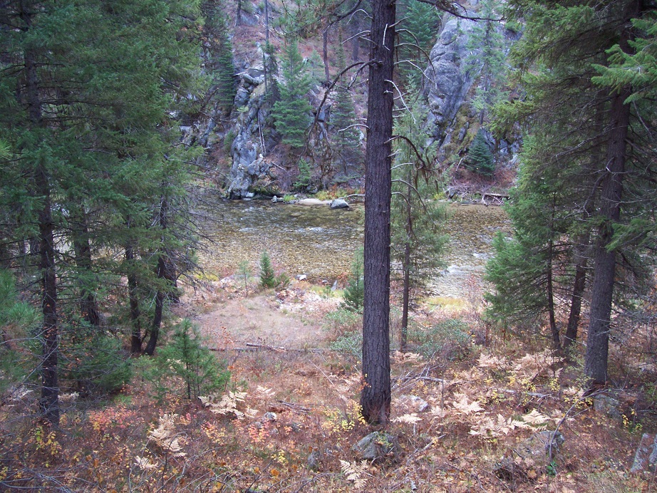
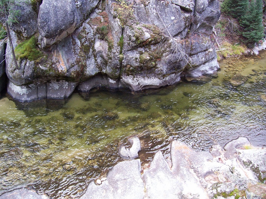
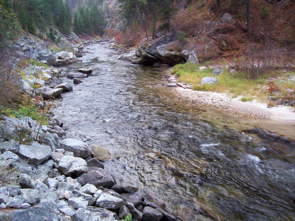
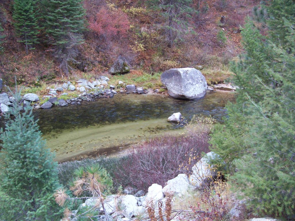
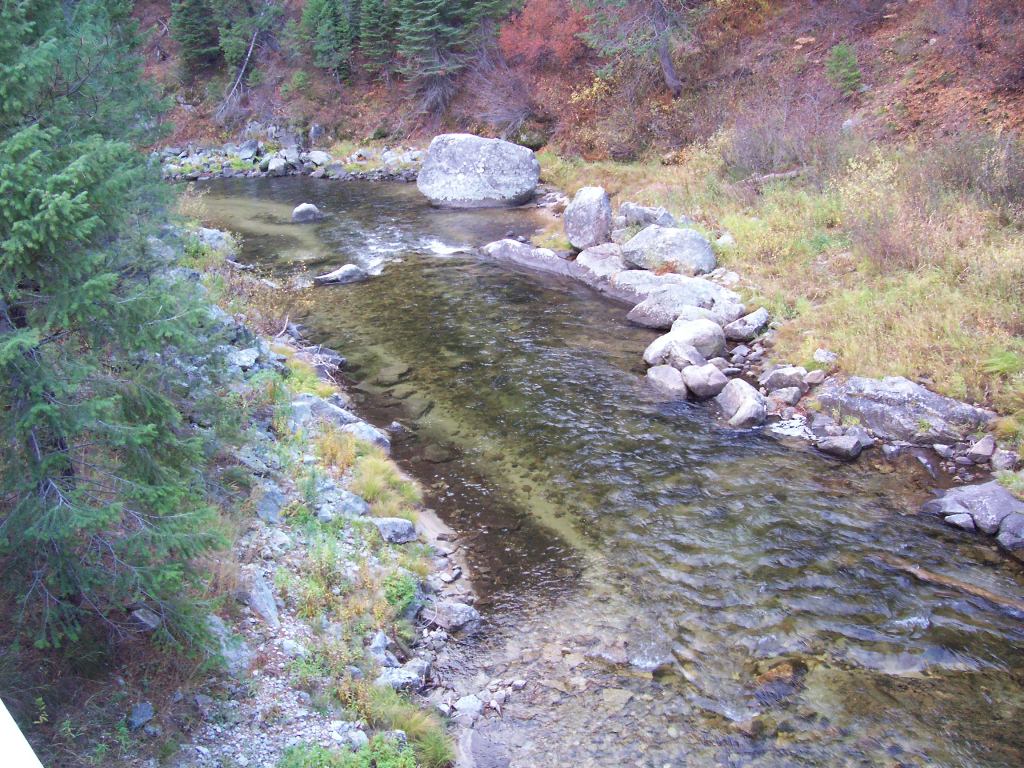
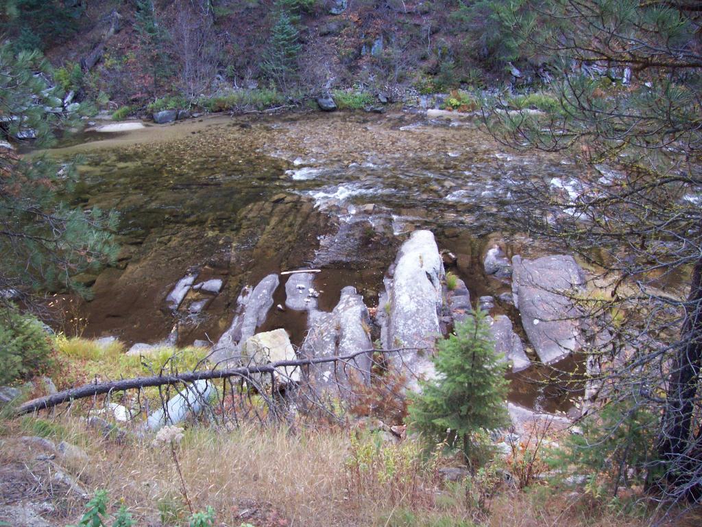
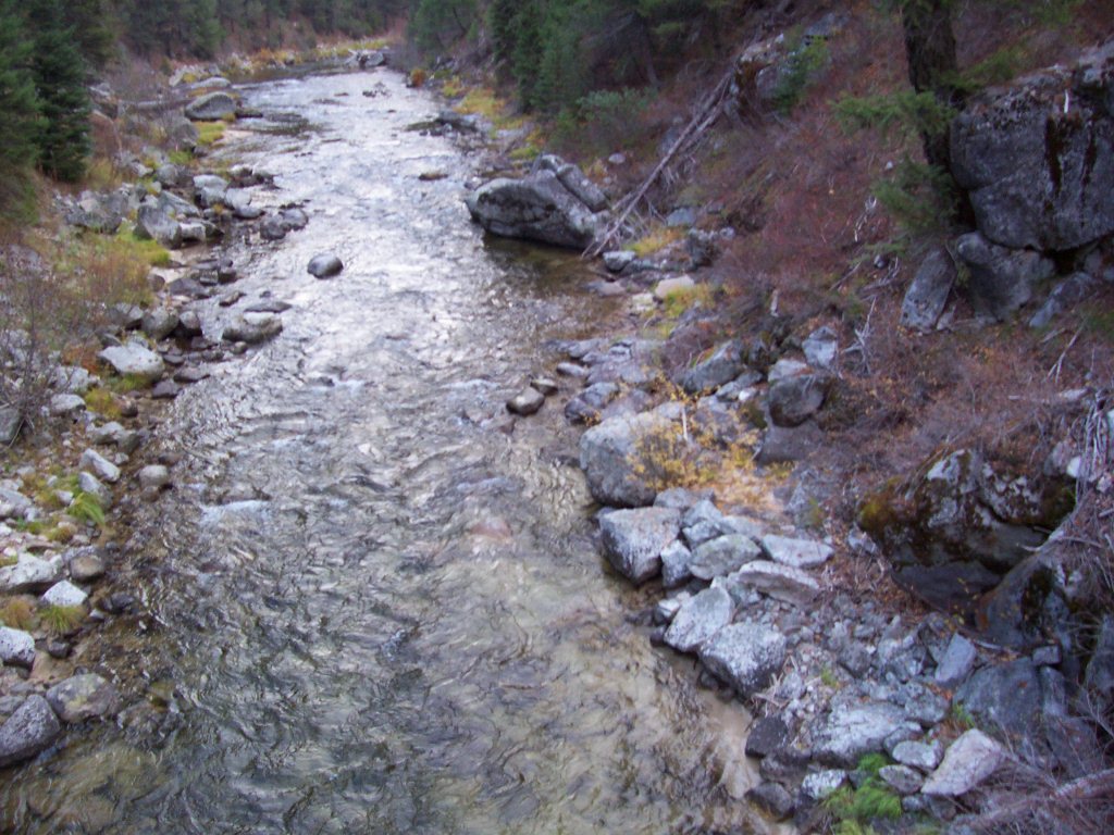
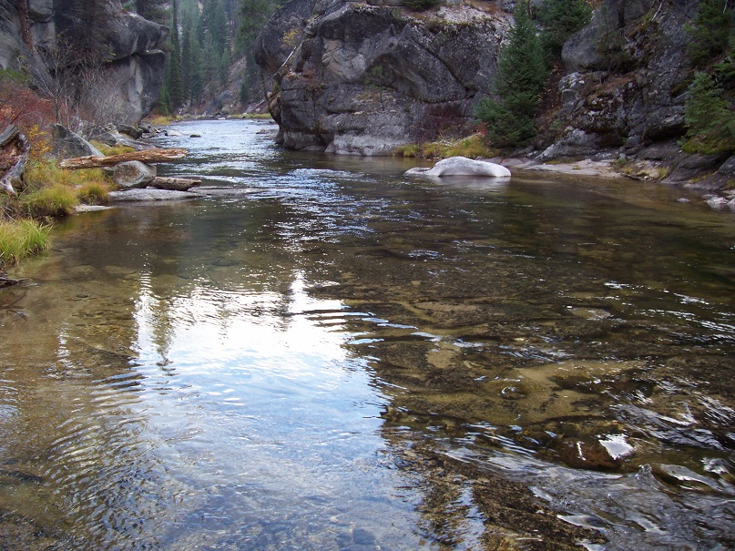
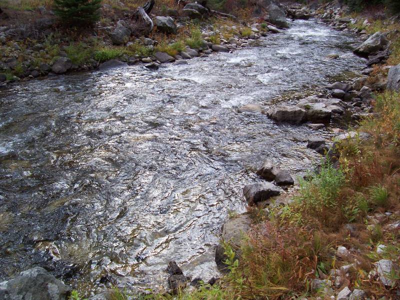
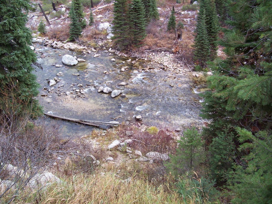
These following mining claims are positioned on the MF of the Payette River. The MF Payette is the main river that flows into the Payette River north of the Crouch & Garden Valley area, which if you are familiar with that area, is the road going up to Boiling Hot Springs, or Silver Creek Plunge. These claims are approximately 18 to 19 miles north of Crouch, in that beautiful scenic riverway. I could go into all the reasons why mining claims are sought after on the Payette, from the history, historic workings, color, etc. however, I don’t know that I could cover all the highlights and splendor this area has to hold. Yet as I know my words would not cover it all, and fall short, here are the things that stand out the most, which I think you would want me to point out: IDWR calls the MF Payette open to dredging from June 30th to Sept 30th; as illustrated from the pictures and as many prospectors “look for” are great areas of exposed bedrock for sniping and crevicing for gold. Even when it is not “during” the dredging season, other prospecting methods such as crevicing/sniping, along with high-banking, sluicing, metal detecting, panning can all still be conducted. You can see from the samples below (under “Show me the GOLD”) at our methods and what we unearthed. There are full services in Crouch and Garden Valley (which is on the way to these mining claims). I will also mention that Idaho Gold Mining does have other abutting claims, so contact me for more data, and we do offer discounts for multiple claim purchases.
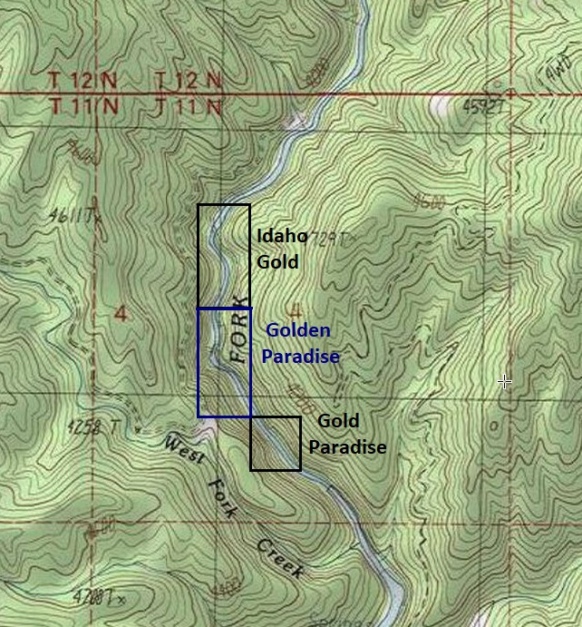
Golden Paradise
Sold
- Acreage: 20 acre unpatented placer claim
- River footage: 1500’ of MF Payette River
- Location: Valley County, Township 11N, Range 5E, Sec. 04, SW ¼
- Mining claim serial #: ID105228352
Map to Claim
Coordinates
Marker Degrees, Minutes, Seconds
NW 44°18’55.6200″N, -115°52’24.4200″W
NE 44°18’55.6200″N, -115°52’16.0680″W
SE 44°18’42.3720″N, -115°52’16.0680″W
SW 44°18’42.3720″N, -115°52’24.4200″W
Marker Latitude & Longitude
NW 44.31545’N, -115.87345’W
NE 44.31545’N, -115.87113’W
SE 44.31177’N, -115.87113’W
SW 44.31177’N, -115.87345’W
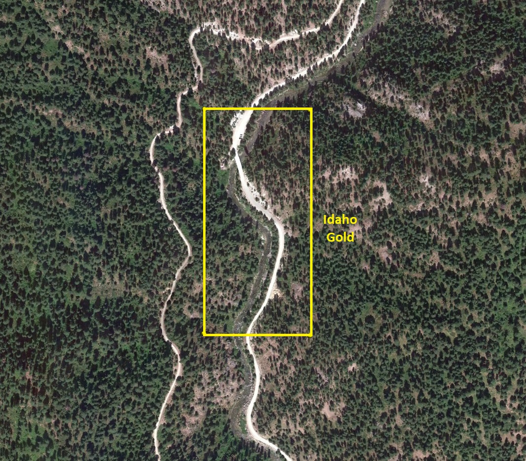
Aerial & Topo Images

Images


**18.7** (distance from driving directions below)
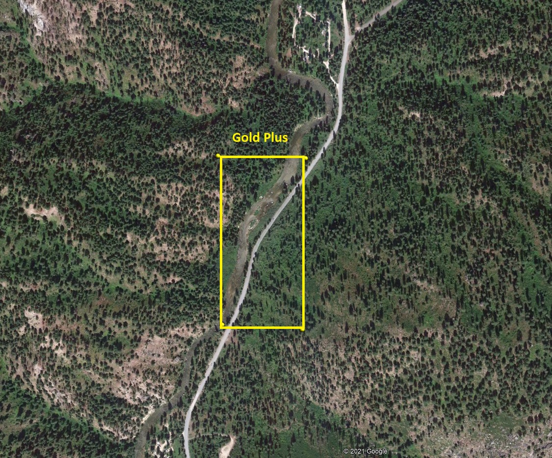
Gold Plus
Sold
- Acreage: 20 acre unpatented placer claim
- River footage: 1500’ of MF Payette River (Pullout on claim, with Rattlesnake Campground 900’ south & Trail Cr Campground 650’ north of claim)
- Location: Valley County, Township 11N, Range 5E, Sec. 21, NW & SW ¼s
- Mining claim serial #: ID105233408
Map to Claim
Coordinates
Marker Degrees, Minutes, Seconds
NW 44°16’25.4640″N, -115°52’41.8800″W
NE 44°16’25.4640″N, -115°52’32.5920″W
SE 44°16’12.2520″N, -115°52’32.5920″W
SW 44°16’12.2520″N, -115°52’41.8800″W
Marker Latitude & Longitude
NW 44.27374’N, -115.87830’W
NE 44.27374’N, -115.87572’W
SE 44.27007’N, -115.87572’W
SW 44.27007’N, -115.87830’W
Aerial & Topo Images

Images


**15.3** (distance from driving directions below)
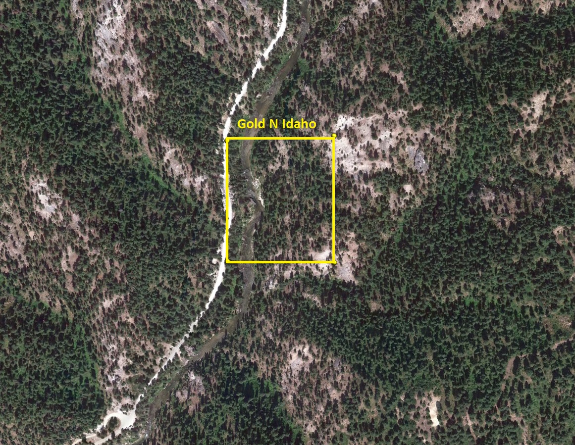
Gold N Idaho
Sold
- Acreage: 10 acre unpatented placer claim
- River footage: 750’ of MF Payette River (Pullout area on claim)
- Location: Valley County, Township 12N, Range 5E, Sec. 33, SE ¼
- Mining claim serial #: ID105233406
Map to Claim
Coordinates
Marker Degrees, Minutes, Seconds
NW 44°19’35.4000″N, -115°51’58.1400″W
NE 44°19’35.4000″N, -115°51’49.3200″W
SE 44°19’28.3440″N, -115°51’49.3200″W
SW 44°19’28.3440″N, -115°51’58.1400″W
Marker Latitude & Longitude
NW 44.32650’N, -115.86615’W
NE 44.32650’N, -115.86370’W
SE 44.32454’N, -115.86370’W
SW 44.32454’N, -115.86615’W
Aerial & Topo Images

Images


**19.8** (distance from driving directions below)
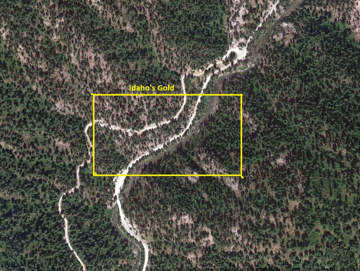
Idaho’s Gold
Sold
- Acreage: 20 acre unpatented placer claim
- River footage: 1100’ of MF Payette River (Large pullout area on claim)
- Location: Valley County, Township 11N, Range 5E, Sec. 04, NW ¼
- Mining claim serial #: ID105228349
Map to Claim
Coordinates
Marker Degrees, Minutes, Seconds
NW 44°19’15.2040″N, -115°52’24.4200″W
NE 44°19’15.2040″N, -115°52’06.7800″W
SE 44°19’08.3280″N, -115°52’06.7800″W
SW 44°19’08.3280″N, -115°52’24.4200″W
Marker Latitude & Longitude
NW 44.32089’N, -115.87345’W
NE 44.32089’N, -115.86855’W
SE 44.31898’N, -115.86855’W
SW 44.31898’N, -115.87345’W
Aerial & Topo Images

Images


**18.9** (distance from driving directions below)
Idaho Golden Waters
Sold
- Acreage: 20 acre unpatented placer claim
- River footage: 850’ of MF Payette River (Pullout with tent camping area on claim)
- Location: Valley County, Township 12N, Range 5E, Sec. 33, SE ¼
- Mining claim serial #: ID105228350
Map to Claim
Coordinates
Marker Degrees, Minutes, Seconds
NW 44°19’28.3440″N, -115°52’06.7800″W
NE 44°19’28.3440″N, -115°51’49.3200″W
SE 44°19’21.8280″N, -115°51’49.3200″W
SW 44°19’21.8280″N, -115°52’06.7800″W
Marker Latitude & Longitude
NW 44.32454’N, -115.86855’W
NE 44.32454’N, -115.86370’W
SE 44.32273’N, -115.86370’W
SW 44.32273’N, -115.86855’W
**19.6** (distance from driving directions below
Aerial & Topo Images


Images


Idaho Gold
Sold
- Acreage: 20 acre unpatented placer claim
- River footage: 1450’ of MF Payette River 1 camping area & large pullout on claim
- Location: Valley County, Township 11N, Range 5E, Sec. 04, NW ¼
- Mining claim serial #: ID105228354
Map to Claim
Coordinates
Marker Degrees, Minutes, Seconds
NW 44°19’08.3280″N, -115°52’24.4200″W
NE 44°19’08.3280″N, -115°52’16.0680″W
SE 44°18’55.6200″N, -115°52’16.0680″W
SW 44°18’55.6200″N, -115°52’24.4200″W
Marker Latitude & Longitude
NW 44.31898’N, -115.87345’W
NE 44.31898’N, -115.87113’W
SE 44.31545’N, -115.87113’W
SW 44.31545’N, -115.87345’W
**18.9** (distance from driving directions below)
Aerial & Topo Images

Images


Idaho Gold Land
Sold
- Acreage: 20 acre unpatented placer claim
- River footage: 1000’ of MF Payette River (1 camping area on claim)
- Location: Valley County, Township 11N, Range 5E, Sec. 04, NE & NW ¼s
- Mining claim serial #: ID105228351
Map to Claim
Coordinates
Marker Degrees, Minutes, Seconds
NW 44°20’52.9800″N, -115°52’16.0680″W
NE 44°20’52.9800″N, -115°51’58.1400″W
SE 44°19’15.2040″N, -115°51’58.1400″W
SW 44°19’15.2040″N, -115°52’16.0680″W
Marker Latitude & Longitude
NW 44.32273’N, -115.87113’W
NE 44.32273’N, -115.86615’W
SE 44.32089’N, -115.86615’W
SW 44.32089’N, -115.87113’W
**19.4** (distance from driving directions below)
Aerial & Topo Images


Images


Golder Paradise
Sold
- Acreage: 10 acre unpatented placer claim
- River footage: 950’ of MF Payette River
- Location: Valley County, Township 11N, Range 5E, Sec. 04, SE ¼
- Mining claim serial #: ID105228353
Map to Claim
Coordinates
Marker Degrees, Minutes, Seconds
NW 44°18’35.7120″N, -115°52’06.6360″W
NE 44°18’35.7120″N, -115°51’57.3840″W
SE 44°18’29.5200″N, -115°51’57.3840″W
SW 44°18’29.5200″N, -115°52’06.6360″W
Marker Latitude & Longitude
NW 44.30992’N, -115.86851’W
NE 44.30992’N, -115.86594’W
SE 44.30820’N, -115.86594’W
SW 44.30820’N, -115.86851’W
**18.3** (distance from driving directions below)
Aerial & Topo Images


Images


Golden Deposit
Sold
- Acreage: 20 acre unpatented placer claim
- River footage: 1150’ of MF Payette River
- Location: Boise County, Township 12N, Range 5E, Sec. 28, NE ¼
- Mining claim serial #: IMC233637
Map to Claim
Coordinates
Marker Degrees, Minutes, Seconds
NW 44°20’52.9800″N, -115°52’06.6360″W
NE 44°20’52.9800″N, -115°51’57.8520″W
SE 44°20’40.4880″N, -115°51’57.8520″W
SW 44°20’40.4880″N, -115°52’06.6360″W
Marker Latitude & Longitude
NW 44.34805’N, -115.86851’W
NE 44.34805’N, -115.86607’W
SE 44.34458’N, -115.86607’W
SW 44.34458’N, -115.86851’W
Aerial & Topo Images


Images


**21.8** (distance from driving directions below)
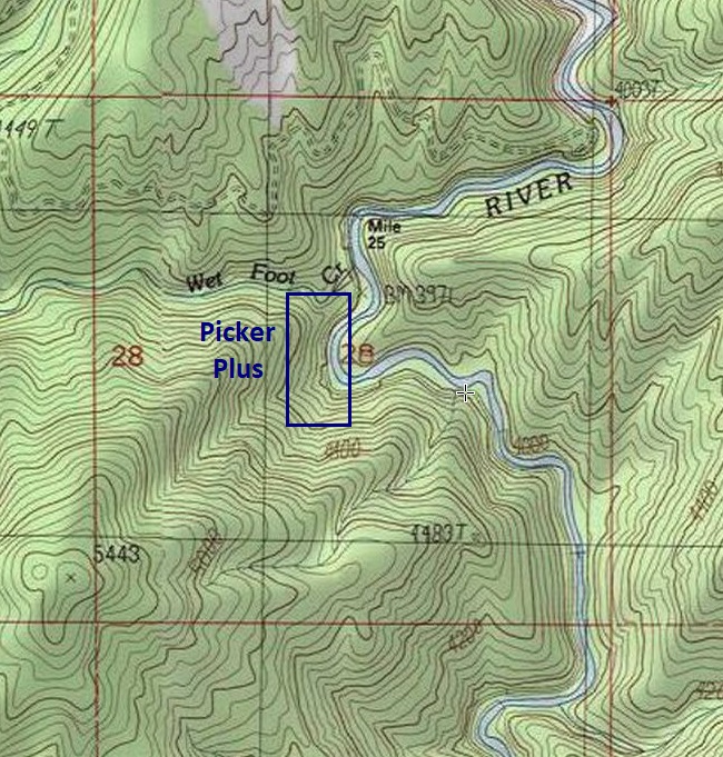
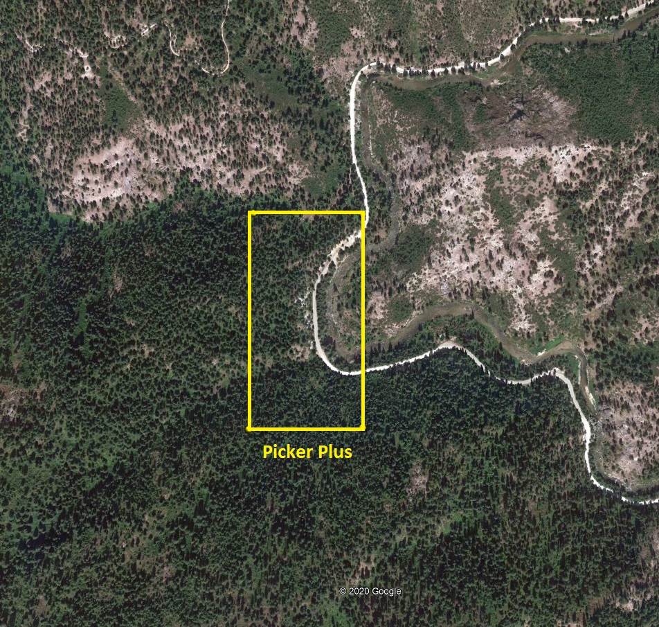
Picker Plus
Sold
- Acreage: 20 acre unpatented placer claim
- River footage: 950’ of MF Payette River (1 camping area on claim)
- Location: Boise County, Township 12N, Range 5E, Sec. 28, NW & SW ¼s
- Mining claim serial #: IMC233633
Map to Claim
Coordinates
Marker Degrees, Minutes, Seconds
NW 44°20’46.7880″N, -115°52’15.9240″W
NE 44°20’46.7880″N, -115°52’06.6360″W
SE 44°20’33.9720″N, -115°52’06.6360″W
SW 44°20’33.9720″N, -115°52’15.9240″W
Marker Latitude & Longitude
NW 44.34633’N, -115.87109’W
NE 44.34633’N, -115.86851’W
SE 44.34277’N, -115.86851’W
SW 44.34277’N, -115.87109’W
**21.6** (distance from driving directions below)
Aerial & Topo Images
Images


Show me the Gold
Dirving Directions from Boise: Take HWY 55 (from State Street aka HWY 44), north out of Boise towards McCall. You will stay on HWY 55 for approximately 30 miles, and make a right onto HWY 17 at Banks (heading towards Garden Valley/Lowman). Continue on HWY 17 for approximately 8.3 miles, turning left (north) on the Middle Fork Rd (signs to Crouch). Stay on this for approximately **(see mining claim details above)** miles until you reach the mining claim(s).
