
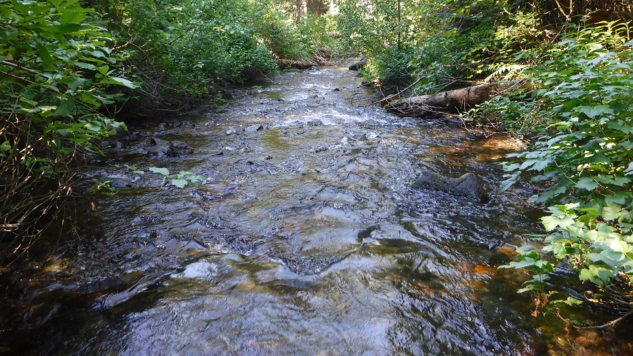
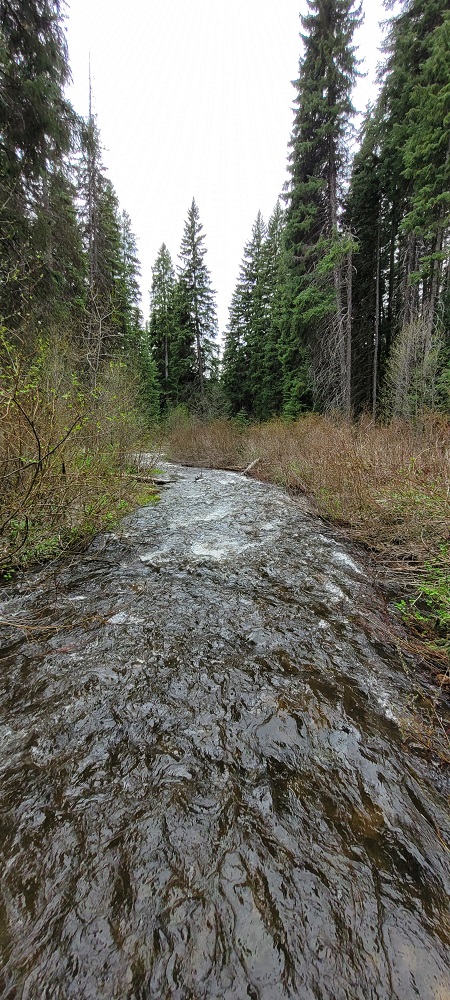
Indian Creek Claims
Cuprum Sold
Check with us directly about availability to adjacent mining claims.
Maps


Overview
Robbers Roost
Sold
- Acreage: 20 acre unpatented placer claim, Several large pullouts
- River footage: 1700’ of Indian Creek
- Location: Adams County, Twn 20N, Rng 3W, Sec. 01, NW ¼ & Sec 02, NE ¼
- Mining claim serial #: ID105748688
Map to Claim
Coordinates
Marker Degrees, Minutes, Seconds
NW 45°06’11.7360″N, -116°39’34.4520″W
NE 45°06’11.7360″N, -116°39’16.5240″W
SE 45°06’05.4000″N, -116°39’16.5240″W
SW 45°06’05.4000″N, -116°39’34.4520″W
Marker Latitude & Longitude
NW 45.10326’N, -116.65957’W
NE 45.10326’N, -116.65459’W
SE 45.10150’N, -116.65459’W
SW 45.10150’N, -116.65957’W
Aerial & Topo Images


Images


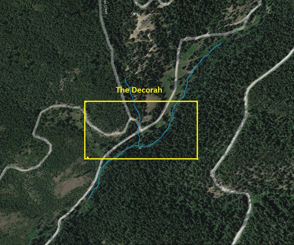
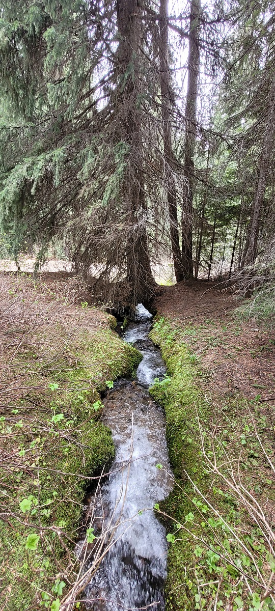
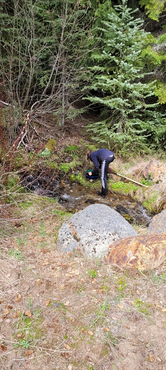
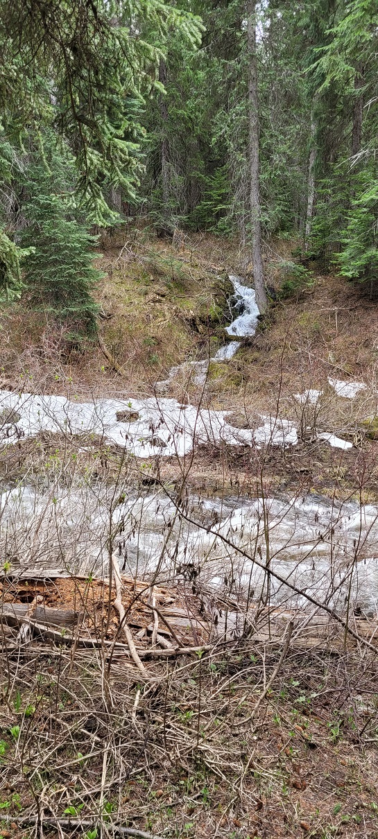
The Decorah
Sold
- Acreage:
- River footage: 1200’ of Indian Creek & 600’ of Garnet Creek (2 large camping areas on claim)
- Location: Adams County, Township 21N, Range 3W, Sec. 36, NE ¼
- Mining claim serial #: ID105748701
Map to Claim
Coordinates
Marker Degrees, Minutes, Seconds
NW 45°06’57.7440″N, -116°38’30.4800″W
NE 45°06’57.7440″N, -116°38’12.4080″W
SE 45°06’51.1920″N, -116°38’12.4080″W
SW 45°06’51.1920″N, -116°38’30.4800″W
Marker Latitude & Longitude
NW 45.11604’N, -116.64180’W
NE 45.11604’N, -116.63678’W
SE 45.11422’N, -116.63678’W
SW 45.11422’N, -116.64180’W
Aerial & Topo Images

Images


Copper Cliff
Sold
- Acreage: 20 acre unpatented placer claim, Large pullout on claim
- River footage: 1150’ of Indian Creek
- Location: Adams County, Twn 20N, Rng 3W, Sec. 02, SW ¼ & Sec 03 SE ¼
- Mining claim serial #: ID105748692
Map to Claim
Coordinates
Marker Degrees, Minutes, Seconds
NW 45°05’39.0120″N, -116°40’49.6920″W
NE 45°05’39.0120″N, -116°40’31.3680″W
SE 45°05’32.2440″N, -116°40’31.3680″W
SW 45°05’32.2440″N, -116°40’49.6920″W
Marker Latitude & Longitude
NW 45.09417’N, -116.68047’W
NE 45.09417’N, -116.67538’W
SE 45.09229’N, -116.67538’W
SW 45.09229’N, -116.68047’W
Aerial & Topo Images


Images


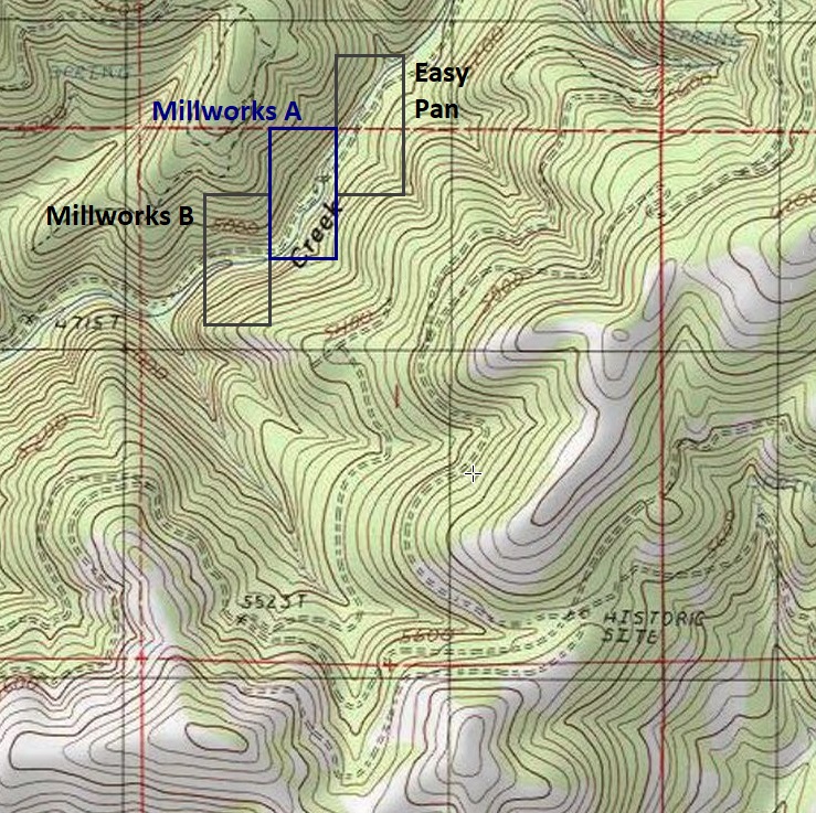
Easy Pickens
Sold
- Acreage: 19.75 acre unpatented placer claim
- River footage: 950’ of Indian Creek
- Location: Adams County, Township 20N, Range 3W, Sec. 10, NE ¼
- Mining claim serial #: ID105748693
Map to Claim
Coordinates
Marker Degrees, Minutes, Seconds
NW 45°05’32.2440″N, -116°40’58.1880″W
NE 45°05’32.2440″N, -116°40’40.8720″W
SE 45°05’25.5840″N, -116°40’40.8720″W
SW 45°05’25.5840″N, -116°40’58.1880″W
Marker Latitude & Longitude
NW 45.09229’N, -116.68283’W
NE 45.09229’N, -116.67802’W
SE 45.09044’N, -116.67802’W
SW 45.09044’N, -116.68283’W
Aerial & Topo Images


Images


Easy Pickens B
Sold
- Acreage: 19.75 acre unpatented placer claim
- River footage: 950’ of Indian Creek
- Location: Adams County, Township 20N, Range 3W, Sec. 10, NE ¼
- Mining claim serial #: ID105748694
Map to Claim
Coordinates
Marker Degrees, Minutes, Seconds
NW 45°05’25.5840″N, -116°41’07.1520″W
NE 45°05’25.5840″N, -116°40’49.6920″W
SE 45°05’19.3920″N, -116°40’49.6920″W
SW 45°05’19.3920″N, -116°41’07.1520″W
Marker Latitude & Longitude
NW 45.09044’N, -116.68532’W
NE 45.09044’N, -116.68047’W
SE 45.08872’N, -116.68047’W
SW 45.08872’N, -116.68532’W
Aerial & Topo Images


Images


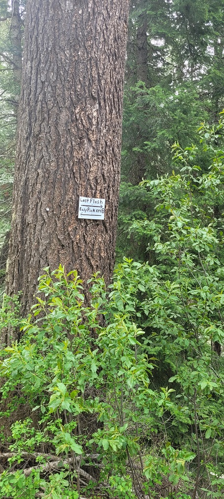


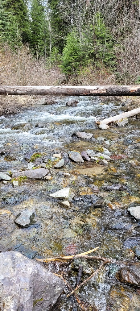
Last Flash
Sold
- Acreage: 20 acre unpatented placer claim
- River footage: 1200’ of Indian Creek
- Location: Adams County, Township 20N, Range 3W, Sec. 10, NE ¼
- Mining claim serial #: ID105748695
Map to Claim
Coordinates
Marker Degrees, Minutes, Seconds
NW 45°05’19.3920″N, -116°41’11.6160″W
NE 45°05’19.3920″N, -116°40’53.5440″W
SE 45°05’12.7320″N, -116°40’53.5440″W
SW 45°05’12.7320″N, -116°41’11.6160″W
Marker Latitude & Longitude
NW 45.08872’N, -116.68656’W
NE 45.08872’N, -116.68154’W
SE 45.08687’N, -116.68154’W
SW 45.08687’N, -116.68656’W
Aerial & Topo Images


Images


Millworks A
Sold
- Acreage: 19.765 acre unpatented placer claim
- River footage: 1450’ of Indian Creek
- Location: Adams County, Township 20N, Range 3W, Sec. 01, NW ¼
- Mining claim serial #: ID105748690
Map to Claim
Coordinates
Marker Degrees, Minutes, Seconds
NW 45°06’24.5880″N, -116°39’07.2720″W
NE 45°06’24.5880″N, -116°38’58.1280″W
SE 45°06’11.7360″N, -116°38’58.1280″W
SW 45°06’11.7360″N, -116°39’07.2720″W
Marker Latitude & Longitude
NW 45.10683’N, -116.65202’W
NE 45.10683’N, -116.64948’W
SE 45.10326’N, -116.64948’W
SW 45.10326’N, -116.65202’W
Aerial & Topo Images

Images


Millworks B
Sold
- Acreage: 20 acre unpatented placer claim, Large pull outs on claim
- River footage: 700’ of Indian Creek
- Location: Adams County, Township 20N, Range 3W, Sec. 01, NW ¼
- Mining claim serial #: ID105748689
Map to Claim
Coordinates
Marker Degrees, Minutes, Seconds
NW 45°06’18.3960″N, -116°39’16.5240″W
NE 45°06’18.3960″N, -116°39’07.2720″W
SE 45°06’05.4000″N, -116°39’07.2720″W
SW 45°06’05.4000″N, -116°39’16.5240″W
Marker Latitude & Longitude
NW 45.10511’N, -116.65459’W
NE 45.10511’N, -116.65202’W
SE 45.10150’N, -116.65202’W
SW 45.10150’N, -116.65459’W
Aerial & Topo Images


Images


Mills End
Sold
- Acreage: 20 acre unpatented placer claim, Large camping area on claim
- River footage: 1000’ of Indian Creek
- Location: Adams County, Township 20N, Range 3W, Sec. 02, NE ¼
- Mining claim serial #: ID105748687
Map to Claim
Coordinates
Marker Degrees, Minutes, Seconds
NW 45°06’11.7360″N, -116°39’44.0280″W
NE 45°06’11.7360″N, -116°39’34.4520″W
SE 45°05’59.1000″N, -116°39’34.4520″W
SW 45°05’59.1000″N, -116°39’44.0280″W
Marker Latitude & Longitude
NW 45.10326’N, -116.66223’W
NE 45.10326’N, -116.65957’W
SE 45.09975’N, -116.65957’W
SW 45.09975’N, -116.66223’W
Aerial & Topo Images


Images


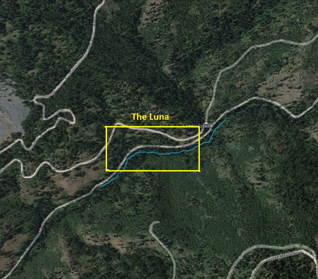
The Luna
Sold
- Acreage: 20 acre unpatented placer claim
- River footage: 1250’ of Indian Creek
- Location: Adams County, Township 20N, Range 3W, Sec. 02, NE ¼
- Mining claim serial #: ID105748686
Map to Claim
Coordinates
Marker Degrees, Minutes, Seconds
NW 45°06’05.4000″N, -116°40’02.8920″W
NE 45°06’05.4000″N, -116°39’44.0280″W
SE 45°05’59.1000″N, -116°39’44.0280″W
SW 45°05’59.1000″N, -116°40’02.8920″W
Marker Latitude & Longitude
NW 45.10150’N, -116.66747’W
NE 45.10150’N, -116.66223’W
SE 45.09975’N, -116.66223’W
SW 45.09975’N, -116.66747’W
Aerial & Topo Images

Luna 2
Sold
- Acreage: 20 acre unpatented placer claim
- River footage: 1150’ of Indian Creek
- Location: Adams County, Township 20N, Range 3W, Sec. 02, SE & SW ¼s
- Mining claim serial #: ID105748685
Map to Claim
Coordinates
arker Degrees, Minutes, Seconds
NW 45°05’59.1000″N, -116°40’12.2880″W
NE 45°05’59.1000″N, -116°39’53.4600″W
SE 45°05’52.4400″N, -116°39’53.4600″W
SW 45°05’52.4400″N, -116°40’12.2880″W
Marker Latitude & Longitude
NW 45.09975’N, -116.67008’W
NE 45.09975’N, -116.66485’W
SE 45.09790’N, -116.66485’W
SW 45.09790’N, -116.67008’W
Aerial & Topo Images


Copper Cliff Gold
Sold
- Acreage: 20 acre unpatented placer claim
- River footage: 1150’ of Indian Creek
- Location: Adams County, Township 20N, Range 3W, Sec. 02, SW ¼
- Mining claim serial #: ID105748684
Map to Claim
Coordinates
Marker Degrees, Minutes, Seconds
NW 45°05’52.4400″N, -116°40’21.8640″W
NE 45°05’52.4400″N, -116°40’12.2880″W
SE 45°05’39.0120″N, -116°40’12.2880″W
SW 45°05’39.0120″N, -116°40’21.8640″W
Marker Latitude & Longitude
NW 45.09790’N, -116.67274’W
NE 45.09790’N, -116.67008’W
SE 45.09417’N, -116.67008’W
SW 45.09417’N, -116.67274’W
Aerial & Topo Images

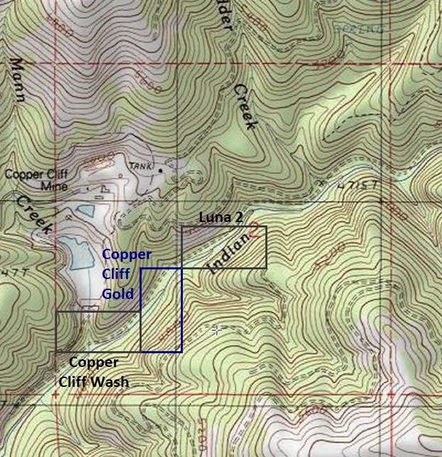
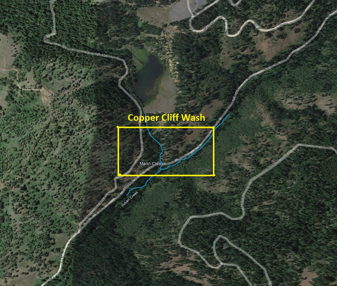
Copper Cliff Wash
Sold
- Acreage: 20 acre unpatented placer claim
- River footage: 1100’ of Indian Creek & 700’ Manns Cr (from mills)
- Location: Adams County, Township 20N, Range 3W, Sec. 02, SW ¼
- Mining claim serial #: ID105748691
Map to Claim
Coordinates
Marker Degrees, Minutes, Seconds
NW 45°05’45.7440″N, -116°40’40.8720″W
NE 45°05’45.7440″N, -116°40’21.8640″W
SE 45°05’39.0120″N, -116°40’21.8640″W
SW 45°05’39.0120″N, -116°40’40.8720″W
Marker Latitude & Longitude
NW 45.09604’N, -116.67802’W
NE 45.09604’N, -116.67274’W
SE 45.09417’N, -116.67274’W
SW 45.09417’N, -116.67802’W
Aerial & Topo Images

Show Me The Gold
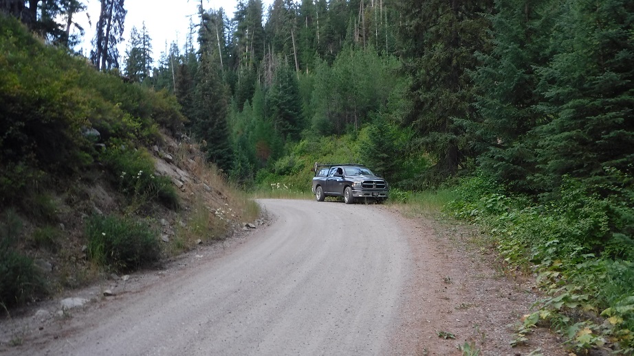
Driving Directions: From Boise, head west on I-84, get off the freeway at Exit 3 (Fruitland/Payette). Make a right onto US-95, and stay on US-95 for 71.4 miles to Council. In Council, make a left at the Shell station onto Michigan St. for 0.5 of
a mile, make a left onto Moser Ave. Take Moser Ave for about two blocks and make a right onto Railroad St. and follow this for about 0.3 of a mile making a right onto Hornet Creek St. In about a block turn left onto the Council Cuprum Rd. which is also known as NF 002. You will stay on this for approximately 37 miles until you reach the mining claims. The claims start abutting and upstream of Cuprum and extend up for the next 2.5 miles.
Google Maps (typing in Boise to Cuprum) will have you turn left at Cambridge and go through Oxbow, Oregon to reach the Cuprum. I would highly advise against this, as it is a rougher and steeper road going this way into the claims, while the NF 002 is a wide 2 lane well graveled and maintained road.
