Idaho City Claims
Idaho City Sold
Overview
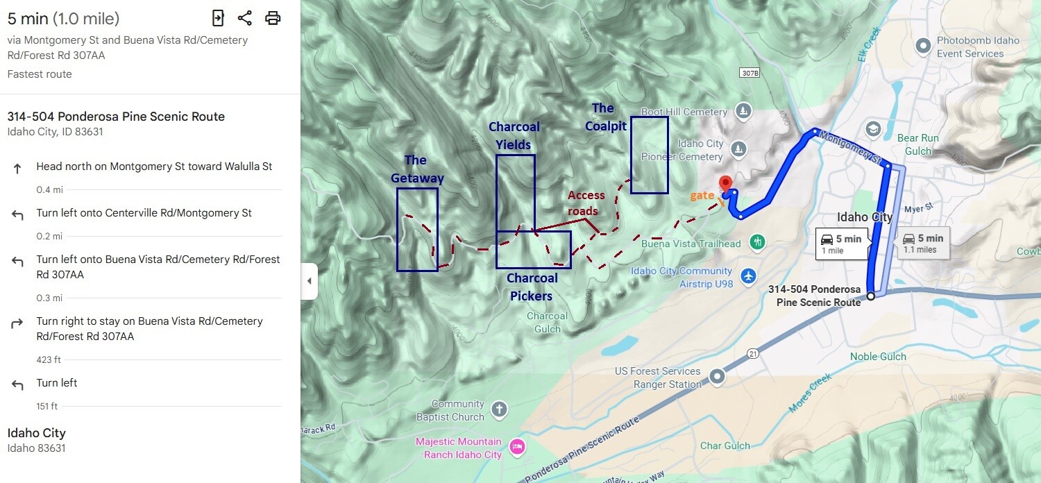
These 4 mining claims are what I would consider the “deal of the year” (or even the century), as these are my own personal inventory of mining claims which I have played on (a day here or there), that I hadn’t necessarily planned on selling. However, as the annual assessments are coming up again this year to renew them and already owing tens of thousands, I thought I would try and liquidate some of these claims that I just haven’t have the time to be working properly. Some of the highlights about these claims; 1) they reside next to Idaho City (within a mile), 2) all 4 are “on” BLM lands (easy to get plans approved), 3) if you have heard my opinions about small drainages, I prefer them as it doesn’t take much work to get down to some good viable material, so less work for better gains. While this is a gated area (another HUGE benefit), BLM hasn’t been able to locate the gate code for me yet (which just needs more prying)…so while a mining claim owner can use that road for vehicle access, more research needs to be done (for the gate code) to get an ATV or equipment back in on them. The drawbacks, Coalpit Gulch only runs for about a month in the spring, while Charcoal and McIntyre have water through them later in the mining season, it is down to a trickle most of the year, so better to work from April through June. On Coalpit for example, I have pulled buckets worth of concentrates and processed them at home, so perhaps a dry-banker could be explored in the summer on this claim, but seeing the gold content, it would be well worth it either way. I do not have pictures of the access road or on the sites, as again, I hadn’t “planned” on selling these, but I did keep pictures of the gold collected from each tributary (see below). For these SUPER low prices, I don’t plan on getting pictures of the claims…otherwise I would be listing these claims for significantly higher based on my own professional opinion about how good these are. I will also “consider” selling these claims after 9/1/2025, however, as my company has to pay an additional $200 per claim, the claims will be priced accordingly to cover these additional costs (while as a small miner, you would only have to pay $15 per claim before 9/1/25).
Will offer a bundle deal of $2,000 for all 4 mining claims
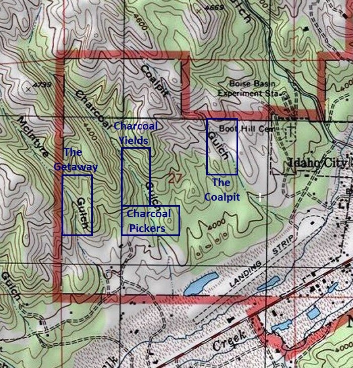
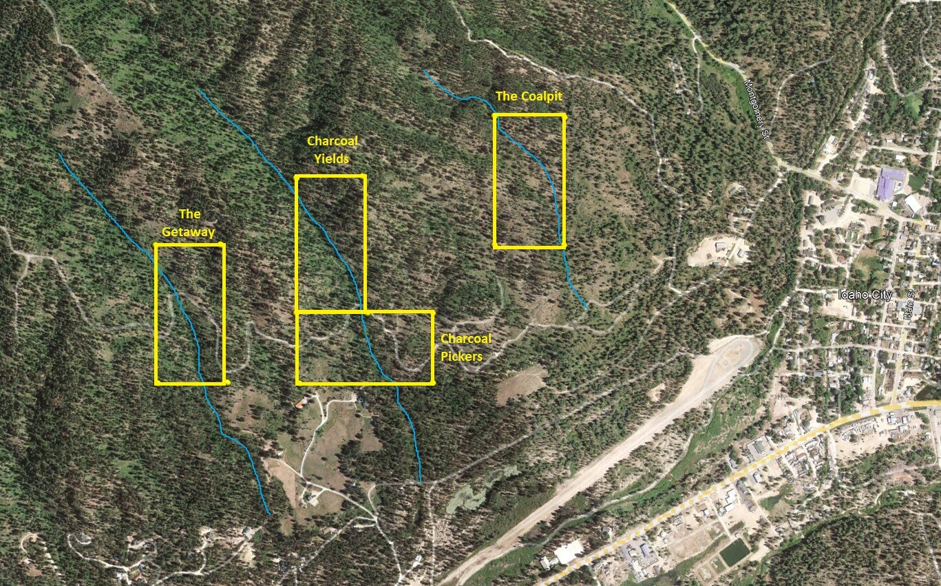
Charcoal Pickers
Sold
- Acreage: 20 acre unpatented placer claim
- River footage: 450’ of Charcoal Gulch
- Location: Boise County, Township 6N, Range 5E, Sec. 27, SW ¼
- Mining claim serial #: ID105825563
Map to Claim
Coordinates
Marker Degrees, Minutes, Seconds
NW 43°49’40.8360″N, -115°51’21.2040″W
NE 43°49’40.8360″N, -115°51’03.4560″W
SE 43°49’34.0320″N, -115°51’03.4560″W
SW 43°49’34.0320″N, -115°51’21.2040″W
Marker Latitude & Longitude
NW 43.82801’N, -115.85589’W
NE 43.82801’N, -115.85096’W
SE 43.82612’N, -115.85096’W
SW 43.82612’N, -115.85589’W
Charcoal Yields
Sold
- Acreage: 20 acre unpatented placer claim
- River footage: 1,350’ of Charcoal Gulch
- Location: Boise County, Township 6N, Range 5E, Sec. 27, SW & NW ¼s
- Mining claim serial #: ID105825564
Map to Claim
Coordinates
Marker Degrees, Minutes, Seconds
NW 43°49’53.6520″N, -115°51’21.2040″W
NE 43°49’53.6520″N, -115°51’12.2400″W
SE 43°49’40.8360″N, -115°51’12.2400″W
SW 43°49’40.8360″N, -115°51’21.2040″W
Marker Latitude & Longitude
NW 43.83157’N, -115.85589’W
NE 43.83157’N, -115.85340’W
SE 43.82801’N, -115.85340’W
SW 43.82801’N, -115.85589’W
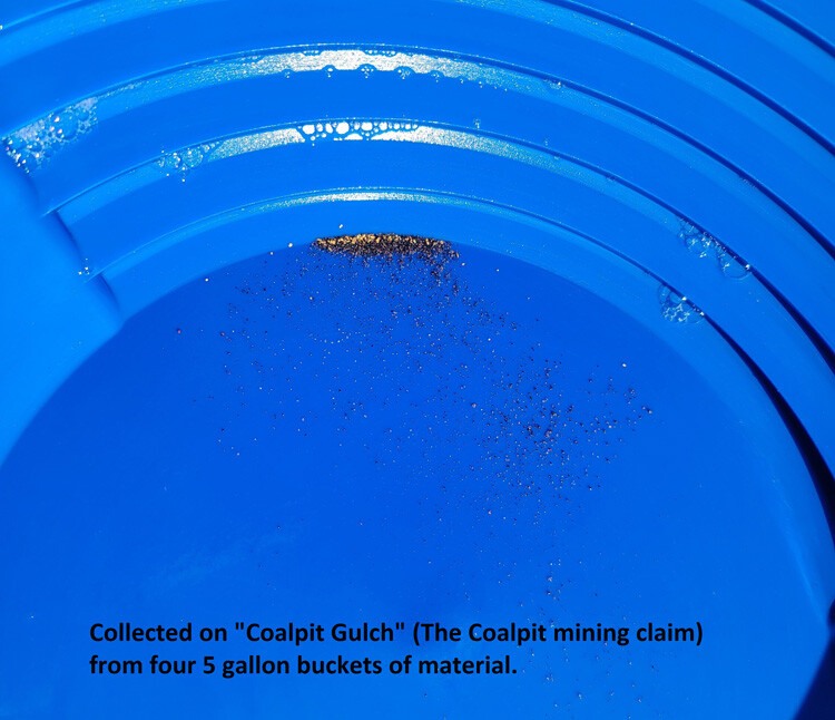
The Coalpit
Sold
- Acreage: 20 acre unpatented placer claim
- River footage: 1550’ of Coalpit Gulch
- Location: Boise County, Township 6N, Range 5E, Sec. 27, NE ¼
- Mining claim serial #: ID105825565
Map to Claim
Coordinates
Marker Degrees, Minutes, Seconds
NW 43°49’59.6640″N, -115°50’55.1040″W
NE 43°49’59.6640″N, -115°50’45.7800″W
SE 43°49’47.4240″N, -115°50’45.7800″W
SW 43°49’47.4240″N, -115°50’55.1040″W
Marker Latitude & Longitude
NW 43.83324’N, -115.84864’W
NE 43.83324’N, -115.84605’W
SE 43.82984’N, -115.84605’W
SW 43.82984’N, -115.84864’W
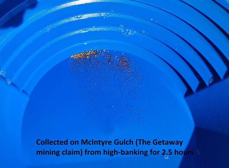
The Getaway
Sold
- Acreage: 20 acre unpatented placer claim
- River footage: 1400’ of McIntyre Gulch
- Location: Boise County, Township 6N, Range 5E, Sec. 27, SW ¼
- Mining claim serial #: ID105825566
Map to Claim
Coordinates
Marker Degrees, Minutes, Seconds
NW 43°49’47.2440″N, -115°51’39.3120″W
NE 43°49’47.2440″N, -115°51’30.4920″W
SE 43°49’34.2120″N, -115°51’30.4920″W
SW 43°49’34.2120″N, -115°51’39.3120″W
Marker Latitude & Longitude
NW 43.82979’N, -115.86092’W
NE 43.82979’N, -115.85847’W
SE 43.82617’N, -115.85847’W
SW 43.82617’N, -115.86092’W
SHOW ME THE GOLD
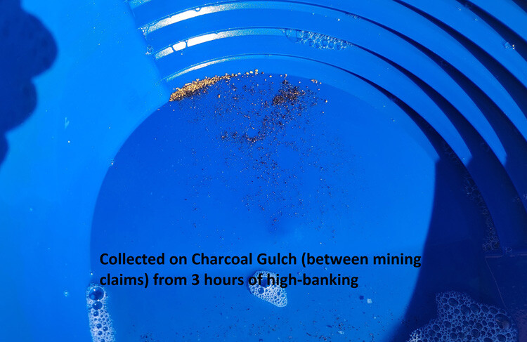
These following pictures were from basic prospecting of these gold bearing tributaries. There are suds in the pictures, which is common, as I use jet-dry in the final cleanup process. Gold scanned from these collections were ranging between 80%-84% (around 20 karats) pure…which is considered a high concentration.
Driving Directions: These claims are “physically” located within a mile or on the outskirts of Idaho City. From Boise, travel north on HWY 21 to Idaho City (approximately 34 miles from I-84). Turn left (north) onto either Montgomery Street or Main Street in Idaho City. In 0.4 of a mile make a left on the Centerville Road. Stay on this road for about 0.2 of a mile making a left on the Buena Vista Rd. (aka FS 307AA), which is also the access to Boot Hill & Pioneer Cemetery. At approximately 0.4 of a mile you will make a left (just before reaching the cemetery). In a couple hundred feet, you will come to a gate and large parking area. The mining claims are located back in on this access road.