Grimes Revenge
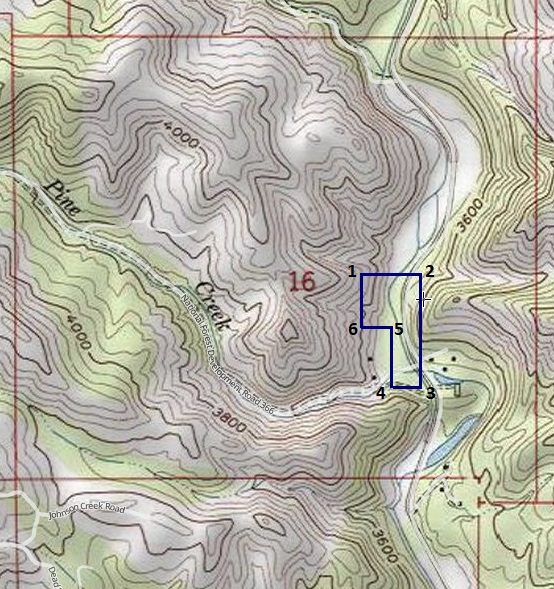
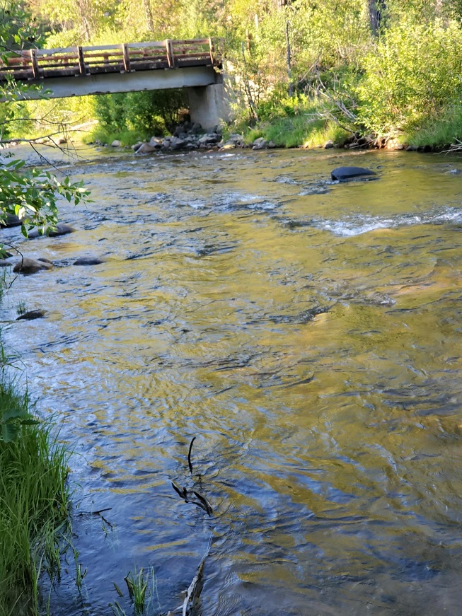
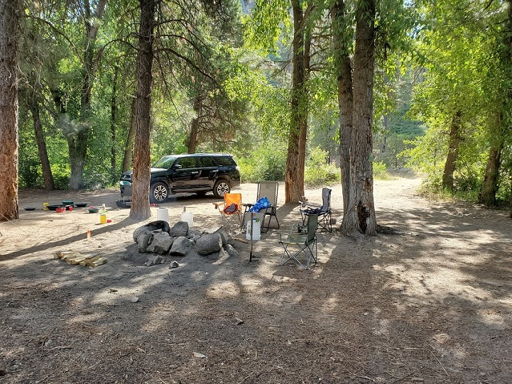
This amazing 15 acre placer mining claim, is located on the lower portion of the historic Grimes Creek, within the area that is open to dredging year-round. The site has easy access (even by car), with a nice creekside camping area right “on” the claim, large enough for RVs, or other camping adjacent on the south side of the claim. There is a bridge on the south side of the claim, for easy access to either side of the river. Even with this being 15 acres, there is over 1300 feet of creek to work on the claim, with lots of bench to also explore. This is a short 30-40 minute drive from Boise, located about 3.5 miles up Grimes Creek road (from HWY 21). Lots of color to be had on this site, just see the results from a day of putting a dredge in the water.
- Acreage: 15 acres
- River footage: 1300’ Grimes Creek
- Placer/lode: placer
- Location: Boise County, Township 5N, Range 4E, Sec.16, SE ¼
- Mining claim serial #: IMC229152
Map to Claim
Coordinates
NW 43.76922’N, -115.98194’W
NE 43.76922’N, -115.97949’W
SE 43.76559’N, -115.97949’W
43.76559’N, -115.98056’W
43.76745’N, -115.98056’W
43.76745’N, -115.98194’W
NW 43°46’09.1920″N, -115°58’54.9840″W
NE 43°46’09.1920″N, -115°58’46.1640″W
SE 43°45’56.1240″N, -115°58’46.1640″W
43°45’56.1240″N, -115°58’50.0160″W
43°46’02.8200″N, -115°58’50.0160″W
43°46’02.8200″N, -115°58’54.9840″W
Maps

Images


Overview
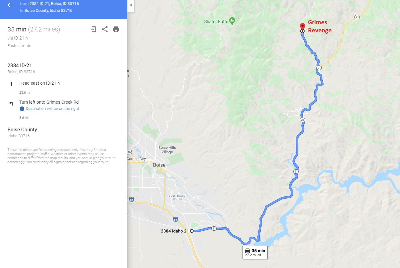
Driving Directions: The claim is located about 3.5 miles up Grimes Creek Road (starts about 100’ upstream of the Pine Cr Rd, aka NF 366 bridge). Driving directions to the claim: from Boise, travel north on HWY 21 towards Idaho City for approximately 23.6 miles (close to MM 29), turning left (northwest) onto Grimes Creek Rd. Stay on this road for about 3.5 miles, until you see the Pine Creek Rd., in about 100’ (still up Grimes Cr Rd) the mining claim is on the left for the next ¼ mile.
Driving Map: