
Crooked River
Crooked River Sold
Overview
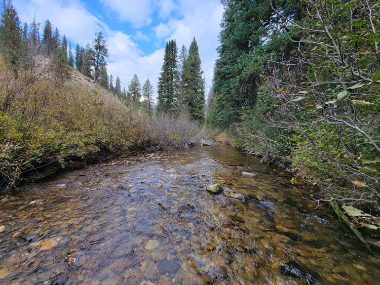
All 9 of these mining claims are located “on” the Crooked River. With the amount of history that this drainage already has, from the dozens of mining claims we have listed over the years, not much more really needs said. If you have talked to me in person, where I have shared stories about clients I have sold mining claims to finding ounces of gold just metal detecting on a weekend, it was from this portion of the river. These pictures where taken in the fall, so as you can see, there is ample year-round water, with a well graded road going across ALL of these mining claims. A couple of these have some very nice existing camping areas on them, but I also took pictures of flat areas next to the road on a couple claims, as it appears that in some areas camping spots could easily be established. You can also read more about the “Crooked River”, but clicking directly on the highlighted “Crooked River” region name.
We will offer bundle offers of $250 off each additional mining claim.


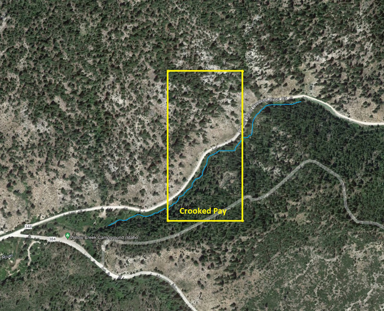
Crooked Pay
Sold
- Acreage: 20 acre unpatented placer claim
- River footage: 900‘ of Crooked River - Camping area adjacent to claim
- Location: Boise County, Township 7N, Range 8E, Sec. 09, NW ¼
- Mining claim serial #: ID106320687
Map to Claim
Coordinates
Marker Degrees, Minutes, Seconds
NW 43°57’47.9160”N, -115°31’39.1800″W
NE 43°57’47.9160”N, -115°31’30.2160″W
SE 43°57’34.8840”N, -115°31’30.2160″W
SW 43°57’34.8840”N, -115°31’39.1800″W
Marker Latitude & Longitude
NW 43.96331°N, -115.52755°W
NE 43.96331°N, -115.52506°W
SE 43.95969°N, -115.52506°W
SW 43.95969°N, -115.52755°W
Aerial & Topo Images
Images


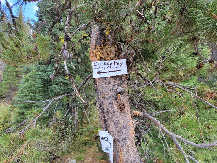


Show Me The Gold
Driving Directions: The claims are located 23 miles outside the historic town of Idaho City. Driving directions to the claims: from Boise, travel north on HWY 21 to approximately 18 miles past Idaho City to the Jackson Peak Lookout turnout (Edna Creek Campground is at this junction). Turn right (east) on Crooked River Road (NF 384) for approximately 6.2 miles. Turn left (north east) at the Willow Creek Campground junction onto NF 348. You will stay on this road for 0.2 of a mile until you reach the mining claims. The mining claims extend up Pikes Fork for an additional 2 miles. There are markers along the road showing the boundaries between the mining claims.
