Crooked River
Sold
Overview
About The Area
Multiple claim purchases will also have a $500+ discount applied (higher discounts for more claims).
Down & Dirty
Sold
- Acreage: 20 acre unpatented placer claim
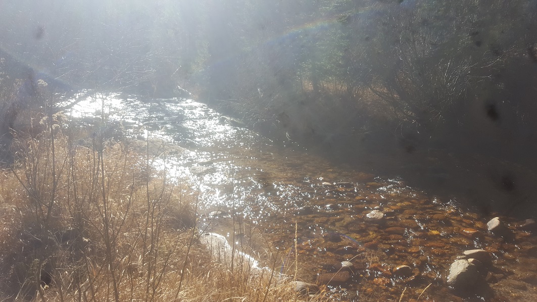
- River footage: 950’ of Crooked River, camping area on claim
- Location: Boise County, Township 7N, Range 8E, Sec. 08 NW ¼
- Mining claim serial #: ID105806735
Map to Claim
Coordinates
Marker Degrees, Minutes, Seconds
NW 43°57’41.3280″N, -115°32’23.5320″W
NE 43°57’41.3280″N, -115°32’14.5680″W
SE 43°57’28.8720″N, -115°32’14.5680″W
SW 43°57’28.8720″N, -115°32’23.5320″W
Marker Latitude & Longitude
NW 43.961480’N, -115.539870’W
NE 43.961480’N, -115.537380’W
SE 43.958020’N, -115.537380’W
SW 43.958020’N, -115.539870’W
Aerial & Topo Images


Images


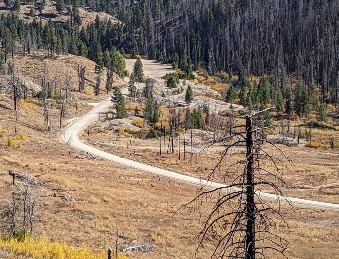
Driving Directions: The claim is located 22 miles outside the historic town of Idaho City. Driving directions to the claim: from Boise, travel north on HWY 21 to approximately 18 miles past Idaho City to the Jackson Peak Lookout turnout (Edna Creek Campground is at this junction). Turn right (east) on Crooked River Road (NF 384) for approximately 5.3 miles to the claim. Markers (as seen in the pictures) have been posted along the road identifying the east and west boundaries.
Banner Finds
Sold
- Acreage: 20 acre unpatented placer mining claim
- River footage: 1350’ of Banner Cr. - Camping NE side of claim
- Location: Boise County, Township 7N, Range 8E, Sec. 06 NE ¼
- Mining claim serial #: ID105806737
Map to Claim
Coordinates
Corner Minutes & Seconds
NW 43°58’39.2880”N, -115°33’25.6320”W
NE 43°58’39.2880”N, -115°33’08.0280”W
SE 43°58’32.5920”N, -115°33’08.0280”W
SW 43°58’32.5920”N, -115°33’25.6320”W
Marker Latidude / Longitude
NW 43.9775800°N, -115.5571200°W
NE 43.9775800°N, -115.5522300°W
SE 43.9757200°N, -115.5522300°W
SW 43.9757200°N, -115.5571200°W
Aerial & Topo Images


Golden Bear
Sold
- Acreage: 20 acre unpatented placer mining claim
- River footage: 1300’ of Crooked River - Large Camping area west side of claim
- Location: Boise County, Township 7N, Range 8E, Sec. 06 SW ¼
- Mining claim serial #: ID105806738
Map to Claim
Coordinates
Corner Minutes & Seconds
NW 43°58’14.0520”N, -115°33’35.0640”W
NE 43°58’14.0520”N, -115°33’26.1000”W
SE 43°58’01.1280”N, -115°33’26.1000”W
SW 43°58’01.1280”N, -115°33’35.0640”W
Marker Latidude / Longitude
NW 43.970570°N, -115.559740°W
NE 43.970570°N, -115.557250°W
SE 43.966980°N, -115.557250°W
SW 43.966980°N, -115.559740°W
Aerial & Topo Images


Banner Tailings
Sold
- Acreage: 20 acre unpatented placer mining claim
- River footage: 1000’ of Banner Cr. - Several camping & access both sides of creek
- Location: Boise County, Township 7N, Range 8E, Sec. 06 NE ¼
- Mining claim serial #: ID105806736
Map to Claim
Coordinates
Corner Minutes & Seconds
NW 43°58’46.0560”N, -115°33’08.0280”W
NE 43°58’46.0560”N, -115°32’50.2440”W
SE 43°58’39.2880”N, -115°32’50.2440”W
SW 43°58’39.2880”N, -115°33’08.0280”W
Marker Latidude / Longitude
NW 43.9794600°N, -115.5522300°W
NE 43.9794600°N, -115.5472900°W
SE 43.9775800°N, -115.5472900°W
SW 43.9775800°N, -115.5522300°W
Aerial & Topo Images


Golden Cup
Sold
- Acreage: 20 acre unpatented placer mining claim
- River footage: 1000’ of the Crooked River & 350’ of Banner Cr. - Large Camping area west side of claim
- Location: Boise County, Township 7N, Range 8E, Sec. 06 SW ¼
- Mining claim serial #: ID105806739
Map to Claim
Coordinates
Corner Minutes & Seconds
NW 43°58’20.3880”N, -115°33’43.9920”W
NE 43°58’20.3880”N, -115°33’26.1000”W
SE 43°58’14.0520”N, -115°33’26.1000”W
SW 43°58’14.0520”N, -115°33’43.9920”W
Marker Latidude / Longitude
NW 43.972330°N, -115.562220°W
NE 43.972330°N, -115.557250°W
SE 43.970570°N, -115.557250°W
SW 43.970570°N, -115.562220°W
Aerial & Topo Images


Images


Show Me The Gold
Driving Directions: Vehicle access to the claim is via a hard-pack dirt road which you can drive virtually up to the riverside. I’ve seen cars access the area as it is a maintained forest service road. The claim is located 22 miles outside the historic town of Idaho City. Driving directions to the claim: from Boise, travel north on HWY 21 to approximately 18 miles past Idaho City to the Jackson Peak Lookout turnout (Edna Creek Campground is at this junction). Turn right (east) on Crooked River Road (NF 384) for approximately 4 miles until you reach the claims (just past the Jackson Peak turnoff junction).
For Banner Finds & Banner Tailings, turn left (north) at the Jackson Peak turnoff onto NF 312. You will stay on this road for 0.5 mile until you reach the claims.