Commercial Placer Gold Op
Overview
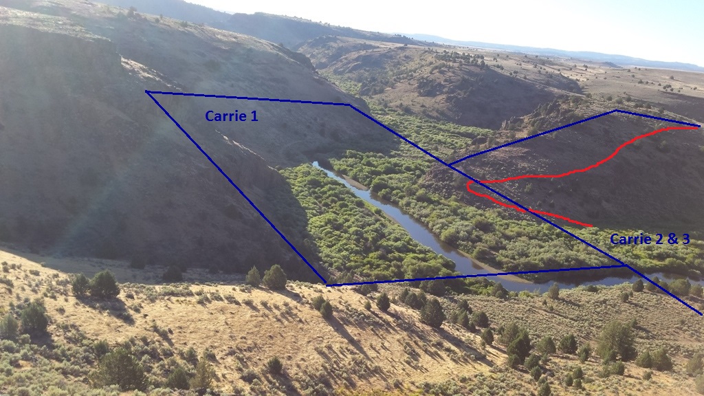
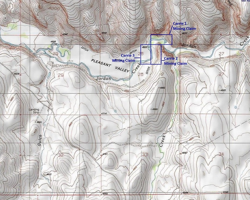
Carrie 1-3
$17,500 for 60 acre commercial midscale placer operation with plan(s) & equipment.
Idaho Gold Mining is excited to offer this 60 acre commercial size gold mining operation site, on historic gold bearing Jordan Creek for the serious gold miner looking for virgin gold bearing ground to work. Once this offer of a lifetime is gone, don’t expect another like it anytime soon. If you’re in the market for a plot to set up operations, jump on it now!
Straight to the facts;
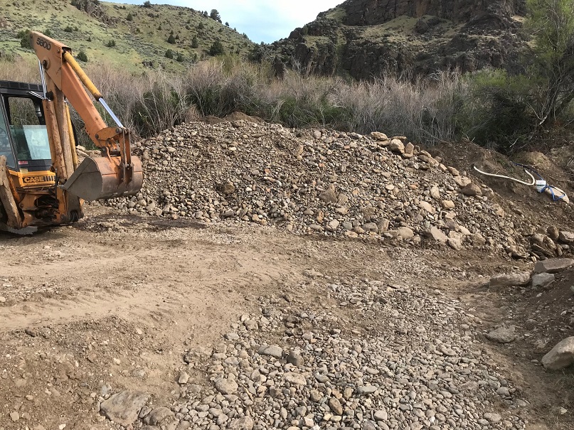
~ Approved exploratory plan (with $5,100 bond), allowing the new owner to start work immediately, under the conditions of the current plan, which is approved for up to 15k lb backhoe, 10k lb. excavator, D4 Dozer 20k lb, trommel, shaker, washplant & supporting pickup trucks, pumps & generators. This plan can be amended to increase work (up to 5 acres disturbance) area or modify the equipment used.
~ Full Plan of Operation has been submitted, pending approval, which is expected in the spring 2019 for 40k lb excavator, 20k lb loader and compatible wash plant/trommel. Along with occupancy, including a wall tent and light camp trailer. This plan can be easily amended to curtail to your operational needs.
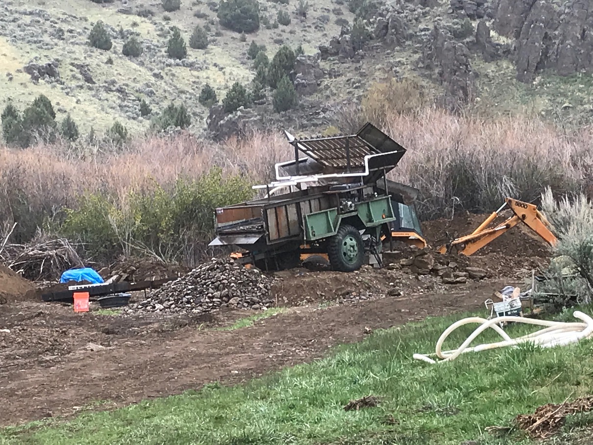
~ Shaker Wash Plant included & on site – capacity of 15 to 20 yph, 6” grizzly (no sluices), see the green machine from the pictures.
~ Ample year round water, which has been approved for annual temporary water right use permit.
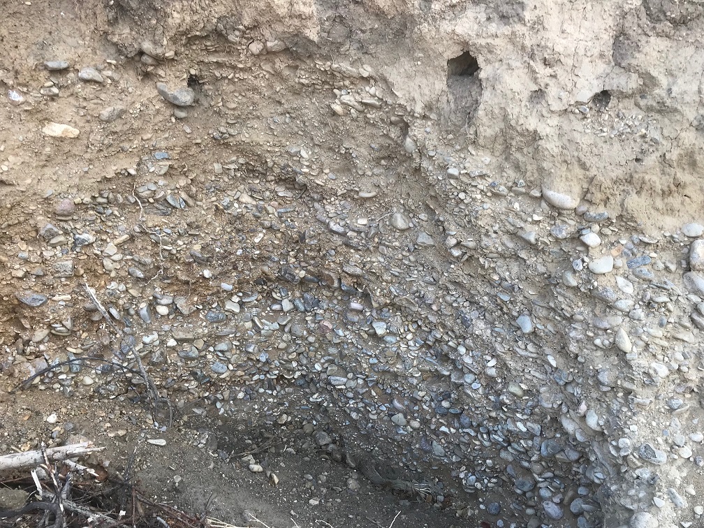
~ Bedrock found at 27 feet deep, in one 50’ x 50’ test hole, giving ample material on the claims to process. 3 smaller 10’ x 10’ shallower (approximately 12’ depth) test pits did not reach bedrock. Only a total of 2,800 SF (0.064 of an acre) was disturbed from sampling test runs (one acre is 43,560 SF). All material from test pits were native & natural deposits in various stratum, verifying that this area is virgin.
~ Gated (with lock) access road into this mining operation, which is part of the exploratory plan, giving owner personal onsite security.
~ Creek was sampled with high banker only 2 feet down finding good color with some amalgam. Skim bars are pretty rich with bigger flood gold (flake).
~ During the sample test runs, many various gemstones were collected that are present onsite, illustrated in the pictures…see below, under “show me the gold”.

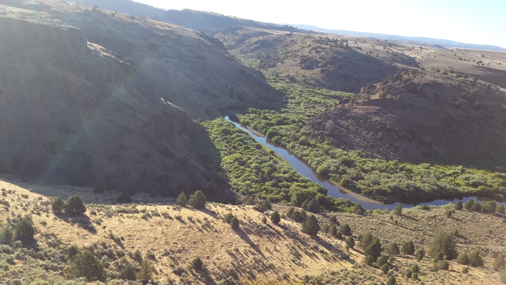


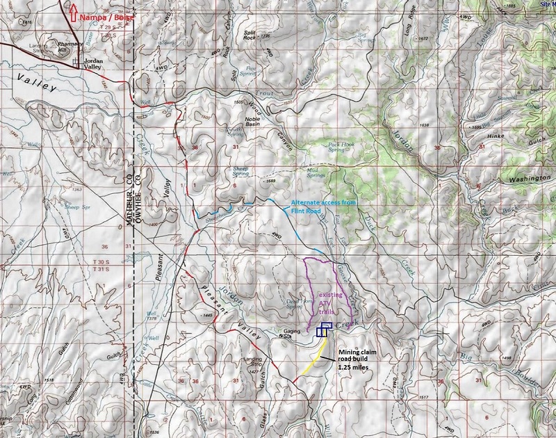
My company is often asked if I have more of a true mid-scale operation with approved mining plan…“backhoe friendly” area… or any good mining claims on historic Jordan Creek. With the well known history of the gold in the Owyhees, and the ease it is to work BLM mining claims, these types of claims are highly sought after. These mining claims are located within the canyon, which is narrower and a bit more remote. But there is a road that was installed as part of this operation that accesses the mining claims. With the remote nature of the claims, there is some comfort in the security of the sites, peaceful serenity, and knowing that the site hasn’t been worked over. Accessing these sites would be from Jordan Valley, see the driving directions below. This area is accessible in early spring when other areas tend to still be snowed in, as they are lower in elevation. Dirt roads passes over 4900’ elevation, operation & claims are at 4500’ elevation.
While many look at Jordan Creek for the rich deposits from the Silver City and De Lamar operations, this lower portion also has collections from the Flint mining district (from Flint Creek to the NE) and South Mountain (from Boulder & Williams Creeks to the SE) as well. The IDWR does call Jordan Creek open for dredging year round. While the claims have ample river on the claims, with great returns, due to the more remote nature of the claims.
*** Both the exploratory plan and Plan of Operation can be transferred to buyer through a change of operator agreement. We will gladly assist you through this process.
*** Owner is only selling as the start up capital for the POO is unobtainable with his budget.
*** Surety bonds are accepted (instead of upfront hard cash) to cover the bond costs, which is roughly 10% of the total bond cost. We will gladly assist you through this process.
*** We can also assist you in submitting the annual Temporary Water Use Permit for the 2019 mining season.
*** Additional information available upon serious request only; ie; approved exploratory plan, submitted plan of operation, gate code, recovery rate chart.


- Acreage: 60 acres
- River footage: 3000+ feet of Jordan Creek total
- Placer/lode: placer
- Unpatented/patented: unpatented
- Location: Twn. 6S, Rng. 5W Sec 28
- Mining claim serial #: Carrie 1 (IMC216111) | Carrie 2 (IMC216112) | Carrie 3 (IMC216113)
Coordinates
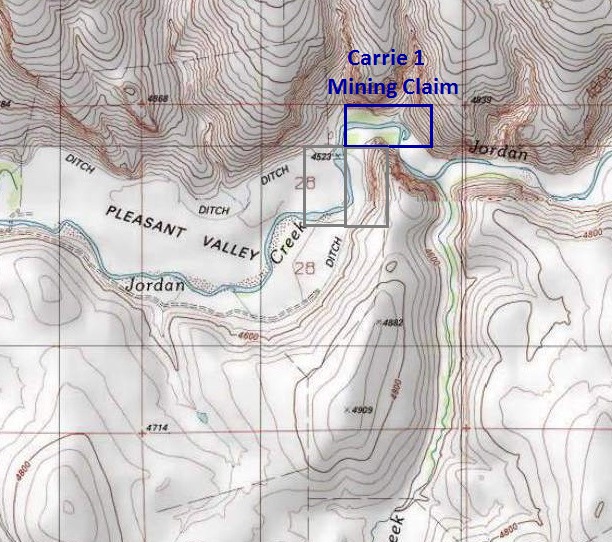
Carrie 1 – 20 acres (IMC216111)
NW Corner 42°52’44.8572”N, -116°56’04.6061”W
NE Corner 42°52’44.8572”N, -116°55’45.6364”W
SE Corner 42°52’38.6510”N, -116°55’45.6364”W
SW Corner 42°52’38.6510”N, -116°56’04.6061”W
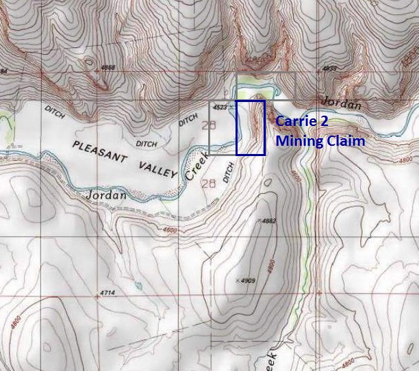
Carrie 2 – 20 acres (IMC216112)
NW Corner 42°52’38.6510”N, -116°56’04.6061”W
NE Corner 42°52’38.6510”N, -116°55’55.9940”W
SE Corner 42°52’25.7811”N, -116°55’55.9940”W
SW Corner 42°52’25.7811”N, -116°56’04.6061”W
Carrie 3 – 20 acres (IMC216113)
NW Corner 42°52’38.6510”N, -116°56’13.2180”W
NE Corner 42°52’38.6510”N, -116°56’04.6061”W
SE Corner 42°52’25.7811”N, -116°56’04.6061”W
SW Corner 42°52’25.7811”N, -116°56’13.2180”W
Wash Plant – As mentioned above, these claims come with the wash plant shown in the pictures.


Driving Directions: From Exit 33A in Nampa, head west on Karcher Rd (name changes to SR-55 just outside Nampa). After 16 miles (past Marsing), turn left (south) on US 95. You will stay on US 95 for approximately 44 miles till you reach Jordan Valley. US 95 takes an abrupt turn west in the center of town, at this turn you will turn left (east) on Yturri Blvd (name changes to Pleasant Valley Rd just outside Jordan Valley). Stay on this road for 8.8 miles, then left on South Mountain Rd. After following this for about 7.2 miles, there will be a dirt access road to the left (southeast), which you will turn on.
Mine access road – constructed, tying in to an existing public access road approximately 1750’ northeast of Pleasant Valley Road (aka South Mountain Rd.) located in the NW SW NW of Sec. 33, Twn. 6S, Rng. 5W, B.M., at an elevation of 4741’, GPS coordinates 42°51’34.47”N, -116°56’37.88”W. The new two track road continues in a northeasterly direction to the SE NE NE of Sec. 28, Twn. 6S, Rng. 5W, B.M., at an elevation of 4545, GPS coordinates 42°52’37.08”N, -116°56’00.89”W.


Show me the Gold
Let’s start by looking over all of the geological reports for the Jordan Creek drainage, and what has collected to these mining claims.
Furthest upstream, Silver City at War Eagle Mountain & Florida Mountain Range, through De Lamar, Flint District and South Mountain (points labeled on topo map).
Geological reports for areas that encompass & drain to Jordan Creek:
https://pubs.usgs.gov/gf/104/text.pdf
www.idahogeology.org/pub/Pamphlets/P-138.pdf
https://www.idahogeology.org/product/b-11
https://www.idahogeology.org/product/p-161
https://www.idahogeology.org/product/t-83-4
Let the pictures speak for themselves… some nice looking color in the pans, some with a bit of size. Including a lot of amazing looking agates and gems.


