Bullion Gulch Bundle
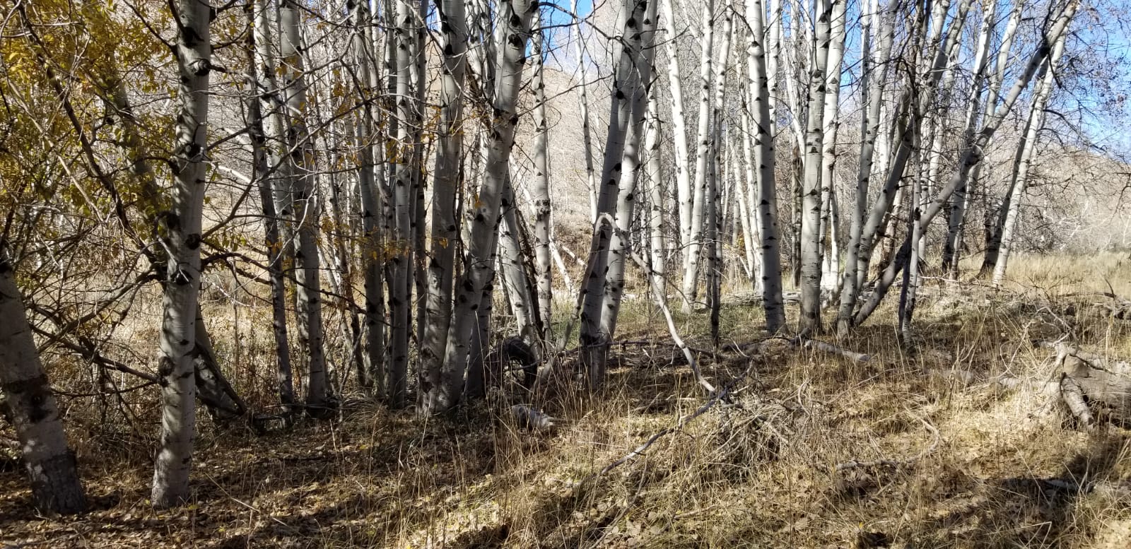
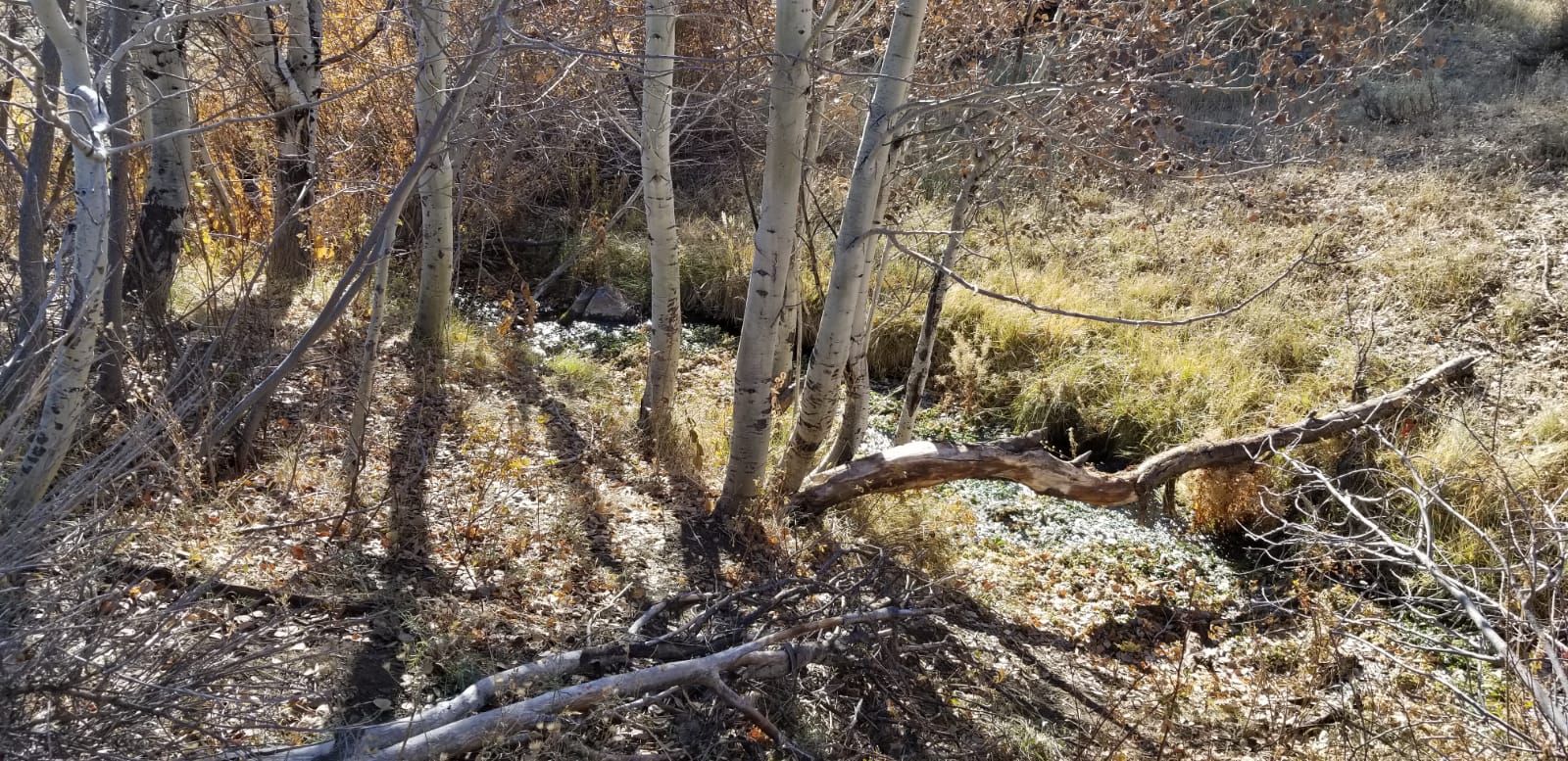
These 3 “Bullion Gulch” mining claims are located in what is known as the “Hailey Gold Belt”. With these claims being about 5.5 miles outside of Hailey, which has full services. Each of these claims have ample areas to park, with hiking trails and easy access to the creek, with low vegetation around the creek, making it easy for high-banker setup to start running. These claims are positioned around older patented mining claims which extend up and down Bullion Creek (as seen from the topo). These claims have good road access which I have seen cars travel on.
Overview
Gold Bullion
Sold
- Acreage: 18.30 acre unpatented placer claim
- River footage: 1300’ of Bullion Creek
- Location: Blaine County, Township 2N, Range 17E, Sec. 23, SE ¼
- Mining claim serial #: IMC232580
Map to Claim
Coordinates
Marker Degrees, Minutes, Seconds
NWW 43°29’14.7480″N, -114°23’18.8880″W
NNW 43°29’17.6640″N, -114°23’15.9360″W
NE 43°29’17.6640″N, -114°23’08.8440″W
SE 43°29’05.3160″N, -114°23’08.8440″W
SW 43°29’05.3160″N, -114°23’18.8880″W
Marker Latitude/Longitude
NWW 43.48743’N, -114.38858’W
NNW 43.48824’N, -114.38776’W
NE 43.48824’N, -114.38579’W
SE 43.48481’N, -114.38579’W
SW 43.48481’N, -114.38858’W
Aerial & Topo Images


Images

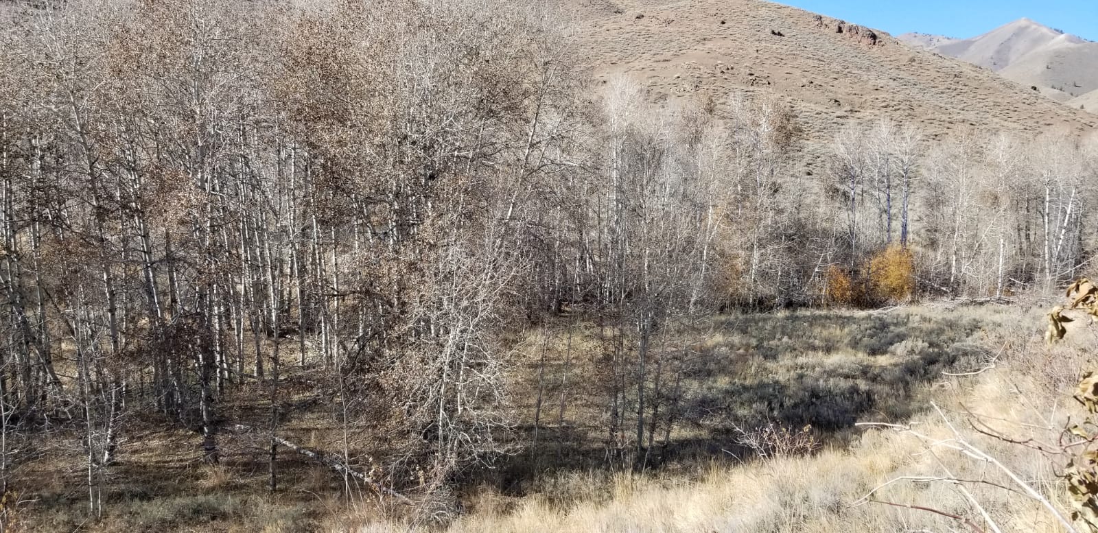


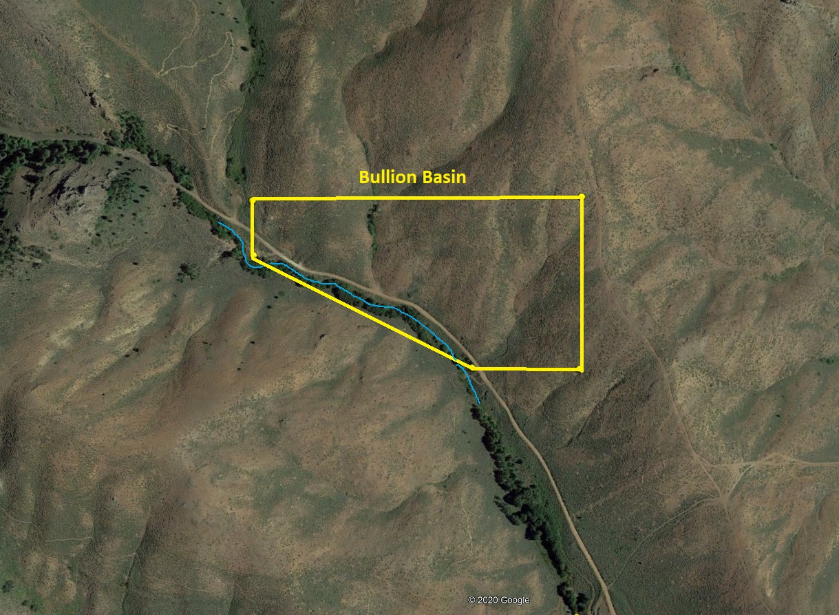
Bullion Basin
Sold
- Acreage: 16.87 acre unpatented placer claim
- River footage: 1100’ of Bullion Creek (1 camping area on claim)
- Location: Blaine County, Township 2N, Range 17E, Sec. 23, SE ¼
- Mining claim serial #: IMC232581
Map to Claim
Coordinates
Marker Degrees, Minutes, Seconds
NW 43°29’25.7280″N, -114°23’30.4440″W
NE 43°29’25.7280″N, -114°23’08.8440″W
SE 43°29’17.6640″N, -114°23’08.8440″W
SSW 43°29’17.6640″N, -114°23’15.9360″W
NSW 43°29’23.1360″N, -114°23’30.4440″W
Marker Latitude/Longitude
NW 43.49048’N, -114.39179’W
NE 43.49048’N, -114.38579’W
SE 43.48824’N, -114.38579’W
SSW 43.48824’N, -114.38776’W
SWW 43.48976’N, -114.39179’W
Aerial & Topo Images

Images


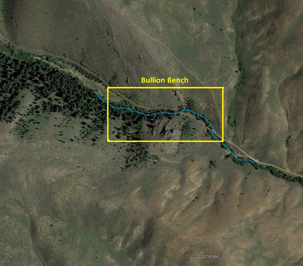
Bullion Bench
Sold
- Acreage: 20 acre unpatented placer claim
- River footage: 1350’ of Bullion Creek
- Location: Blaine County, Township 2N, Range 17E, Sec. 23, SW & SE ¼
- Mining claim serial #: IMC232582
Map to Claim
Coordinates
Marker Degrees, Minutes, Seconds
NW 43°29’30.9840″N, -114°23’50.8560″W
NE 43°29’30.9840″N, -114°23’32.9280″W
SE 43°29’24.9360″N, -114°23’32.9280″W
SW 43°29’24.9360″N, -114°23’50.8560″W
Marker Latitude/Longitude
NW 43.49194’N, -114.39746’W
NE 43.49194’N, -114.39248’W
SE 43.49026’N, -114.39248’W
SW 43.49026’N, -114.39746’W
Aerial & Topo Images

Images


Driving Directions: From Hailey, Idaho (off Main Street or HWY 75), turn west onto Bullion Street (after the bridge the name changes to Croy Creek Rd). Continue for 4.3 miles on Croy Creek Rd, and make a right (north) onto Bullion Gulch Road. The mining claims start approximately 1.1 miles up Bullion Gulch, with signs along the road labeling where each mining claim is positioned.