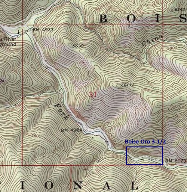
Boise Oro 3-1/2
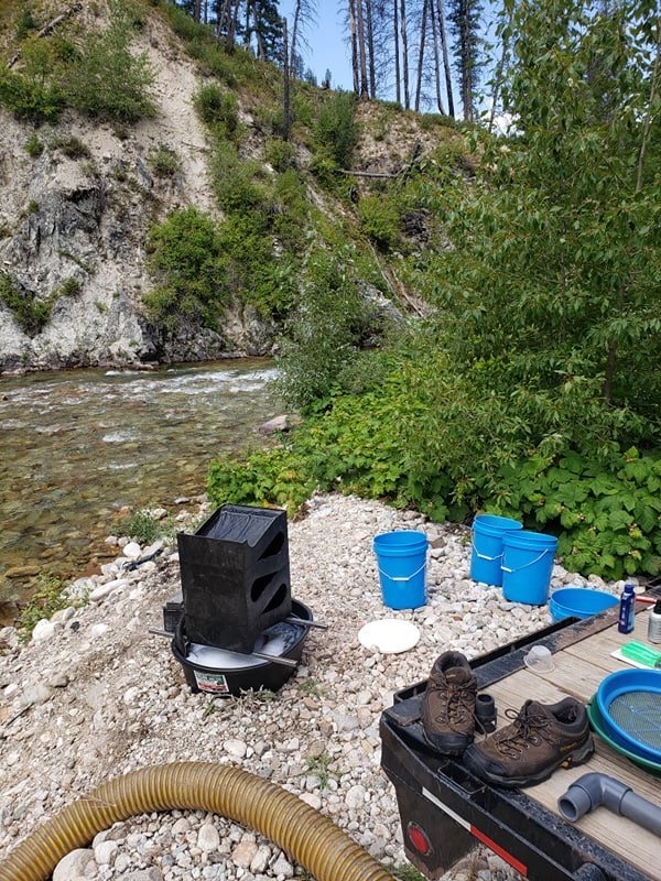
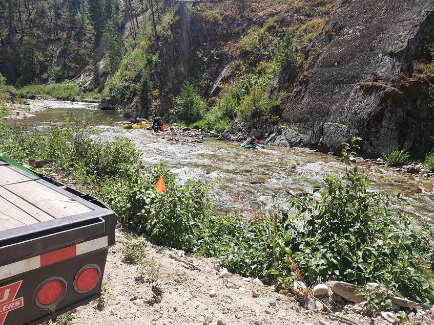
This amazing 20 acre unpatented mining claim has over 1400’ of the much desired historic gold-bearing Middle Fork of the Boise River, just a short 3.5 miles downstream of Atlanta, Idaho. The claim can be reached from various routes (depending on direction you’re coming from. Camping area right on the claim, with ample places on the claim to set up, with exposed bedrock evident on the claim. Ample year round water across all of the claims, and open to dredging according to IDWR. Incredible scenery, lots of trails and ATV roads, and hidden hot springs dotted across this area, for all kinds of recreational enjoyment nearby.
- Acreage: 20 acres
- River footage: 1450' of NF Boise River
- Placer/lode: placer
- Location: Elmore Counties, Township 6N, Range 11E, Section 31 SE ¼
- Mining claim serial #: IMC 202894
Map to Claim
Coordinates
NW 43.80915’N, -115.19414’W
NE 43.80915’N, -115.18886’W
SE 43.80733’N, -115.18886’W
SW 43.80733’N, -115.19414’W
NW 43°48’32.9400″N, -115°11’38.9040″W
NE 43°48’32.9400″N, -115°11’19.8960″W
SE 43°48’26.3880″N, -115°11’19.8960″W
SW 43°48’26.3880″N, -115°11’38.9040″W
Maps

Images


Overview
Driving Directions: From This mining claim is about 3.5 miles downstream on the Middle Fork of the Boise River from the town of Atlanta which has three main ways of getting to it; 1) Head north out of Mountain Home (on HWY 20), then up past Anderson Ranch on NF 61 then NF157, and then left on NF 268, 2) North out of Boise on HWY 21 (18 miles past Idaho City), right on NF 384, left on NF 327 then left on NF 268. or 3) Head north on Hwy 21 (about 12 miles), turning right on Spring Shores/NF 268 and follow this for 63 miles
