Beaver Creek Claims
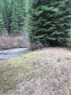
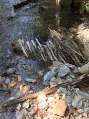
These incredible unpatented mining claims have great access to the rich deposits located on Beaver Creek. The Beaver Creek deposits are a collection of some of the rich placers coming from some of the historic mines (Silvertip Mine & Monitor Mine to name a few), with adits and prospects found scattered throughout many of the various drainages that feed into Beaver Creek. You can still see the old tailing pile remnants and works up and down Beaver Creek, from the patented mines that still to this day stretch out over most of this stream. Remarkably, these claims are relatively pristine, and as you see from the pictures, from testing done on the site, this claim holds pretty rich deposits. There are areas next to the road to park while working the site, and let’s not forget to mention the best part, they are open to suction dredging. Full services available in Wallace, about 9 miles from the claim. Again excellent access suitable for a car, RV, trailers, with ample year round water across the claim. Incredible lush scenery, with lots of trails and ATV roads, old mining townsites & camps, ghost towns, old rustic mining diggings to explore, and hidden hot springs dotted across this area, for all kinds of recreational enjoyment nearby.
Individual sale prices below, or will offer both “Beaver Gold” and “Beaver Placers” for $3,500
Overview
Beaver Gold
- Acreage: 14.36 acres
- River footage: 950 feet of Beaver Creek
- Placer/lode: placer
- Unpatented/patented: unpatented
- Location: Shoshone County, Township 49N, Range 4E, Section 35 NW ¼
- Mining claim serial #: IMC221492
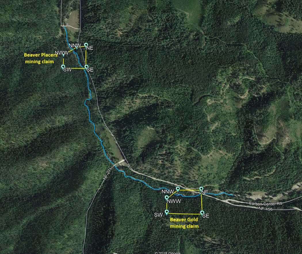
Map to Claim
Coordinates
NWW 47.55733’N, -115.92022’W
NNW 47.55799’N, -115.91889’W
NE 47.55799’N, -115.91610’W
SE 47.55623’N, -115.91610’W
SW 47.55623’N, -115.92022’W
NWW 47°33’26.3880″N, -115°55’12.7920″W
NNW 47°33’28.7640″N, -115°55’08.0040″W
NE 47°33’28.7640″N, -115°54’57.9600″W
SE 47°33’22.4280″N, -115°54’57.9600″W
SW 47°33’22.4280″N, -115°55’12.7920″W
Aerial & Topo Images


Beaver Placers
- Acreage: 6.95 acres
- River footage: 750 feet of Beaver Creek
- Placer/lode: placer
- Unpatented/patented: unpatented
- Location: Shoshone County, Township 49N, Range 4E, Section 27 NE ¼
- Mining claim serial #: IMC221491
Map to Claim
Coordinates
NWW 47.56900’N, -115.93267’W
NNW 47.56961’N, -115.93108’W
NE 47.56961’N, -115.92988’W
SE 47.56787’N, -115.92988’W
SW 47.56787’N, -115.93267’W
NWW 47°34’08.4000″N, -115°55’57.6120″W
NNW 47°34’10.5960″N, -115°55’51.8880″W
NE 47°34’10.5960″N, -115°55’47.5680″W
SE 47°34’04.3320″N, -115°55’47.5680″W
SW 47°34’04.3320″N, -115°55’57.6120″W
Aerial & Topo Images


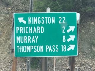


Driving directions to the claim:
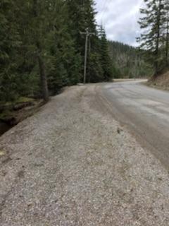
Vehicle access to the claim is via well maintained road which you can drive virtually up to the riverside. I’ve seen cars access the area as it is a well maintained forest service road. From Coeur d’Alene, Idaho, travel east on Interstate 90 (I-90) for to approximately 45 miles exiting at Wallace (Exit 61). From the exit, make an immediate right on Frontage Road, then an immediate left on Front Street, after about 0.4 mile you will turn left on 9 Mile Creek Rd., and then at a block (about 350 feet), another left onto NF 456 (aka 9 Mile Creek). You will stay on NF 456 for approximately 9 miles (which will take you over Dobson Pass summit), which drops down into Beaver Creek. The “Beaver Gold” mining claim is located on the left, immediately after the bridge, and “Beaver Placers” is located 1 mile further down. Signs for the mining claim is marked along the road. Full Services are available in Wallace 9 miles from the claim.
Geological Report links
http://www.idahogeology.org/PDF/Staff_Reports_(S)/2000/S-00-7.pdf
https://pubs.usgs.gov/bul/1027p/report.pdf