Woof Color
Woof Creek Sold
- Acreage: 20 acres
- River footage: 1,400’ Woof Creek
- Placer/lode: placer
- Location: Boise County, Township 7N, Range 4E, Sec.02, SE ¼
- Mining claim serial #: ID106333416
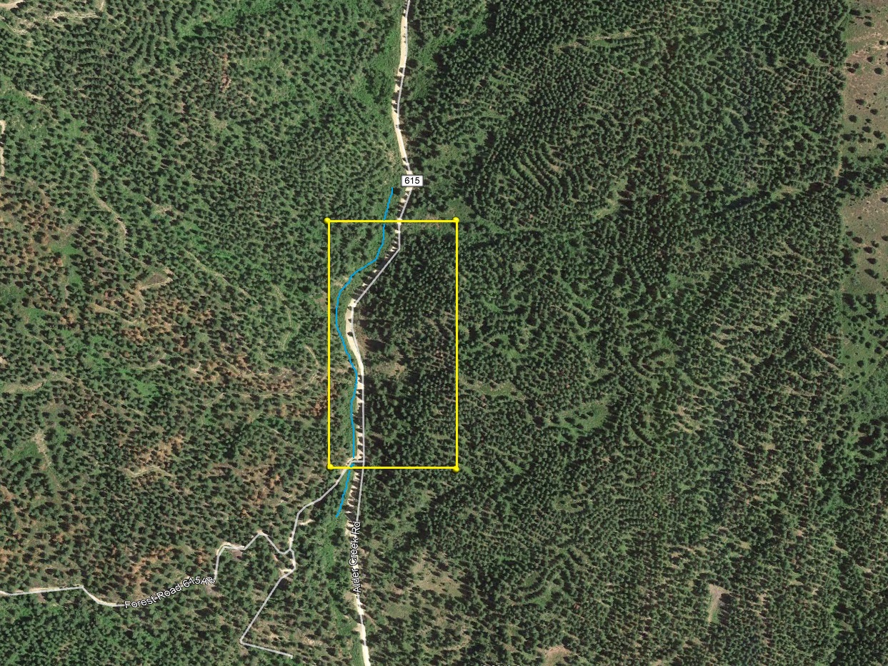
Map to Claim
Coordinates
NW 43.96938’N, -115.94889’W
NE 43.96938’N, -115.94632’W
SE 43.96582’N, -115.94632’W
SW 43.96582’N, -115.94889’W
NW 43°58’09.7680″N, -115°56’56.0040″W
NE 43°58’09.7680″N, -115°56’46.7520″W
SE 43°57’56.9520″N, -115°56’46.7520″W
Maps

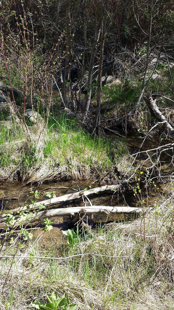
Images


Overview
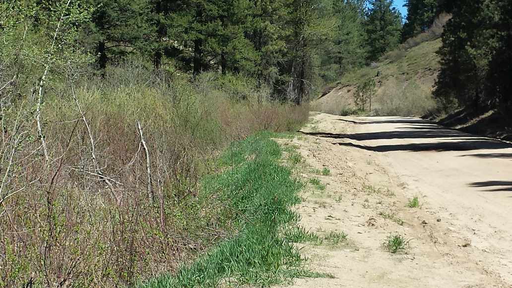
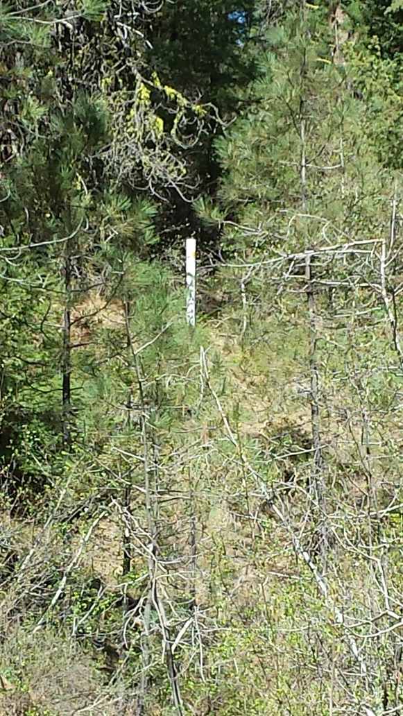
Driving Directions from Boise: Take HWY 55 (from State Street aka HWY 44), north out of Boise towards McCall. You will stay on HWY 55 for approximately 42 miles, and make a right onto HWY 17 at Banks (heading towards Garden Valley/Lowman). Continue on HWY 17 for approximately 11.5 miles (about a mile past Garden Valley), turning right (south) on the Meadow Creek Rd. (NF615 aka Alder Creek Rd. that heads to Placerville). In a ¼ mile you will cross the bridge over the SF Payette River. ** Stay on this for 8.5 miles until you reach the mining claim. The claim is marked on the side boundaries (north/south edges) along the road (on the creek side).


About Woof Creek
Where does the gold in Woof Creek come from? There is a vein close to the Alder Creek Summit (upstream to the southeast of these placer claims), which mostly heads southwest to northeast. In 1918 patented lode mines known as the “Gold Dollar Group” (Gold Dollar, Black Diamond, Up to Date, Potlatch & Monumental lode mines) were established under Mineral Survey 2905, producing mainly gold and silver from the ore.
MS 2905
http://www.idahogeology.org/services/minesandminerals/results.asp?switch=MILSREF&Value=160150018
Show me the Gold
Let’s talk about the gold…we ran two test samples, with bedrock ranging between 1 to 4 feet deep. After 5 hours of running, I recovered 2.19 grams gold. Let the pictures speak for themselves, as you can see there was one nugget recovered and a couple pickers. There was a lot of fine gold as well, but found the large pieces of gold embedded in the bedrock cracks I was able to work. There is a granite base, so should be good pockets and cracks. A very small percentage of the gold did appear to have some amalgam, telling me that way back in the day mercury had been used by some of the old operations, but still a great amount of gold left behind. There is also more evidence of some old workings, with hand stacked rocks next to the creek, but it still didn’t prevent me from finding a decent amount of gold. There was a fair amount of large quartz material in the deposit. In the concentrates, there was a fair amount of black sand, with red garnet and a heavy gold sand.


