Price: $4,000 - $17,500
AvailableSuperstition Lode Claims
Overview
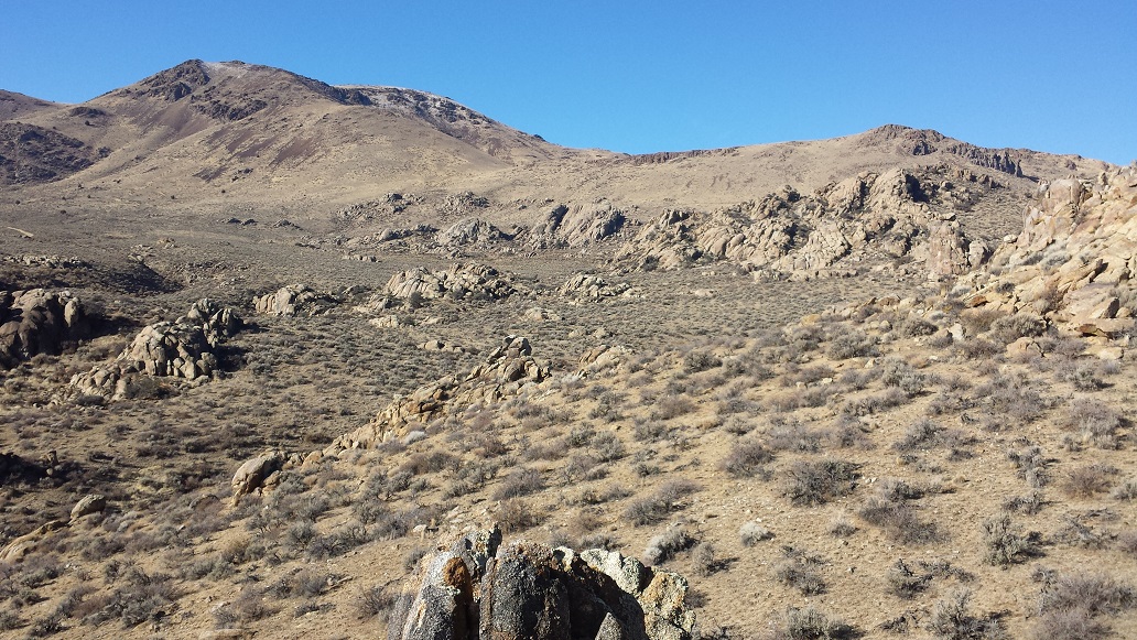
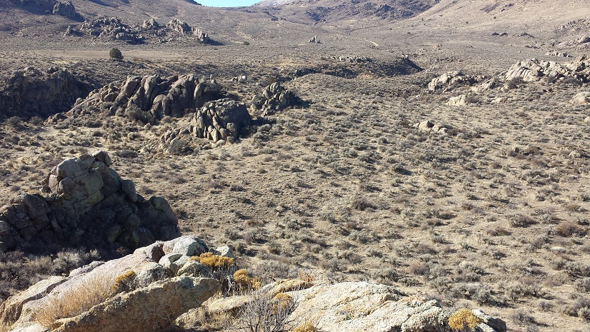
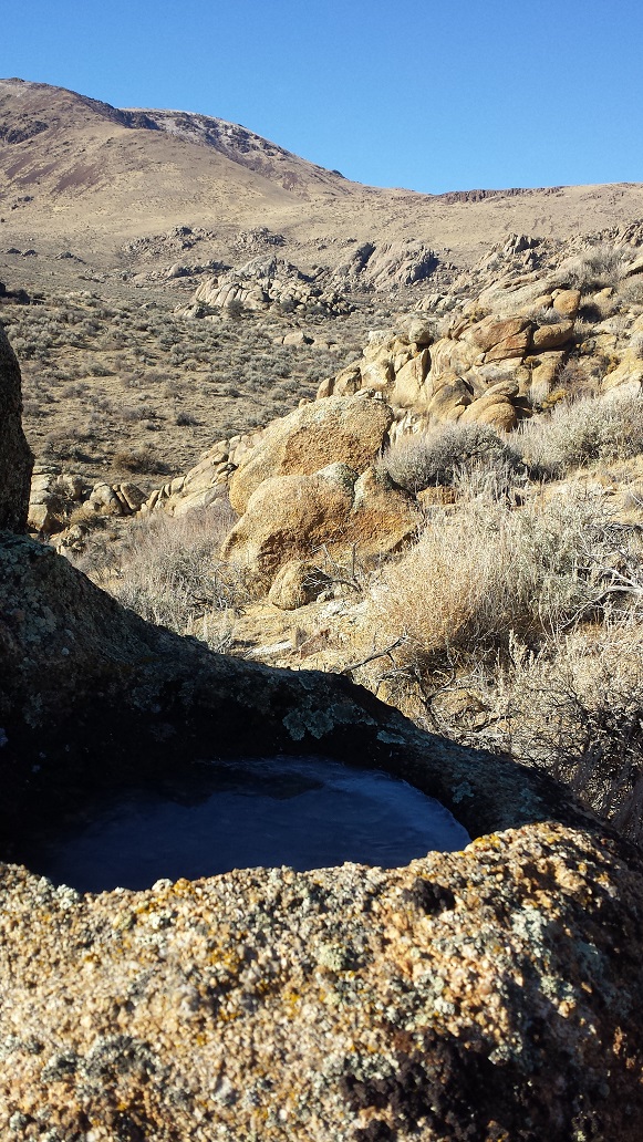
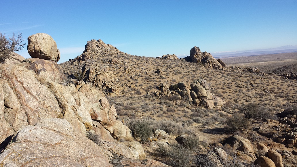
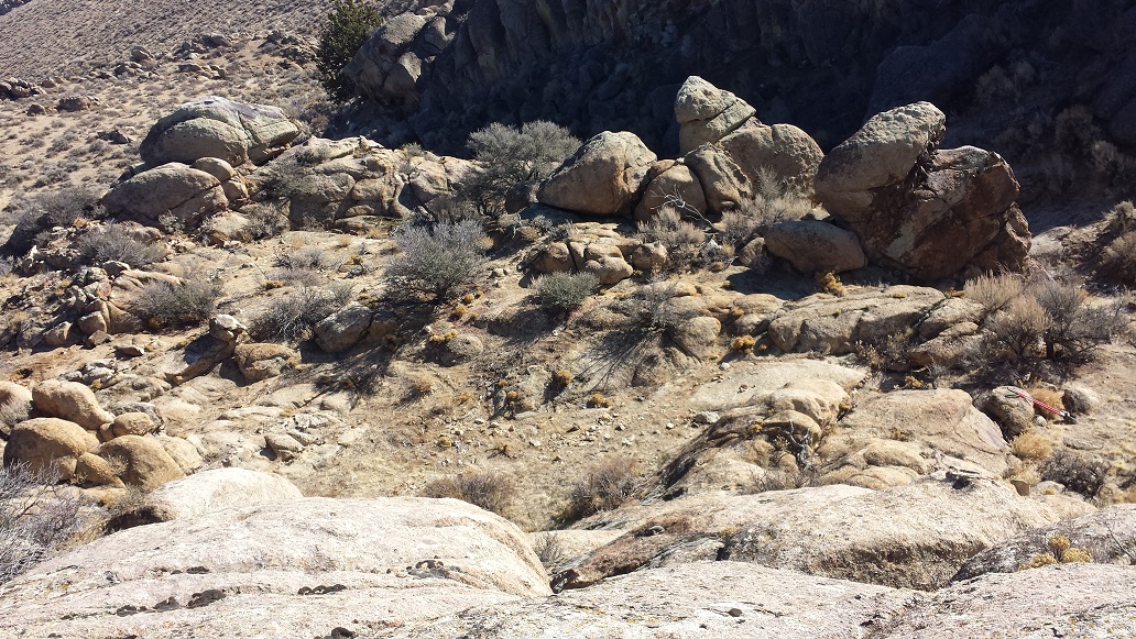
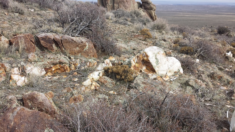
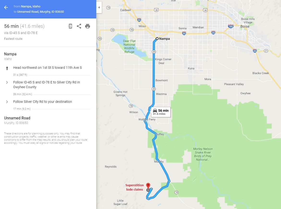
Some of the best sites are ones that people just tend to “stumble” upon. While doing some exploring, came across some impressive granite outcroppings which had quartz lining the washes. Doing some initial poking around, these outcroppings were laced with quartz veins and seems that ran all through the area. Sizes of the veins ranged from just a few inches to some larger ones 12”+ thick. Pulled multiple samples, ran assays, and then processed (crushed and free-milled) a couple hundred pounds of ore, and found it rich with gold (see results below). Even panning out some of the loose deposits in the washes produced nice color. These two lode mining claims sit on the Murphy side of War Eagle, and at a lower elevation of 3900 feet, they are ideal for early spring all the way through late fall to get in and do some work. Yet even in dryer winters they are accessible intermittently through the winter. These are about 45 minutes out of Nampa, so quick easy sites to access, and as these claims sit on BLM land, it makes it easy to get an operations set up in. Aside from the little bit of scratching the surface that was done when taking these samples, the ground is in virgin condition.


Pricing:
Bundle Price of all 7 Claims: $17,500
Bundle of 3 Superstition claims “Superstition”, “Superstition Ext”, “Superstition Ext 2”: $12,500
Bundle of 2 Desert claims “Desert King” and “Desert Queen”: $4,000
Bundle of 2 Matteson claims “Matteson” and “Matteson Ext”: $5,000
Superstition Claims
Bundle Price of $12,500 for 3 claims.
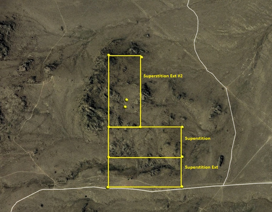

Superstition
- Acreage: 20.66 acre
- Placer/lode: unpatented lode claim
- Location: Owyhee County, Township 3S, Range 2W, Sec. 29, NW ¼
- Mining claim serial #: IMC226791
GPS Coordinates
Marker Latitude & Longitude
NW #1 43.135080’N, -116.611120’W
NE #2 43.135080’N, -116.605580’W
SE #3 43.133420’N, -116.605580’W
SW #4 43.133420’N, -116.611120’W
Marker Degrees, Minutes, Seconds
NW #1 43°08’06.2880″N, -116°36’40.0320″W
NE #2 43°08’06.2880″N, -116°36’20.0880″W
SE #3 43°08’00.3120″N, -116°36’20.0880″W
SW #4 43°08’00.3120″N, -116°36’40.0320″W
Superstition Ext
- Acreage: 20.66 acre
- Placer/lode: unpatented lode claim
- Location: Owyhee County, Township 3S, Range 2W, Sec. 29, NW & SW¼
- Mining claim serial #: IMC226790
GPS Coordinates
NW #1 43.133420’N, -116.611120’W
NE #2 43.133420’N, -116.605580’W
SE #3 43.131790’N, -116.605580’W
SW #4 43.131790’N, -116.611120’W
NW #1 43°08’00.3120″N, -116°36’40.0320″W
NE #2 43°08’00.3120″N, -116°36’20.0880″W
SE #3 43°07’54.4440″N, -116°36’20.0880″W
SW #4 43°07’54.4440″N, -116°36’40.0320″W
Superstition Ext #2
- Placer/lode: Unpatented lode claim
- Location: Owyhee County, Township 3S, Range 2W, Sec. 29, NW ¼
- Mining claim serial #: Claim Serial No.: IMC228527
GPS Coordinates
NW #1 43.139030’N, -116.611120’W
NE #2 43.139030’N, -116.608760’W
SE #3 43.135080’N, -116.608760’W
SW #4 43.135080’N, -116.611120’W
NW #1 43°08’20.5080″N, -116°36’40.0320″W
NE #2 43°08’20.5080″N, -116°36’31.5360″W
SE #3 43°08’06.2880″N, -116°36’31.5360″W
SW #4 43°08’06.2880″N, -116°36’40.0320″W
Desert King and Desert Queen
Bundle Price of $4,000 for both claims.


Desert King
- Placer/lode: Unpatented lode claim
- Location: Owyhee County, Township 3S, Range 2W, Sec. 29, SW ¼ & 30 SE ¼
- Mining claim serial #: Claim Serial No.: IMC230290
GPS Coordinates
NW #4 43.131580’N, -116.614640’W
NE #1 43.131580’N, -116.609060’W
SE #2 43.129880’N, -116.609060’W
SW #3 43.129880’N, -116.614640’W
NW #4 43°07’53.6880″N, -116°36’52.7040″W
NE #1 43°07’53.6880″N, -116°36’32.6160″W
SE #2 43°07’47.5680″N, -116°36’32.6160″W
SW #3 43°07’47.5680″N, -116°36’52.7040″W
Desert Queen
- Placer/lode: Unpatented lode claim
- Location: Owyhee County, Township 3S, Range 2W, Sec. 29, SW ¼
- Mining claim serial #: Claim Serial No.: IMC230289
GPS Coordinates
NW #1 43.131580’N, -116.609060’W
NE #2 43.131580’N, -116.603610’W
SE #3 43.129880’N, -116.603610’W
SW #4 43.129880’N, -116.609060’W
NW #1 43°07’53.6880″N, -116°36’32.6160″W
NE #2 43°07’53.6880″N, -116°36’12.9960″W
SE #3 43°07’47.5680″N, -116°36’12.9960″W
SW #4 43°07’47.5680″N, -116°36’32.6160″W


Matteson Lode Mining Claims
Bundle Price of $5,000 for both claims.


Matteson
- Placer/lode: 20.66 acre unpatented lode claim/li>
- Locationn: Idaho County, Township 3S, Range 2W, Sec 30 NW & NE ¼s
- Mining claim serial #: Claim Serial No.: ID106326606
GPS Coordinates
NW 43°08’22.6320″N, -116°37’26.2200″W
NE 43°08’22.6320″N, -116°37’01.9560″W
SE 43°08’16.2240″N, -116°37’01.9560″W
SW 43°08’16.2240″N, -116°37’26.2200″W
NW 43.13962’N, -116.62395’W
NE 43.13962’N, -116.61721’W
SE 43.13784’N, -116.61721’W
SW 43.13784’N, -116.62395’W
Matteson Ext
- Placer/lode: 20.66 acre unpatented lode claim/li>
- Locationn: Idaho County, Township 3S, Range 2W, Sec 30 NW & NE ¼s
- Mining claim serial #: Claim Serial No.: ID106326607
GPS Coordinates
NW 43°08’22.6320″N, -116°37’26.2200″W
NE 43°08’22.6320″N, -116°37’01.9560″W
SE 43°08’16.2240″N, -116°37’01.9560″W
SW 43°08’16.2240″N, -116°37’26.2200″W
NW 43.13962’N, -116.62395’W
NE 43.13962’N, -116.61721’W
SE 43.13784’N, -116.61721’W
SW 43.13784’N, -116.62395’W


Driving Directions: From Nampa, travel south on HWY 45 approximately 14 miles to the HWY 78 junction, road will naturally curve left (southeast) onto HWY 78, head southeast on HWY 78 to approximately 4.5 miles past Murphy to the Silver City turnout, turn right heading southwest on the Silver City Road for approximately 6 miles (to major switchback and large parking area). Turn right on BLM access road. Stay on this service road for 2.5 miles to fork, turn left at fork. At about 1.6 miles you will make a right onto an access road. By continuing about 0.4 miles this road will pass by the east boundary of the Matteson claims, OR at approximately 0.2 of a mile there will be the access roads to the left which end at the adits of the Matteson. These mine access roads are fairly rough, so taking the lower road at first and hike into the adits on the mining claims is recommended to get an assessment of the mines.
There is an alternate route into the mining claims: While traveling southeast on HWY 78 approaching Murphy, make an immediate right onto Rabbit Creek Rd. (which is before the bridge as you enter Murphy). Stay on Rabbit Creek Rd. for 1.0 mile and make a left onto Old Stage Road. Stay on this for approximately 7.4 miles until you reach the mining claims. This is a slower route as the road is rougher, and would recommend 4WD vehicle.
Driving Maps

Show me the Gold
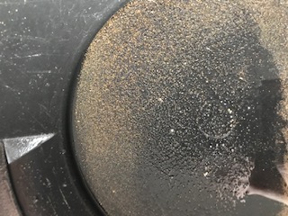
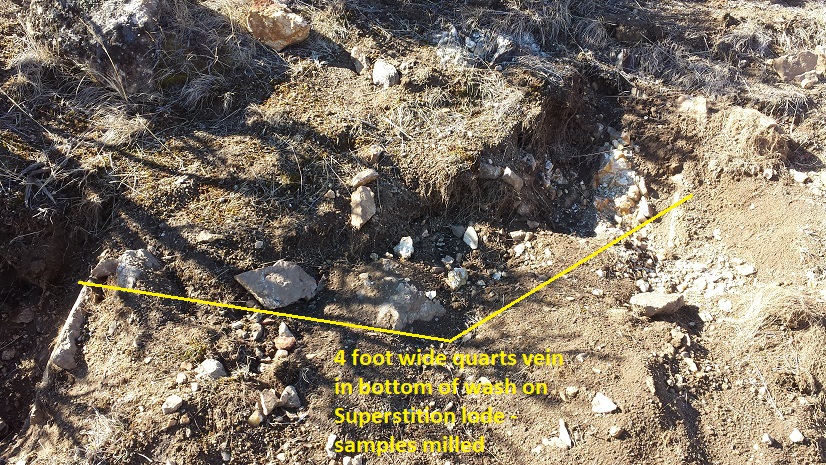
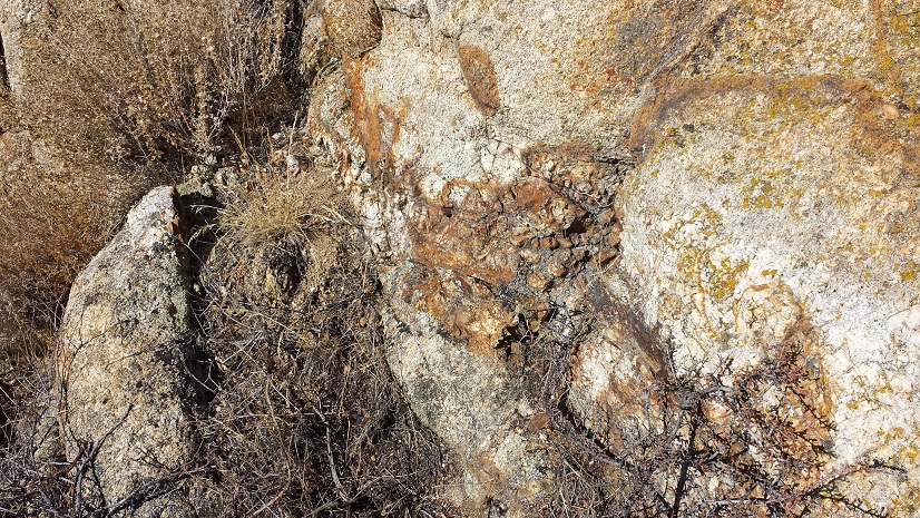
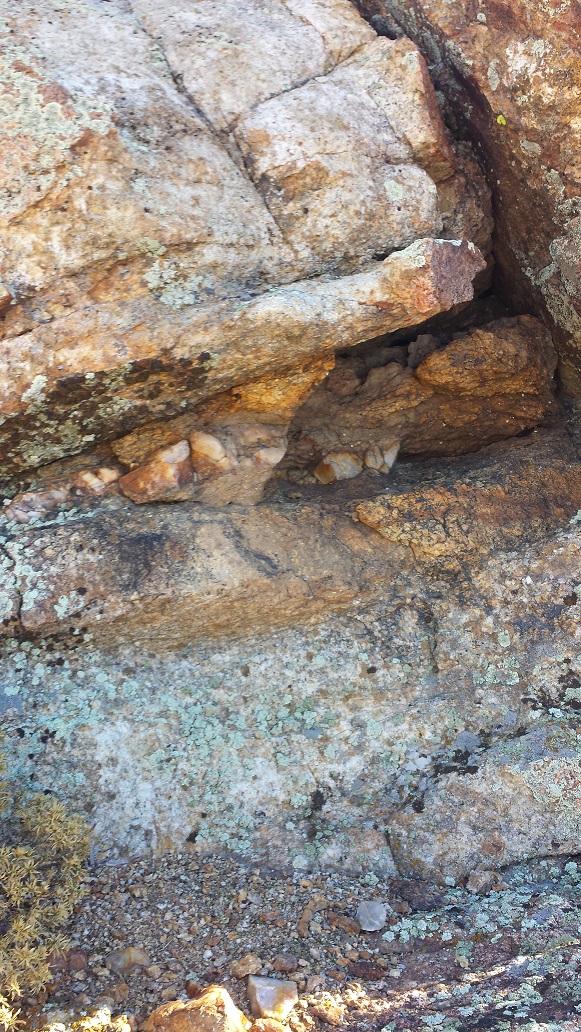
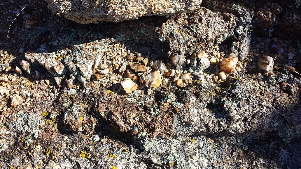
As mentioned, all of the washes throughout these claims showed good visible rough chunky gold from panning out material (just like what you would expect to find that close to the source), with visible loose quartz scattered throughout. A couple hundred pounds were extracted from the visibly exposed veins on the surface of the outcroppings in three different locations (one per claim). One of these veins is on Superstition Ext, roughly 6” to 8” thick, with rust stained granite abutting, and rust color interlaced through the quartz. The vein on Superstition lode adjacent to the wash, with the quartz vein at an impressive 3 to 4 feet width where the sample was pulled.
On Superstition Ext #2, the exposed vein was an incredible 5 to 8 feet wide thick, with many different fissures ranging a couple inches to a couple feet thick spreading from it. From each of the lodes, two samples (random tablespoon) of material from each location were sent in for assay (provided per request), which each showed positive for both gold (Au) and silver (Ag) in the specimens. But just like with placer mining, and the test samples being so small and the few that were run, “Assays only paint a small picture” ~ Aaron Weiner – Geological Survey.
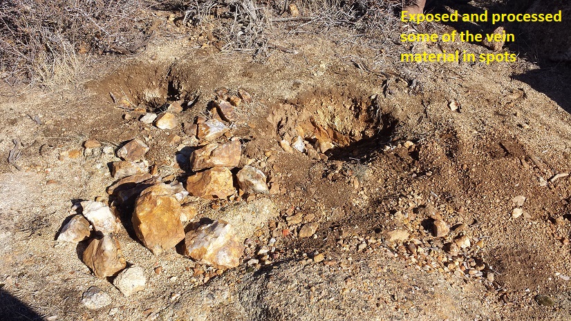
So the couple hundred pounds were crushed and sluiced, and all three of the vein structures showed good amounts of free-mill gold from the results. These pictures were the results from crushing and panning out the vein material, and even in this free-mill style of processing, it is estimated that only 60% to 70% is recovered.