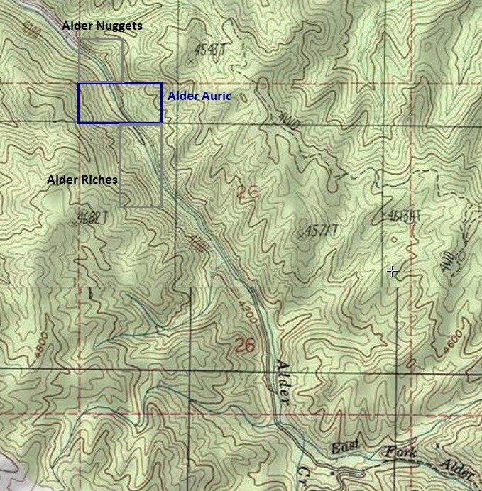
Alder Creek Claims
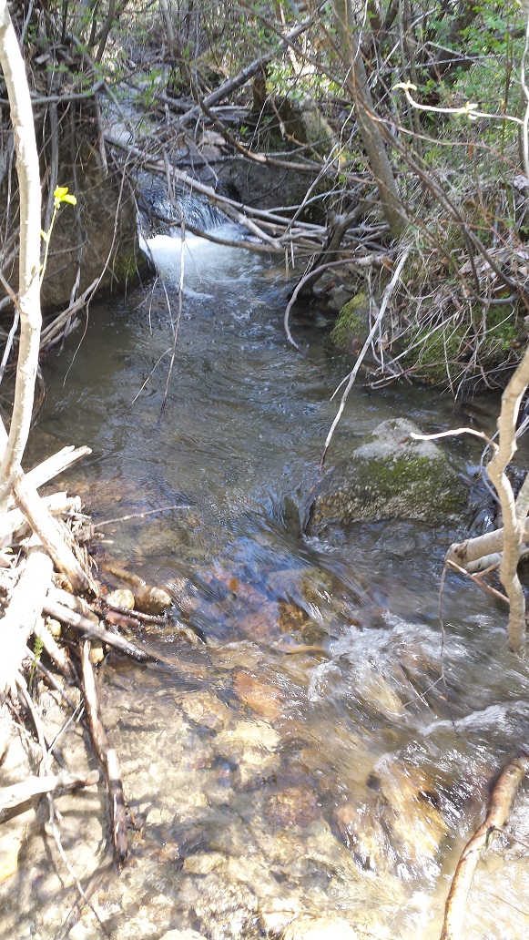
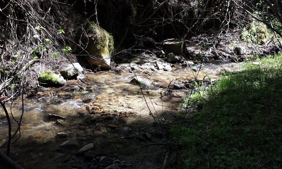
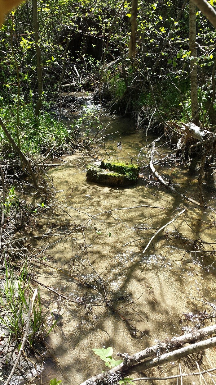
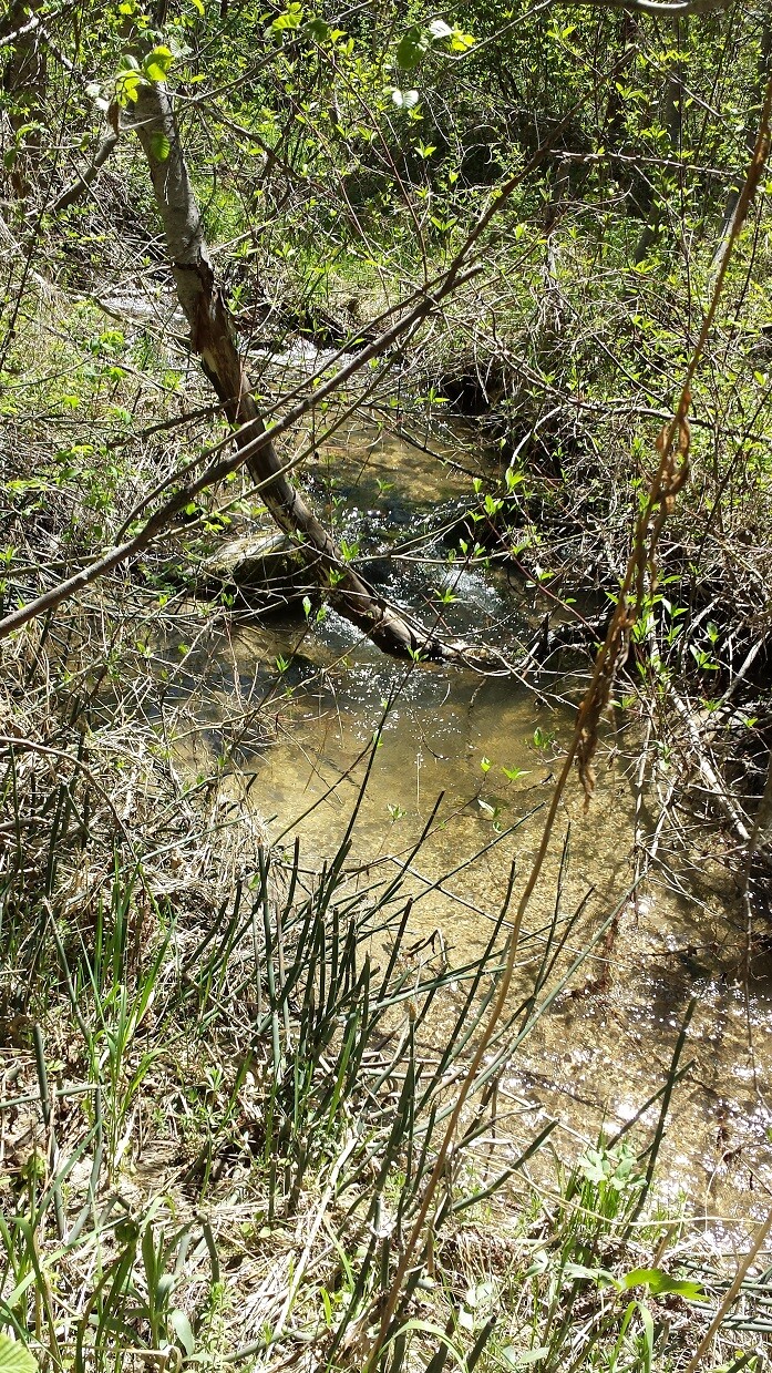
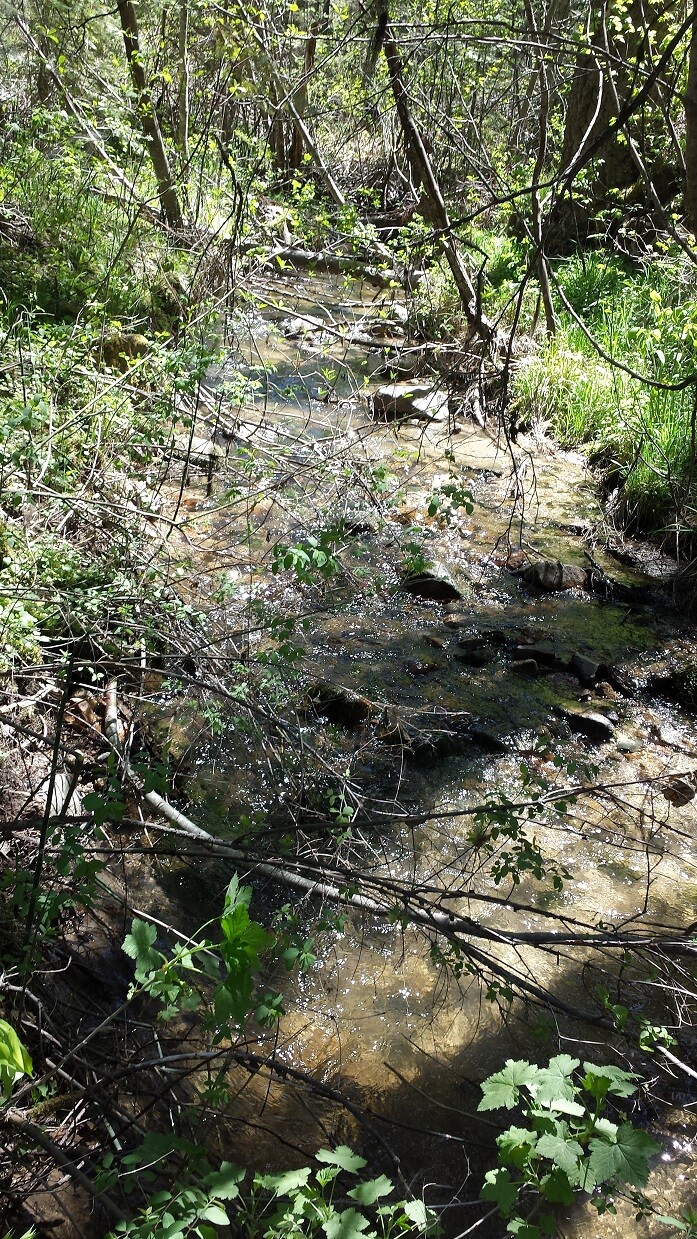
Alder Creek is a unique mining area, accessible in early spring when other areas tend to still be snowed in. Even in heavy snow winters, I have accessed these sites at the beginning of April, giving you an area that could be worked early on in the season. With only being a couple minutes out of Garden Valley (about 5 miles), it has close services and great access into the claim. There are existing mining claims that encompass all up & down Alder Creek (abutting these claims to the north and south), and from the pictures illustrated in “Show me the Gold” (see below) & patented lodes from the geological reports, it’s easy to understand how rich the prospects and potential is in here.
Maps


Overview
Alder Yields
Sold
- Acreage:
- River footage: 750’ Alder Creek
- Placer/lode: placer
- Unpatented/patented: unpatented
- Location: Boise County, Township 8N, Range 4E, Sec.22, SE ¼
- Mining claim serial #: IMC221498
Coordinates
NW 44.01424’N, -115.96395’W
NE 44.01424’N, -115.96142’W
SE 44.01072’N, -115.96142’W
SW 44.01072’N, -115.96395’W
NW 44°00’51.2640″N, -115°57’50.2200″W
NE 44°00’51.2640″N, -115°57’41.1120″W
SE 44°00’38.5920″N, -115°57’41.1120″W
SW 44°00’38.5920″N, -115°57’50.2200″W
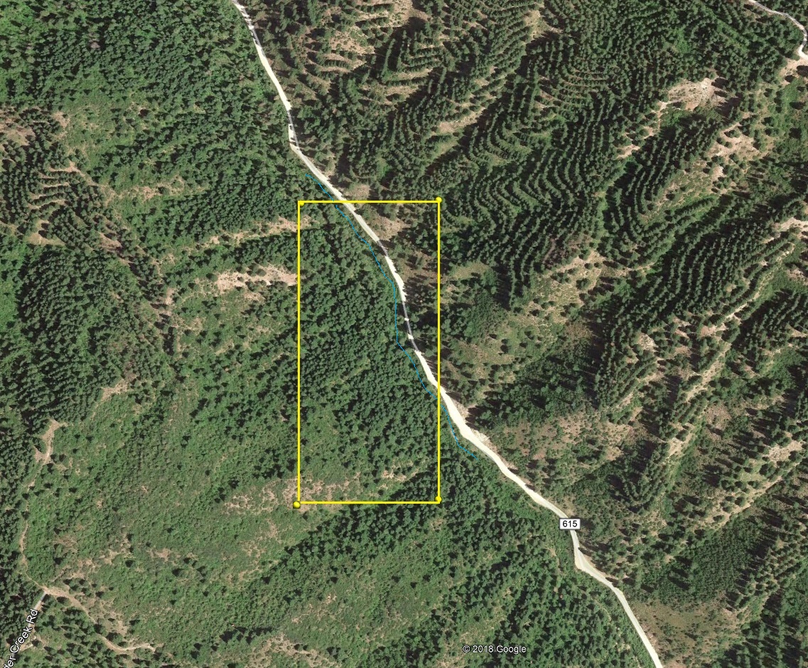
Aerial & Topo Images
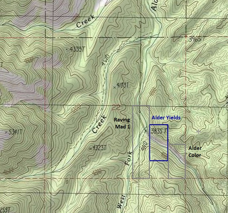

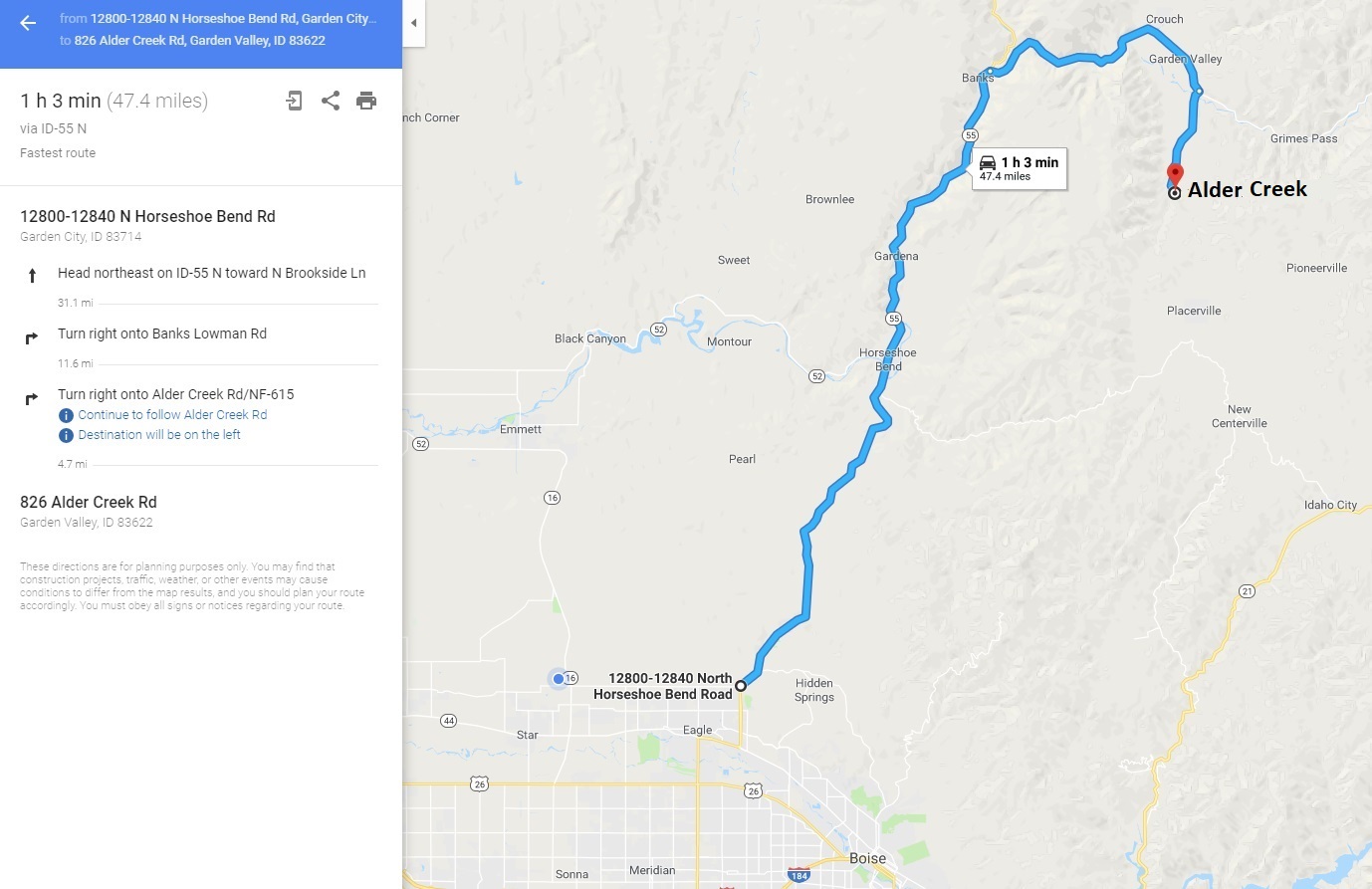
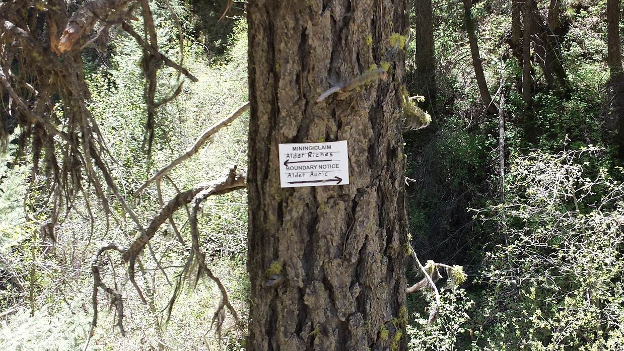
Driving Directions from Boise: Take HWY 55 (from State Street aka HWY 44), north out of Boise towards McCall. You will stay on HWY 55 for approximately 42 miles, and make a right onto HWY 17 at Banks (heading towards Garden Valley/Lowman). Continue on HWY 17 for approximately 11.5 miles (about a mile past Garden Valley), turning right (south) on the Meadow Creek Rd. (NF 615 aka Alder Creek Rd. that heads to Placerville). In a ¼ mile you will cross the bridge over the SF Payette River. Stay on this for 4.6 miles until you reach the mining claims. The claims are marked on the side boundaries (north/south or east/west edges) along the road (on the creek side), as well as corner markers.
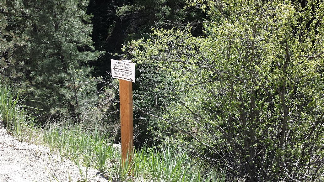
Alder Nuggets
Sold
- Acreage: 10 acres
- River footage: 750’ Alder Creek
- Placer/lode: placer
- Unpatented/patented: unpatented
- Location: Boise County, Township 8N, Range 4E, Sec.23, SW ¼
- Mining claim serial #: IMC221500
Coordinates
NW 44.01072’N, -115.95902’W
NE 44.01072’N, -115.95644’W
SE 44.00887’N, -115.95644’W
SW 44.00887’N, -115.95902’W
NW 44°00’38.5920″N, -115°57’32.4720″W
NE 44°00’38.5920″N, -115°57’23.1840″W
SE 44°00’31.9320″N, -115°57’23.1840″W
SW 44°00’31.9320″N, -115°57’32.4720″W
Aerial & Topo Images


Driving Directions from Boise: Take HWY 55 (from State Street aka HWY 44), north out of Boise towards McCall. You will stay on HWY 55 for approximately 42 miles, and make a right onto HWY 17 at Banks (heading towards Garden Valley/Lowman). Continue on HWY 17 for approximately 11.5 miles (about a mile past Garden Valley), turning right (south) on the Meadow Creek Rd. (NF 615 aka Alder Creek Rd. that heads to Placerville). In a ¼ mile you will cross the bridge over the SF Payette River. Stay on this for 4.9 miles until you reach the mining claims. The claims are marked on the side boundaries (north/south or east/west edges) along the road (on the creek side), as well as corner markers.
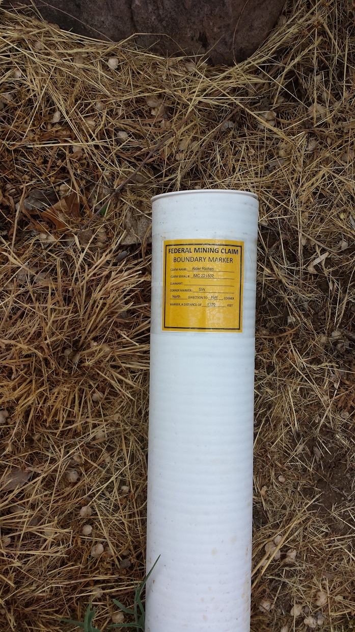
Alder Riches
Sold
- Acreage: 20 acres
- River footage: 1000' Alder Creek
- Placer/lode: placer
- Unpatented/patented: unpatented
- Location: Boise County, Township 8N, Range 4E, Sec.26, NW ¼
- Mining claim serial #: IMC221502
Coordinates
NW 44.00714’N, -115.95644’W
NE 44.00714’N, -115.95400’W
SE 44.00347’N, -115.95400’W
SW 44.00347’N, -115.95644’W
NW 44°00’25.7040″N, -115°57’23.1840″W
NE 44°00’25.7040″N, -115°57’14.4000″W
SE 44°00’12.4920″N, -115°57’14.4000″W
SW 44°00’12.4920″N, -115°57’23.1840″W
Aerial & Topo Images

Driving Directions from Boise: Take HWY 55 (from State Street aka HWY 44), north out of Boise towards McCall. You will stay on HWY 55 for approximately 42 miles, and make a right onto HWY 17 at Banks (heading towards Garden Valley/Lowman). Continue on HWY 17 for approximately 11.5 miles (about a mile past Garden Valley), turning right (south) on the Meadow Creek Rd. (NF 615 aka Alder Creek Rd. that heads to Placerville). In a ¼ mile you will cross the bridge over the SF Payette River. Stay on this for 5.2 miles until you reach the mining claims. The claims are marked on the side boundaries (north/south or east/west edges) along the road (on the creek side), as well as corner markers.
Alder Deposits
Sold
- Acreage: 20 acre unpatented placer claim
- River footage: 1,100’ Alder Creek Camping area on SE corner
- Unpatented/patented: unpatented
- Location: Boise County, Township 8N, Range 4E, Sec. 26, NW & SW ¼
- Mining claim serial #: IMC221504
Coordinates
NW 44.00347’N, -115.95147’W
NE 44.00347’N, -115.94906’W
SE 43.99988’N, -115.94906’W
SW 43.99988’N, -115.95147’W
NW 44°00’12.4920″N, -115°57’05.2920″W
NE 44°00’12.4920″N, -115°56’56.6160″W
SE 43°59’59.5680″N, -115°56’56.6160″W
SW 43°59’59.5680″N, -115°57’05.2920″W
Aerial & Topo Images


Images


Driving Directions from Boise: Take HWY 55 (from State Street aka HWY 44), north out of Boise towards McCall. You will stay on HWY 55 for approximately 42 miles, and make a right onto HWY 17 at Banks (heading towards Garden Valley/Lowman). Continue on HWY 17 for approximately 11.5 miles (about a mile past Garden Valley), turning right (south) on the Meadow Creek Rd. (NF 615 aka Alder Creek Rd. that heads to Placerville). In a ¼ mile you will cross the bridge over the SF Payette River. Stay on this for 5.6 miles until you reach the mining claim. The claim is marked on the side boundaries (east/west edges) along the road (on the creek side), as well as corner markers.
Alder Placers
Sold
- Acreage: 20 acre unpatented placer claim
- River footage: 1,000’ Alder Creek
- Unpatented/patented: unpatented
- Location: Boise County, Township 8N, Range 4E, Sec.26, NW ¼
- Mining claim serial #: ID106339899
Coordinates
NW 44.00522’N, -115.95400’W
NE 44.00522’N, -115.95147’W
SE 44.00171’N, -115.95147’W
SW 44.00171’N, -115.95400’W
NW 44°00’18.7920″N, -115°57’14.4000″W
NE 44°00’18.7920″N, -115°57’05.2920″W
SE 44°00’06.1560″N, -115°57’05.2920″W
SW 44°00’06.1560″N, -115°57’14.4000″W
Aerial & Topo Images


Images


Driving Directions from Boise: Take HWY 55 (from State Street aka HWY 44), north out of Boise towards McCall. You will stay on HWY 55 for approximately 42 miles, and make a right onto HWY 17 at Banks (heading towards Garden Valley/Lowman). Continue on HWY 17 for approximately 11.5 miles (about a mile past Garden Valley), turning right (south) on the Meadow Creek Rd. (NF 615 aka Alder Creek Rd. that heads to Placerville). In a ¼ mile you will cross the bridge over the SF Payette River. Stay on this for 5.4 miles until you reach the mining claims. The claims are marked on the side boundaries (north/south or east/west edges) along the road (on the creek side), as well as corner markers.
Alder Auric
Sold
- Acreage: 20 acre unpatented placer claim
- River footage: 750’ Alder Creek
- Unpatented/patented: unpatented
- Location: Boise County, Township 8N, Range 4E, Sec.26, NW ¼
- Mining claim serial #: IMC234684 ID105220820
Map to Claim
Coordinates
Marker Latitude & Longitude
NW 44.00887’N, -115.95902’W
NE 44.00887’N, -115.95400’W
SE 44.00714’N, -115.95400’W
SW 44.00714’N, -115.95902’W
Marker Degrees, Minutes, Seconds
NW 44°00’31.9320″N, -115°57’32.4720″W
NE 44°00’31.9320″N, -115°57’14.4000″W
SE 44°00’25.7040″N, -115°57’14.4000″W
SW 44°00’25.7040″N, -115°57’32.4720″W
Aerial & Topo Images
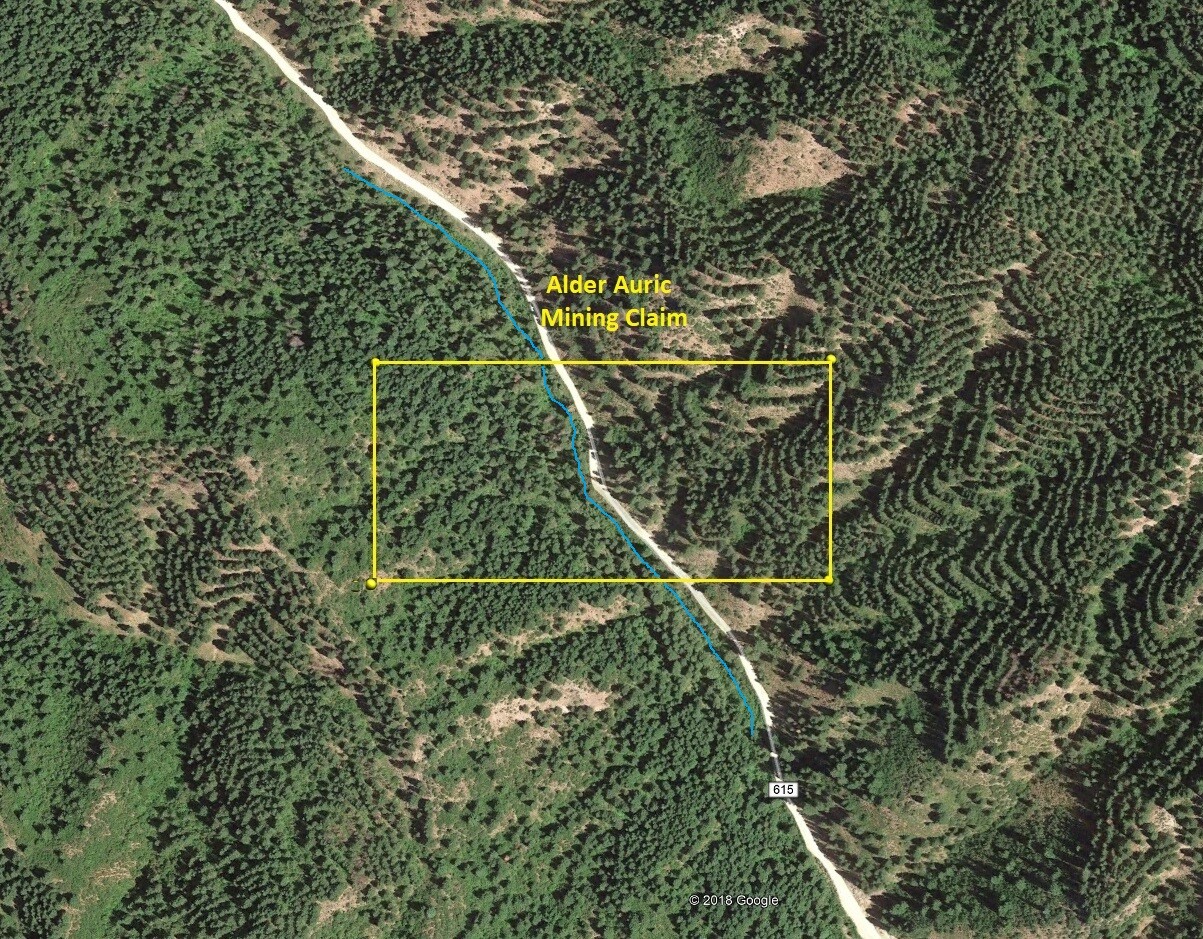
Images

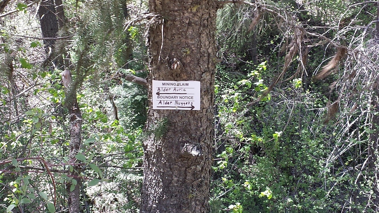
Driving Directions from Boise: Take HWY 55 (from State Street aka HWY 44), north out of Boise towards McCall. You will stay on HWY 55 for approximately 42 miles, and make a right onto HWY 17 at Banks (heading towards Garden Valley/Lowman). Continue on HWY 17 for approximately 11.5 miles (about a mile past Garden Valley), turning right (south) on the Meadow Creek Rd. (NF 615 aka Alder Creek Rd. that heads to Placerville). In a ¼ mile you will cross the bridge over the SF Payette River. Stay on this for 4.7 miles until you reach the mining claims. The claims are marked on the side boundaries (north/south or east/west edges) along the road (on the creek side), as well as corner markers.
Driving Directions from Boise: Take HWY 55 (from State Street aka HWY 44), north out of Boise towards McCall. You will stay on HWY 55 for approximately 42 miles, and make a right onto HWY 17 at Banks (heading towards Garden Valley/Lowman). Continue on HWY 17 for approximately 11.5 miles (about a mile past Garden Valley), turning right (south) on the Meadow Creek Rd. (NF 615 aka Alder Creek Rd. that heads to Placerville). In a ¼ mile you will cross the bridge over the SF Payette River. Stay on this for 4.6 to 5.0 miles until you reach the mining claims. The claims are marked on the side boundaries (north/south or east/west edges) along the road (on the creek side), as well as corner markers.